![]()
Gaspé
3433 Miles
We were all set to travel up to the Northeast, and explore some new territory, when the April 1997 Rider magazine issue came out. "Motorcycling in the Mouth of History" was the article's name; we were hooked. We immediately changed our plans, and the following tells how we went about it:
![]()
Day One - Cincinnati to Ithica, New York
We left on a Friday in early August. The weather was supposed to be cool in Cincinnati for the next several days, so I packed some extra clothes. This would prove prophetic since this was the last day for a week that I rode in a t-shirt with no jacket. We traveled all interstate until we jumped off on St. Rt. 66 near Clarion, PA. The plan was to ride through the Allegheny Nat'l Forest, taking U.S. 6 deeper into the forest. Once we got into the forest, we did not find the scenery particularly good. We opted to stay on U.S. 6 east bound riding out of the forest. U.S. 6 is fairly nice road, the scenery was nice through the Tioga State Forest. Once in Mansfield we headed north on U.S. 15 until we reached St.Rt. 17 near Corning, NY. U.S. 17 took us to St.Rt. 13 that went straight into Ithica. When we arrived in Ithica we found a great state park for camping, unfortunately it was full. We ended up finding a cheap motel (after a round of negotiating) on the south side of town. After a futile attempt to find a good place to eat, we choked a couple of beers, got a few good cigars, and called it a night.
![]()
Day Two - Ithica, New York to S. Albug, Vermont
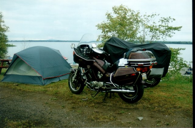
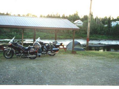
St.Rt. 13 took us to I-81 at Cortland. We rode I-81 north until exiting at Pulaski. Another Rider magazine article I found talked about riding around Lake Ontario on St. Rt. 3 & St. Rt. 12 also known as the Seaway Trail. Once again, Rider was right on. The St. Rts. along the Lake and into the Thousand Islands region were fabulous. The roads were in great shape, and there were plenty of sights. We stopped in Alexandria Bay for lunch; this was a neat little town that was in the middle of their annual vintage boat days. We continued on St. Rt. 12 until it turned into St.Rt. 37. After Messena, NY we bid farewell to the St. Lawrence Seaway for awhile, jumped onto U.S. 11 and rocketed toward Lake Champlain. We targeted east side of the lake on what is known as the Grand Isle, in Vermont as our place to camp for the night. We were now running south on U.S. 2 when we spotted what looked like a good seafood place. Shortly after, we came upon a campground where we stopped to inquire about the accommodations. Ten bucks got us a camp spot right on the lake, it was beautiful. Once we visited that seafood place, we ready for some adult beverages, and a good game of horseshoes. I won the horseshoes. After dark, we watched the bingo games (whoa!), and talked to some older ladies from New Hampshire who had been camping at this spot for many years. That night it rained cats, and dogs. Fortunately the beers helped me sleep, but Steve got a bit wet.
![]()
| Lunch time; looking out at the Thousand Islands region. | Our campsite on Lake Champlain near South Alburg, Vermont | Looking north on U.S.2 from our campsite |
![]()
Day Three - S. Albug, Vermont to Ashland, Maine
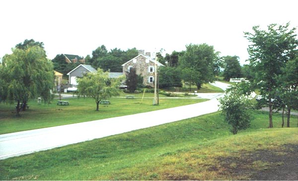
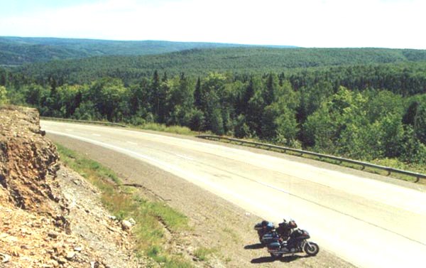
The rain hung around us. After a warm shower we got underway around 7:00. The rain held off for about 10 minutes. Sunday morning driving through the rain in Vermont; not the most fun. We stayed on U.S. 2, and jumped on I-89 south to make some time, and try to get out of the rain. By the time we reached Montpelier the rain had stopped. We shed the rain suits, and traveled on U.S. 2 toward St. Johnsbury. We stayed on U.S. 2 through New Hampshire. U.S. 2 is a great road, not a whole lot of twisties, but just enough to keep things interesting. It is easy to make good time on this road; its wide and well marked making passing easy. We rode U.S. 2 until we got to Bangor, ME. At Bangor we headed north on I-95. Once we got about 25 miles north of Bangor I knew we were heading into some sparsely populated areas. There is nothing out here; it's great! At one spot we went 56 miles in-between exits. This is almost like out west. We jumped of the interstate at Sherman Mills on St.Rt. 11. We stopped here to get beer for our camping that night. $15 for a twelve pack, once again I knew we were in the sticks. The helpful grocer told us there were many rest areas along St.Rt. 11, and it would probably be alright if we were to camp in one. As we traveled north on 11 we did see many of these rest stops, but they were clearly marked: "No Camping". So we went on to Ashland. Once there we got a bite to eat and asked about the local motel. They wanted too much for a night's sleep, so we decided to press on. On our way out of town we came upon a Sportsman club along the Aroostook River where a sign read: "Camping at Own Risk". This was us! We set up camp, built a fire, and started polishing off the expensive beer. Along came the Sheriff. We were worried he would ask us to leave, in the dark, in the cold (45F) after we had had a few. This was not the case, the Sheriff was overly gracious, and promised to check on us periodically throughout the night.
![]()
![]()
Day Four - Ashland, Maine to Perce, Quebec
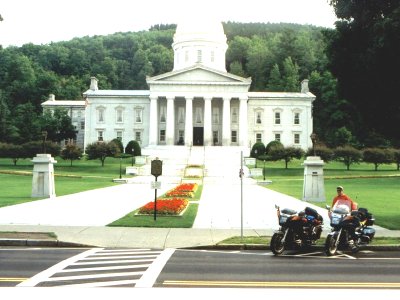
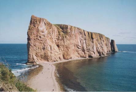
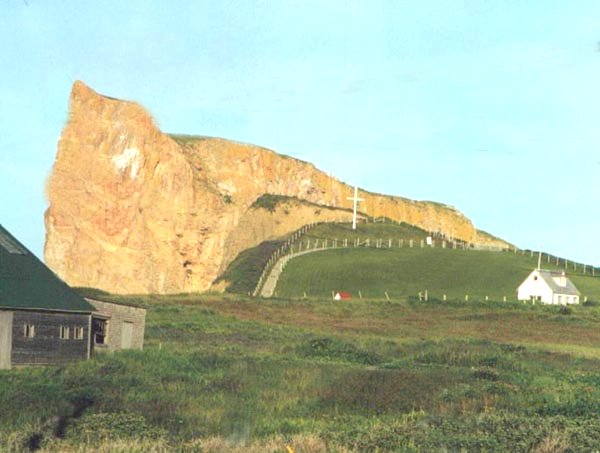
After a cold night of sleep, and no shower we headed east on St.Rt. 163 to Presque Isle, then north on U.S.1 toward Van Buren,ME and the Canadian border. None of the roads in northern Maine were well maintained. The scenery was great, but you had to keep an extra cautious eye on the roads. After changing money at a U.S. bank we went over to New Brunswick. The road in Canada was route 17. It started in bad condition, and we ran into several big logging trucks. But once we past St. Quentin we got into rolling hills, better roads, and fewer trucks. On this road, I was leading, and pushing about 80 mph, when I saw a black bear head into the road. While the Venture is not known for its braking, mine did just fine. We got into some major construction outside of Campellton before we crossed the bridge over into Quebec. Finally; we were on Gaspé peninsula. As we traveled the peninsula in a counter clockwise manner we stopped for lunch at Carleton. This lunch proved very educational, we quickly learned the majority of the natives not only spoke French, but only French. Ordering lunch was a task. We got it to go, and sat on Chaleur Bay to eat it. We continued Rt. 132 toward our final stop at Perce. Rt. 132 is a nice road, sweeping curves dominate sprinkled with an occasional set of twisties. As you approach Perce, you first spot the Ile de Bonaventure. This island is a summer home to a colony of 50,000 gannets, the largest sanctuary of the large white sea birds in North America. The town of Perce is dominated by a 300 foot high monolith of rock that is 1,420 feet long, and estimated to weigh 500 million tons. It sits just offshore of town, and you can walk to it at low tide. The rock was in view on the front porch of our hotel. Low tide was 8:00 that evening, and we walked out to it. Standing out by the rock we wondered why we traveled 2000 miles to see this rock. Of course the pleasure comes in getting there, but we knew we were at the half way point. From here on, we were traveling towards home.
![]()
| Map of Gaspé | In New Brunswick Canada near St. Quentin on Canada Highway #17 | The big rock at Percé | Panoramic view of Percé |
![]()
Day Five - Perce, Quebec to Rimouski, Quebec
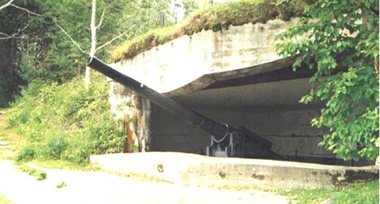
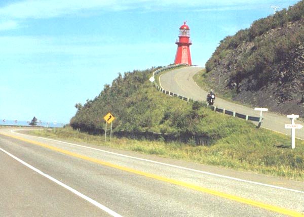
We continued on toward the city of Gaspe on Rt. 132. The town of Gaspe is the regions only deep water port. The British Navy had intended to use this port as their home during WWII had the Germans invaded England. The port is easy to defend due to the narrow entrance into the port. The town looked to be rather large, but we did not go through it, Rt. 132 goes to the south of the town. As we were approaching the Forillon National Park the roads were becoming increasingly twisty. Once in the park region, we stopped at the old military base. This base consisted of a couple of 40mm (?) guns that protected the Gaspe harbor at its narrowest point. During the WWII there was some action out in the Gulf of St. Lawrence. A German U-boat sank some freighters. After our stop in the park we found some open road conditions, and took advantage. The road was becoming less winding, and a little more wide open. We stopped at Petite Vallee for a lobster club sandwich, it was very good. As we continued on the road dropped down closer to the sea. There were road signs warning of waves crashing onto the road. This did not happen to us, but we could see it was probably not too uncommon. The really neat apart about this region was every 10 miles or so you passed through a small little town. Each town had its own characteristics, but each town had its own huge Catholic church. Some of these seemingly little towns had huge cathedrals, it was really neat. When we got into Rimouski we decided to call it a night. We found a small motel and checked in. After we got unpacked we took a hike back behind the place and found the neatest city (?) park. We hiked some trails and wound up overlooking this immense inlet at low tide. It looked as though one could walk into to town from there, but I imagine it was too muddy to walk.
![]()
| The big Guns at Gaspe Harbor | The Big Rock at Perce | Steve overlooking Petite Vallee | Coming down from the Lighthouse at Mont St. Pierre |
![]()
Day Six - Rimouski, Quebec to Eden Mills, Vermont
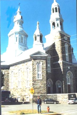
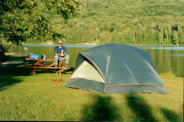
We started back on Rt. 132 again. Our first stop was Trois Pistoles (three gold coins). Some French sailor lost these coins here. The main attraction is the Notre-Dame-des-Neiges-de-Trois-Pistoles. This cathedral built in 1887 looks magical from the outside. The inside is breath taking. After we passed through Trois Pistoles the country turns into farm land. At Riviere-du-Loup we jumped on the freeway and sped down towards Vermont. It kind of felt good to open the bikes up and cruise at 85mph for an hour and a half uninterrupted. We crossed over at Derby VT late in the afternoon. Once across, we decided to cruise down St. Rt. 100. This was great riding. Nice twisties, and not much traffic. As we got about 50 miles south of the border we came upon a nice look campground in Eden Mills. After dinner at Uncle Bill's Steve got revenge in the horseshoe pits. Our camp was right on the lake (Eden Lake?). This was the first time we had camped since northern Maine, and I don't think it was much warmer. My guess would be mid-40s.
![]()
![]()
Day Seven - Eden, Vermont to Allegany, New York
After a shower in the bath house, we had breakfast at Uncle Bill's and continued down St.Rt. 100. This road; which we traveled down the entire length of Vermont, was great from beginning to end. We rode through Stowe, and Killington ski areas. Both looked like they could give Colorado a run for the money. I was even able to listen to the I-Man out of Rutland, VT this morning. When we got to US7 in Wilmington we headed west toward Albany, NY. US7 in Vermont was nice but as we got towards Troy the road changed to St.Rt. 7 in NY and became more congested and less well kept. We got on I-88 and blasted toward Binghamton. Even though we were on interstate the scenery was nice. It was late in the day so we were riding into the sun, but the gentle rolling hills of south central NY looked appealing. I may have to come back here and get of this interstate. We finally found a room in Allegany. It was late, a couple of beers at the bar, and we were out.
![]()
![]()
Day Eight - Allegany, New York to Cincinnati
Not much to say here. I've ridden this road way too many times.
![]()
![]()
Email me Ken Adams

Home