Dual
Sport in Southwest Colorado
For our trip this year
we decided to make it a dual-sport trip in Southwest Colorado. Steve and I had
traveled down the Million-Dollar Highway in the summer of 1995, and fell in love
with the area. We thought if we ever had the opportunity we should come back to
this area and ride the trails.
.gif)
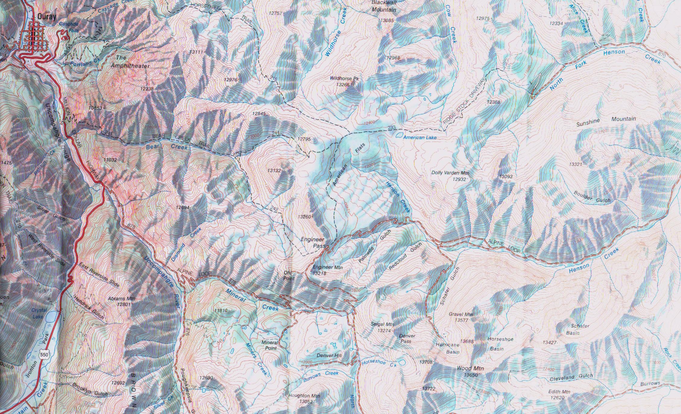
Map east of
Ouray.(798k)
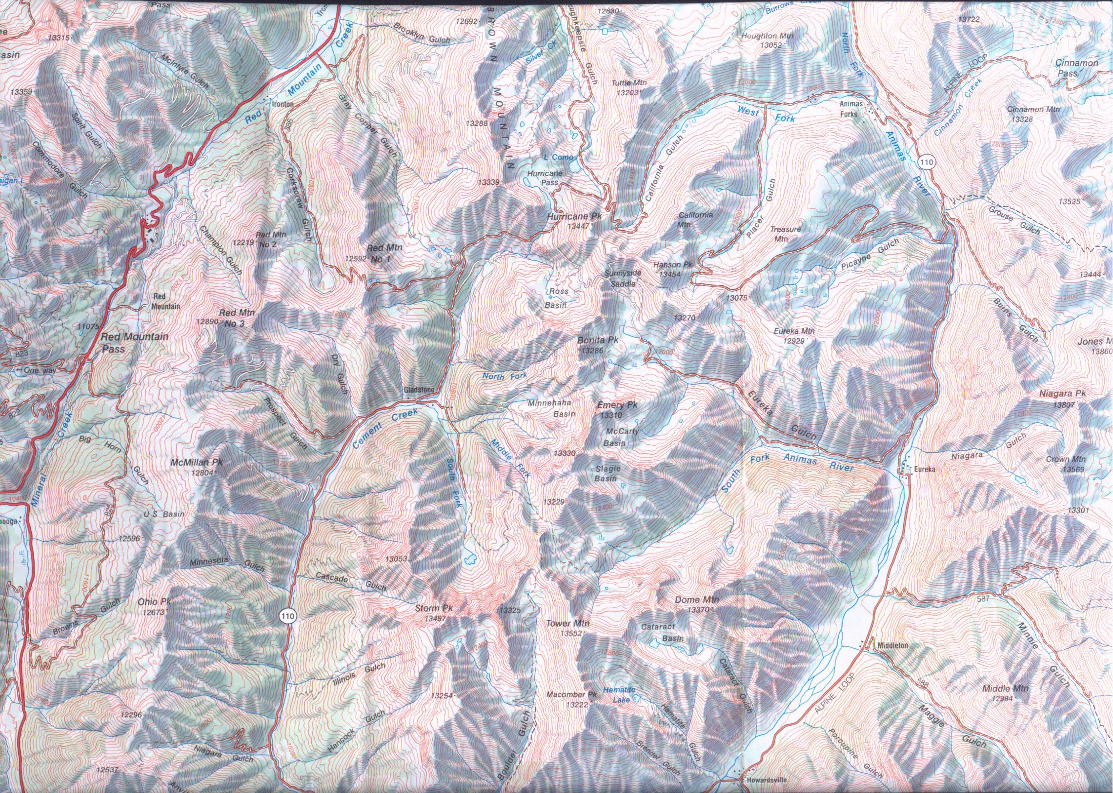
Map south and
east of Ouray.(1.11MB)
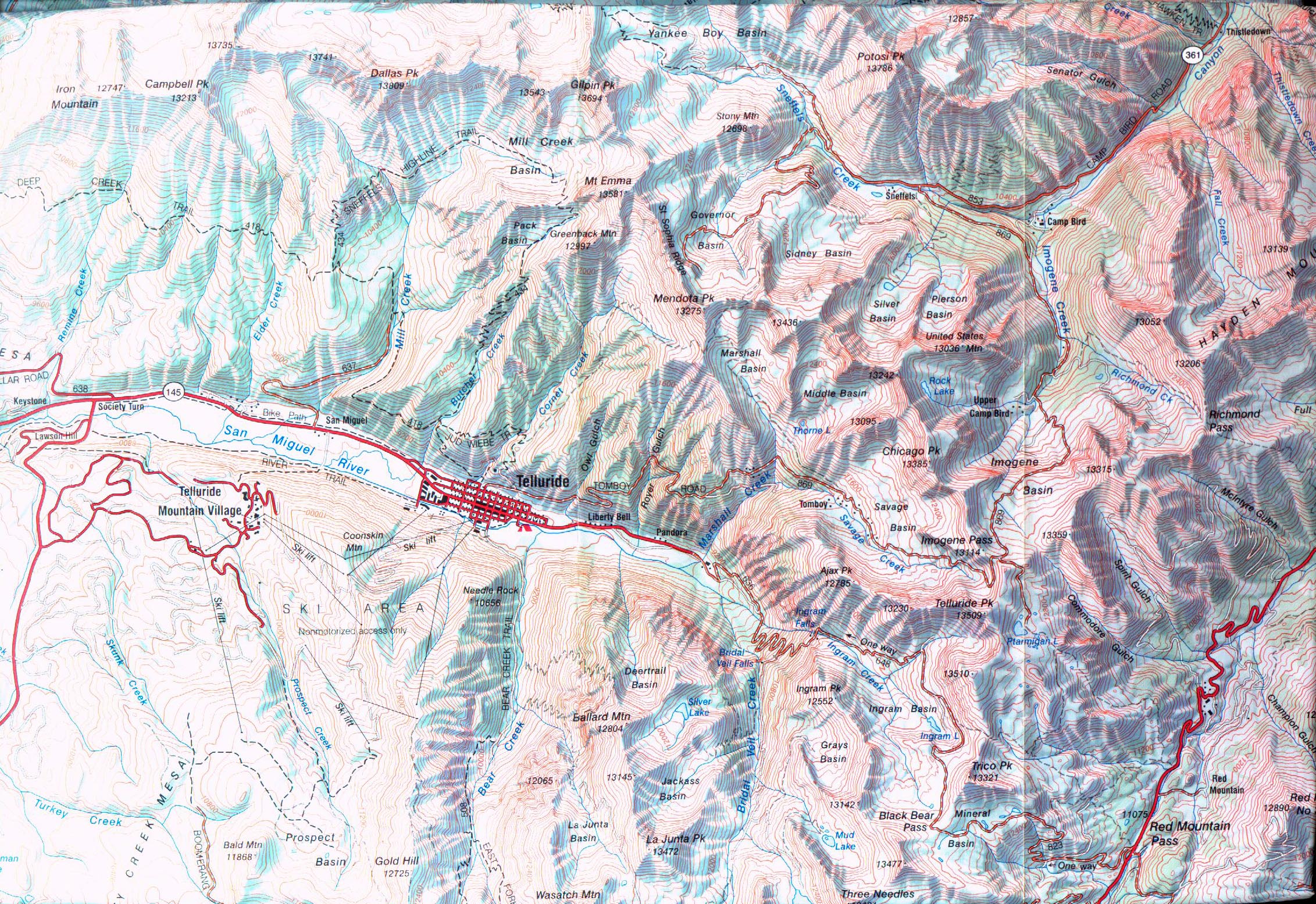
Map south and
west of Ouray & Telluride area.(1.16MB)
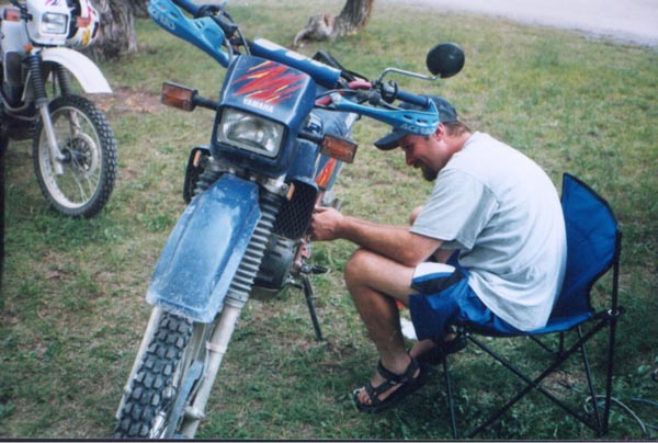
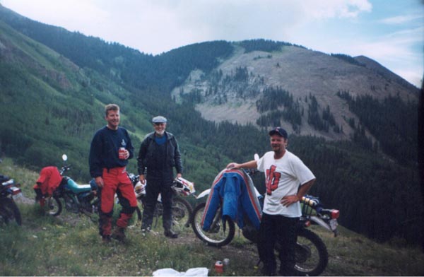
Getting our Bikes and Getting to Colorado:
We knew Mike and his Dad would probably be up for this type of trip as
well, and it only took about one minute to convince Mike and his Dad to go. We
started looking for bikes to purchase late last year, and by April we all had
purchased our steeds. Steve was the first to find his. He and Mike traveled to
the
Knoxville
area to pick up his Yamaha
XT350. I had located a Suzuki DR350, but at the last minute I made an offer
I didn't think would fly on a Kawasaki
KLX650 and the guy bit on it. The three of us went to
Clarksville
TN
to pick up my bike. Mike and his Dad bought both of their bikes from the same
person. A Yamaha XT225, and a Yamaha XT350 respectively. Some debate ensued over
the following months as to which bike would perform the best. Mike graciously
offered the use of his pick-up truck with a camper attached, and his Dad had a
spacious trailer that would get all of our bikes there along with his Venture
for an extended ride after our week long vacation (it must be nice to be
retired).
We set out on Friday afternoon at around 4:30. Ironman Mike drove the
first three tanks full of gas. During his second tank somewhere in
Missouri
we had our first setback; a flat tire on the trailer. Fortunately we had a
spare and the lost time was held to a minimum. At the start of his third and
final tank, Steve yelled from the back to stop. After turning onto the ramp we
discovered the door to the camper had not been properly shut, wedged against one
of the bikes, and crumpled up. Eliminating the door we now had just a screen
door. Once in
Kansas
and into the daylight we stopped at Lakin on
U.S.
50 to get gas. Just down the road there was a tire store where stopped to have
the spare replaced. There we lost the screen door in a similar episode; now
there was no door on the camper at all. The rest of trip across
U.S.
50 was uneventful, we arrived in Ouray 28 hours after we had left.

Now the good stuff!
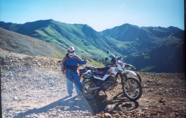
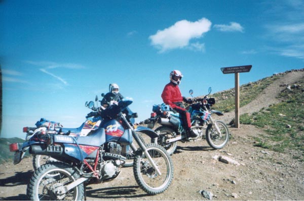
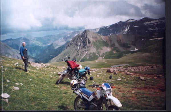
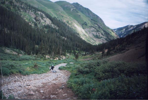
Day One of Riding (Sunday):
We had purchased many maps and videos instructing where the best rides
were so we had a pretty good idea where to begin. After a big breakfast we
headed down
U.S.
550 (
Million Dollar Highway) to the entrance of the Alpine
Loop. This trail would take us up onto of
Engineer
Mountain and down
Engineer
Pass.
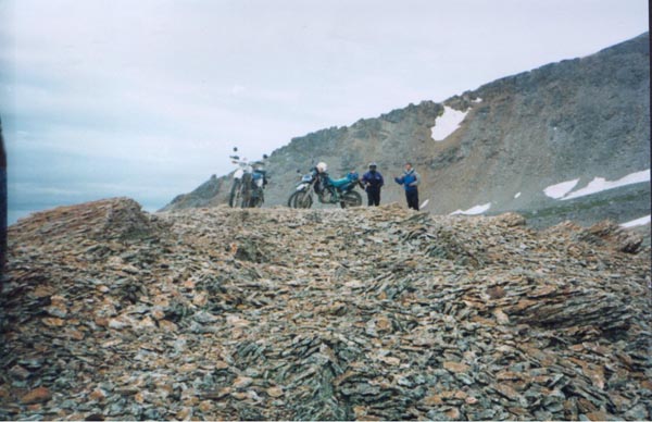
Going up Engineer Mt. Steve experienced a front flat tire. We had forgotten the
fix-a-flat at camp so we flagged down a passing rider who had some extra. The
tire was quickly fixed and we rode on. Engineer
Pass was rated moderate to difficult but we had no problem getting up and
down. Mike and Steve had noticed a significant loss of performance with their
bikes at this high altitude. Even with the loss of performance they still were
riding with vigor. We all had some experience with riding in the dirt. Steve had
the least while Mike and his Dad were quite proficient with a great deal of
experience on trials bikes. We rode the Loop to
lake
City
for Lunch a local café. While eating lunch it began to rain. Leaving
Lake
City
we continued on the Loop over
Cinnamon
Pass.
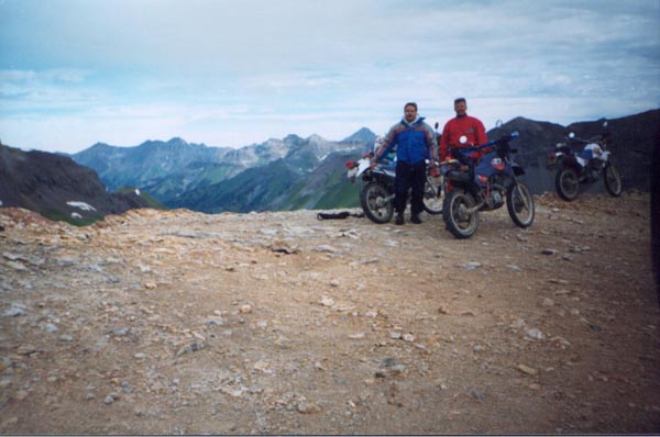
Once on top of Cinnamon
Pass we stopped for a break. There we found a challenging hill to climb that
was relatively steep, and we all made it up with varying degrees of success.
Cinnamon
Pass
was also rated moderate to difficult, and again we were not terribly
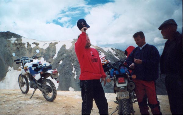
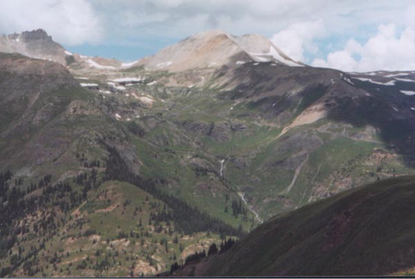
challenged. The view on all the mountain peaks was particularly spectacular. We
continued to run across a number of jeeps and other four-wheel drive vehicles.
Occasionally we ran into other motorcyclists, but we were far outnumbered. When
we cam upon a four wheeled vehicle we flew by with ease. The only difficulty we
had was with the big multi-passenger tour vehicles. These guys had no intention
of getting out of our way, and made passing as difficult as they could. Down the
backside of
Cinnamon
Pass
we came into the ghost town of Animas forks. There is a collection of old
buildings, mostly in support of the abandon mine there. In Animas Forks I made a
mistake by listening to some cage driver who steered us in the wrong direction
(probably on purpose). We ended up going down
Colorado
110 into Silverton. We had to stop there to try some local brew. After that, we
headed back up
U.S.
550 and to the KOA (our
campsite) in Ouray. We were done for the day.
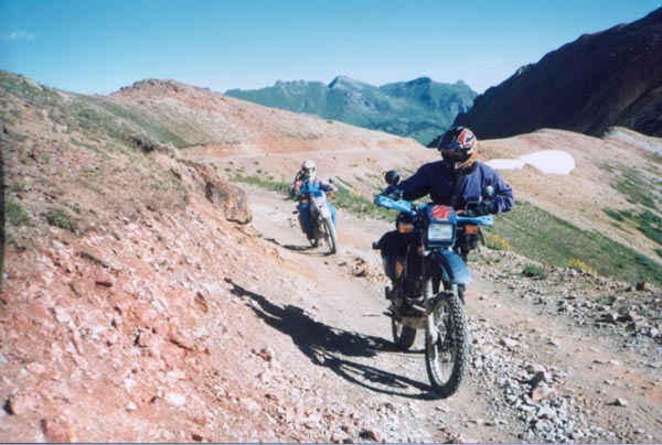
Day Two of Riding (Monday):
In an attempt to catch what we missed by my misguided directions we went
back to the same area. This time we rode further down
U.S.
550 and entered the trail system at Corkscrew
Gulch. It had rained most of the night and the trip up Corkscrew was more
difficult than going up
Engineer
Pass.
This particular stretch highlighted mine and Steve's poor decision on tire
selection (OK… my
decision). We had purchased Metzler 50-50 rear tires, and they did not
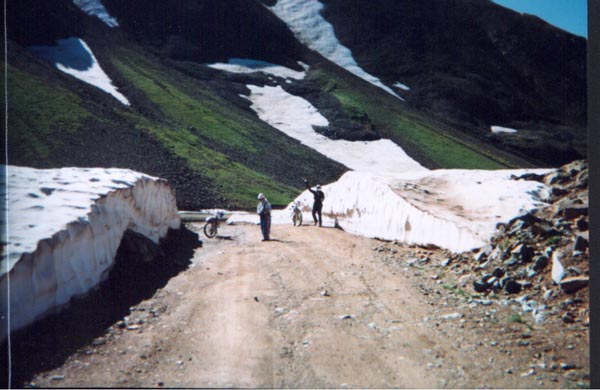
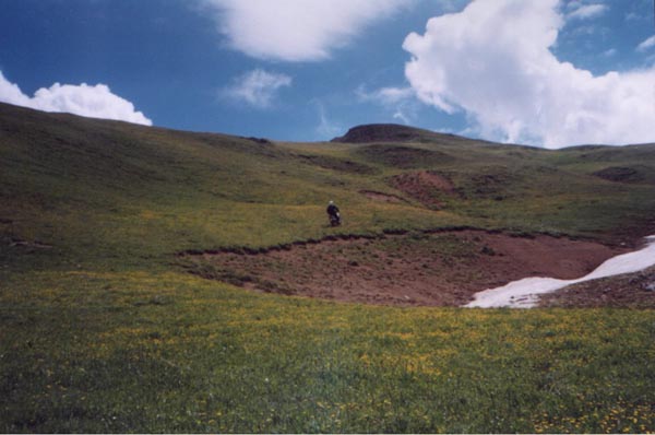
perform well in mud. Nevertheless we made it up the Gulch which placed us on Hurricane
Pass. Going down
Hurricane
Pass
we rode through sections of snow where the clearing for the trail left 15-foot
banks on either side. We had our sights set on
Poughkeepsie
Gulch once we were on top of
Hurricane
Pass.
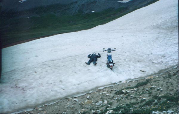
Once again we missed our tun off and wound up going across
California
Gulch. Going down
Hurricane
Pass
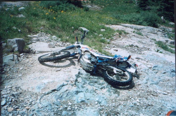
Ralph found a patch of snow he tried to traverse; he did not make it. It was
this kind of abandon that kept us all amazed at Ralph's vehemence at age 64. California
Gulch put us back into the ghost town of Animas
Forks. Once there we turned north and headed back over
Engineer
Pass.
As headed back towards
Lake
City
we took a couple of side trips. First up Matterhorn
Creek trail where we rode through a fantastic grove of Aspen trees. This was
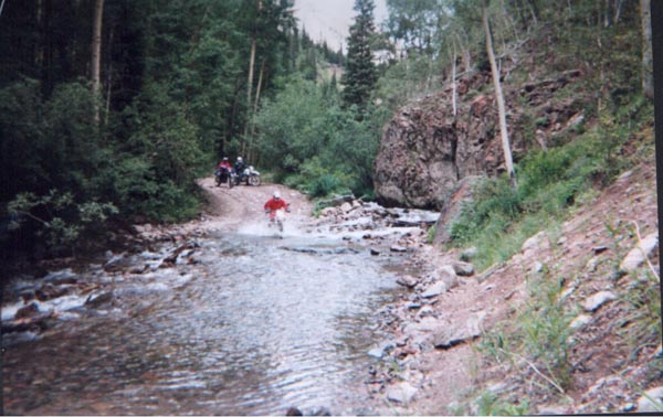
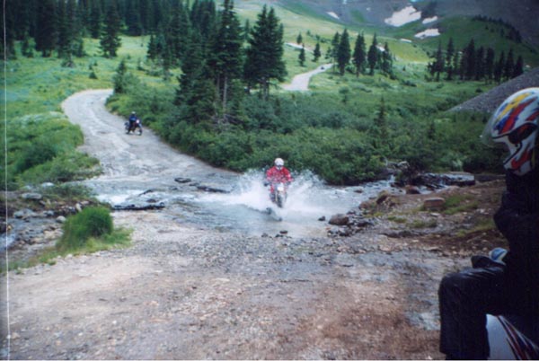
a fairly short trail but had some good water crossings. Next we rode Nellie
Creek just east of the Matterhorn Creek trail. This was a really nice trail, lots
of whoop-de-dews, and great scenery. We also ran across a couple of great water
crossings. We all enjoyed this trail a great deal. As we raced towards
Lake
City
we ran into heavy rain once again. After lunch at a different spot, we headed
back towards
California
Gulch and were determined to hit
Poughkeepsie
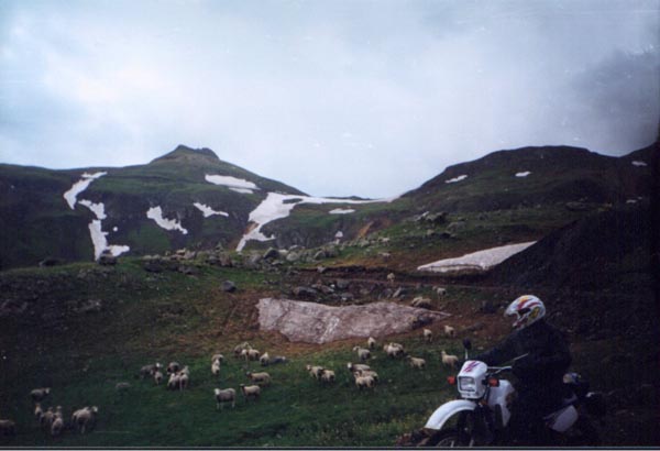
Gulch again. Before we got there we took a little detour across Picayne Gulch
and up Placer Gulch. Placer had some open range on it where a herd of sheep was
grazing. Turning left on
California
Gulch we climbed back up Hurricane
Pass. But once again we missed Poughkeepsie
Gulch, Imagine how we felt missing it again for the second that day. Back
down Corkscrew Gulch we were nearing the end of the day. After we went back to
camp for awhile we decided to check out the
hot springs
in town. It was just what the doctor ordered. The 105o F water
temperature erased all of the cold accumulated from a day's riding in the rain.
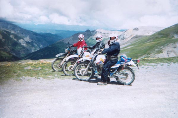
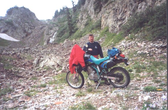
Day Three of Riding (Tuesday):
After our normal stop at our breakfast café we initiated our run at the
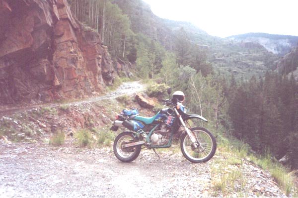
most difficult of all trails; Black Bear Pass. We rode
U.S.550 up on top of Red
Mountain Pass and turned west on the trail. Getting to the top of Black Bear
Mountain proved easy enough, we began to chuckle to ourselves thinking how could
this be rated difficult? Going down Black
Bear Pass was not as easy, loose rock and steep cliffs taxed our abilities.
My bike was geared too high for this portion of the trail, and I had to slide
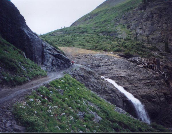
down the cliffs with my back brake locked. All this was peanuts compared to what we
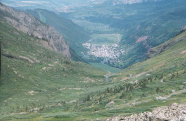
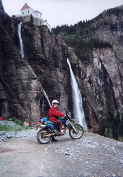
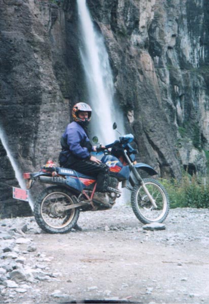
were in store for. At the very top of the falls, as we looked down at the town of
Telluride
spread out majestically before us we saw an extremely narrow path down to the
main falls. This path was as wide as a jeep with a cliff that had a shear drop off
to the left, and a rock wall to the right. Needless to say we hugged the wall.
What made it difficult was on the right side of the path were steps in the rock
approximately four feet in height. These steps lasted for about 1000 yards. If
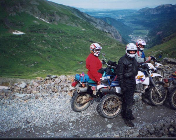
your throttle stuck or you fell to the left you were gone. Once at Bridal Veil
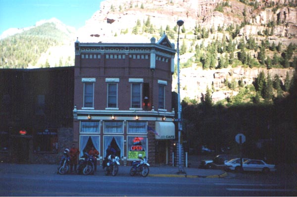
Falls we wound down into the town of
Telluride. We ate lunch there at a trendy spot called Smuggler's
Brew Pub. Good food, good brew. Halfway through town we turned north and got
onto the trail taking us up to Imogene Pass. At 13,509 feet elevation Imogene
was the highest peak we would climb. Going down Imogene
Pass had us thirsting to reverse direction and go back up. The Yankee
Boy Basin and Sneffels
Creek trail beckoned us. Yankee Boy was no easy trail either. There were
several routes up the Mountain, and of course we took the most difficult. It was
rather difficult to get to the top. As the skies looked about to open up we
thought we should start to head back. Obviously we did not make it, going back
into Ouray on Colorado
361 we got drenched. That night we spent some time in the hot tub at the
campground. This day's ride was the best of the trip.
Day Four of Riding (Wednesday):
We were not sure what we wanted to ride today, we had found what looked to
be an open trail called
Richmond
creek. This trail would have dumped us back onto
Imogene
Trail
but the trail was not maintained and was not passable. Our backup plan had us
headed back down
U.S.
550 to the entrance of Black Bear. On the east side of the road opposite Black
Bear is Big Horn Gulch. We took off on this trail. It was not at all difficult,
but the scenery was nice. We caught a good view of Black Bear Trail on the
adjacent mountain. Once through Big Horn and through Browns Gulch we were dumped
back onto to
U.S.
550. We decided to run on the
Ophir
Pass.
I had experienced a flat the day before, and thought the tire was fixed. After
beginning down the Ophir Trail I went through a whole can of Fix-A-Flat. I
decided then that I needed to head back into town. I went as fast as I could but
only made it to the outskirts of town. While I waited, Steve went back to camp
to get another can. We ended up riding to Ridgeway where there was a motorcycle
shop. The owner of the shop was a guy named Chuck who participates in the Pike's
Peak Run every year and does very well (he finished second this year). Mike and
Ralph had found this shop the day before when they were looking for new jets for
Mike's carburetor. Chuck put a new tube on front tire while Ralph and Mike rode
Governor's Basin Trail. It sounded like Steve and I really missed out on a good
ride. That we went into town for dinner and some souvenir shopping.
Day Five of Riding (Thursday):
Chuck had told us there were some great trails west of Ridgeway in the Umcompahgre
National Forest. We found
Last Dollar Road
like we were told, and began to look for trails off of that road. We did not
find anything that great but there were a few trails to ride. Most of the trails
were in heavy trees, and made the going difficult with my bike, and tire
combination. We went back into Ridgeway for lunch, and to get some more
information from Chuck. There we discovered Mike had hurt his leg two days
earlier without telling any of us, and it was beginning to bother him. We
stopped at a local medical clinic for it to be x-rayed. Fortunately there were
no broken bones. Mike headed back to camp to rest while the rest of us went back
to find some more trails. We did find a series of trails that looked to be used
by quadrunners. Nothing much to speak of here. It was getting late some we
hustled back to camp.
Day Six of Riding (Friday):
Our last of riding before we have to leave. After all of attempts to find Poughkeepsie
Gulch we were determined to find it today. Steve stayed back at camp while
the rest of us tried the trail. Getting to
Poughkeepsie
proved pretty easy after all. A quick jump onto the Alpine Loop towards
Engineer
Pass
, and there was the sign, it did exist! I don't know how the hell we missed it.
Poughkeepsie
Gulch is known for its 3000 yard patch of loose rocks that would be better
described as small boulders. Ralph and Mike were in the front, and I brought up
the rear. My first attempt stalled after about 100 yards. My bike was geared too
high, and it really showed here. To ascend up
Poughkeepsie
you need to be able to ride slow and have a great deal of available torque at
all times. While Mike and Ralph kept chugging up the hill I tried it another
time but to no avail. Then I saw an alternate path and thought I could bypass
the rocks. This little trial was also difficult but not as difficult as the main
trail. I got up even with Mike about 2000 yards up but the trail I was on dead
ended. I yelled for them to go on, and went back down to try one last time. This
time I didn't make it as far as I had the second time so I turned and went back.
Back in camp I gathered up Steve for a ride to either Four Corners or at least
Durango
. We started out but a nasty looking storm was brewing to the south so we
grabbed a bar stool in Ouray. Mike and Ralph told us of there experience on Poughkeepsie
and made me quite jealous that I could not make it. When they got to the end of
the rocks they were confronted with the "Wall". After several tries
they both were able to make it to the top. Triumphant, they rode back to camp.
That night we packed our things for an early morning departure.
Trip home:
Ralph stayed to ride his Venture in Colorado
for a time so the three of us drove back with fewer incidences than on the way
there.
Conclusion:
The
debate on the right bike will last for probably some time. I think if I had it
to do over again I would buy a dirt type bike and bolt a license plate to it. I
saw a number of Honda XRs, and
Kawasaki
DXs that were not perfectly street legal, but out there the police don't
seem to hassle them. If I had to take my bike out again I would have a 13 tooth
counter shaft sprocket rather than the standard 15 tooth. I tried to make this
change at Chuck's shop but he did not have one. The jetting on the Yamahas were
somewhat suspect. Mike had to drop three sizes to find the perfect mixture of
gas and air. While Steve and Ralph's bikes went unmodified the
Kawasaki
with its vacuum diaphragm carburetor performed the best. A good map is
essential in
Colorado, and while we had several maps it was still difficult at times to navigate to
the best places. I would also stick with an 80%-20% (dirt-street) tire. What
performance you lose on the street is well made up for on the dirt. The one area
where we were covered was clothing. This is one area that translates back to
street riding very well. We all had some sort of riding suit and would have
mighty cold without them.
Email me Ken Adams

Home
