Southwest Colorado Extravaganza
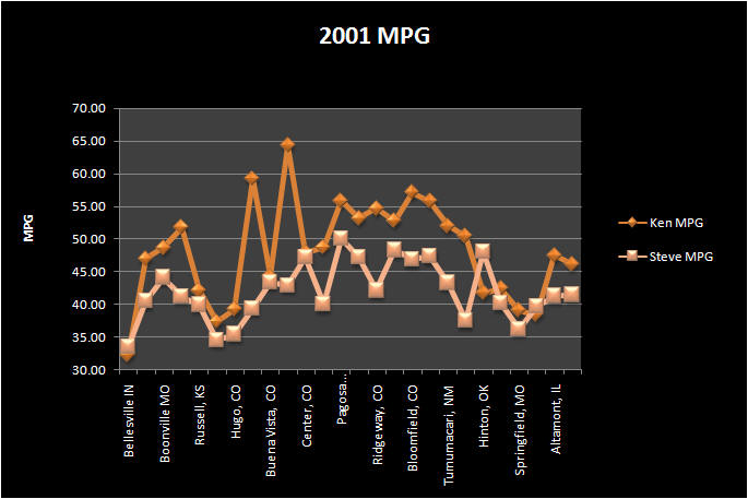
4403 Miles
Every year we try to improve our road trip in someway. Sometimes it is as simple as how to better pack for the trip. This year we decided to improve on how we made our nightly accommodations. Normally we would only have a rough idea of where we wanted to stay, once we got close or as the day began to fade we would start looking for a place to stay. The difficulty was always trying to guess whether there would be a better, less expensive place to stay just around the bend. Often times we would cut a day's riding short to guarantee a place to stay. This year we decided to have all of our accommodations setup prior to our trip. There was some risk in this but with our knowledge of the area we felt it was one worth taking. Now we could ride all day and not have to worry about finding a place to stay. Since we were concentrating on the southwest portion of Colorado we also decided to stay more than one night in a couple of locations. This way we would not have to fully pack every morning to begin our ride.
![]()
Day One (August 3, 2001) Cincinnati - Oakley, Kansas - 985 miles
We chose to stay in Oakley knowing it was our jumping off point of I-70, and that it was roughly 950 miles. We felt if we could make it this far in one day we could still make the next day fairly eventful. Oakley is on the doorstep to Colorado, and the ride from there to Colorado Springs is relatively short and somewhat enjoyable. We identified a motel we felt met our needs on the internet. The name of the place was Kansas Kountry Inn. Getting there was plenty uneventful. We left my house at 5:00 a.m. and rode and rode and rode. We didn't hit rain until about the 5th mile of the trip. Fortunately it wasn't heavy and by the time we were 40 miles into Indiana it had stopped. It took six tanks of gas but we pulled into the lot about 9:30 p.m. MST. In the last two hours we covered 180 miles. The final total was 987 miles; a new record for one day mileage on our trips. The motel turned out to be fairly nice. After unpacking we took a dip in the pool, and met some other motorcyclists from Missouri.
![]()
![]()
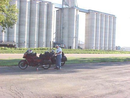
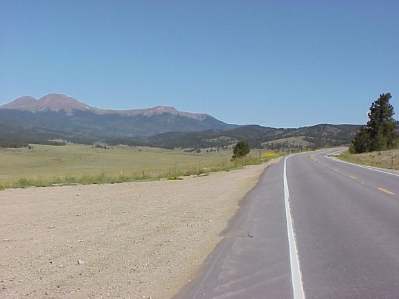
Day Two Oakley, Kansas - Canon City, Colorado - 385 miles
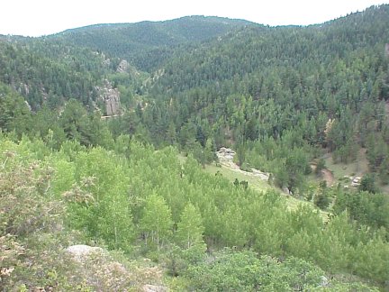
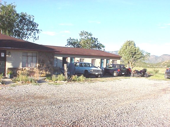
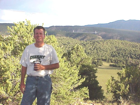
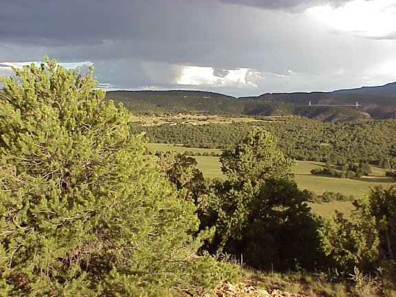
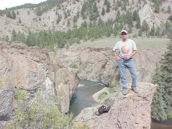
Despite our late arrival and long ride the day before we got our traditional 7:00 a.m. start. We headed out U.S. 40 with our sights set on Colorado Springs (CS). The ride on U.S. 40 is little different than the interstate in the sense of speed. There was little traffic and we traveled at speeds of 80mph. The difference is you travel through some small towns and feel a little closer to the scenery than the rather aseptic interstate. The most common sight along U.S. 40 are the huge grain elevators, and the mile long trains sitting idle on the tracks as they await loading. We stopped for a rest in Weskan on the border of Kansas and Colorado. We came through here in 1995 and had stopped at Sharon Springs to fill up with water and some gas and to basically get out of the 104o heat. Today the weather was pleasant and quite comfortable; what a difference six years makes. We continued out U.S 40 through the towns of Cheyenne Wells and Kit Carson. We had mapped a course that calculated to be a 15 mile shortcut to CS. Looking at the map in Weskan (KMZ) we targeted for a fill up in Punkin Center. So 12 miles past Kit Carson we turned onto C94 towards CS and saw the sign no services for 70 miles (KMZ). With 140 miles already on the tank we realized we couldn't make it. So we kept on U.S. 40 towards Limon, and would get to CS that way. Once in Limon we jumped on U.S. 24 towards CS. On the west side of CS we began to run into the Saturday morning Pike's Peak traffic. We exited the main U.S.24 and ran through Manitou Springs on the business route. We had to stop again at the Royal Tavern for a brew (KMZ); we had stopped there in 1995 for the same reason. We also grabbed a bite to eat across the street and wished we hadn't. Back out onto U.S. 24 we headed into Woodland Park. U.S. 24 in this area was fairly busy particularly on either side of Woodland Park. Once through Woodland Park we passed over Trout Creek and Rule Creek as we began the climb up Ute Pass. As we were climbing we turned south at the town of Divide on C67 (KMZ). This was the beginning of the Gold Belt Tour. This tour is 131 miles of scenic byway that passes through historic Cripple Creek, Florence, McCourt, Adelaide, Wilbur, Victor, and other former mining camps. At a stop near Midland (KMZ) we plotted our strategy for our assault on Cripple Creek. We decided to each spend $40 on blackjack. We would either quit after being up $40 or after losing $40. We ambled into the Double Eagle Casino (KMZ) and sat at the first $5 table we ran into. After two hours we couldn't seem to get much off of the even mark. After a couple of house beers we decided we needed to get a move on. We left, down a total of $5 for all of our effort. After filling up in town we headed north out of town. A couple miles north of town we turned right onto 82nd that took us east and then due south. 82rd goes through the old mining towns of Stratton, Independence, and Goldfield before ending in Victor. Victor was a very unique town and rustic town. There seemed to be quite a bit of activity for a late Saturday afternoon. We could not find any reference to Phantom Canyon Road so we did what guys most hate to do; we stopped to ask directions. Fortunately, the guy we asked was a motorcycle rider. He also confirmed that we would not have any trouble riding our street bikes down Phantom Canyon Road. We thought it was a dirt road, and we really were not certain is could be traveled on a street bike. After finding where to turn the paved road quickly turned to dirt. The road wasn't terrible but we could not go much faster than 30mph. The road was well worth taking the views were spectacular, and there were very few cars on the road. We stopped a couple of times along the road to soak in the scenery (KMZ). Each time we stopped there wasn't a soul around (KMZ). The road is about 30 miles long, and has very gentle grades because it is on an old railroad bed. The road claims to have the most bridges than any other in Colorado (15 in 16 miles). The road also passes through two tunnels as it winds its way down through the canyon. There are campers sprinkled about the canyon and more of them towards the southern end of the road. The road essentially dumps out on US 50 about 6 miles east of Canon City. Once we got into Canon City I realized I forgot to bring the motel confirmation sheet with me. I knew I probably didn't need the sheet but I forgot the name of the motel! I figured I would remember it once I got in town, and I knew it was on US50; how difficult could it be? As we got on the west side of town without seeing any motel that looked familiar we stopped at a convenience store to consider our options. We tried contacting someone at home that could access the internet but had no luck. Finally I remembered the name had "rose" in it and we searched thought the phone book and found the Cactus Rose listing. The motel (KMZ) was actually out of town about 10 miles in the area of the Royal Gorge. Our first impression of the motel as we pulled in the parking lot was not too favorable. We like staying at the budget places but this seemed a little off the mark. We were wrong. The rooms were clean and the hospitality was exceptional. The owners told us if we wanted to climb the ridge behind the motel we would be able to see the Royal Gorge bridge. We walked a good mile and a half back to the ridge and climbed up (KMZ). The view on top was pretty nice, the bridge could be seen off in the distance. As we walked backed the skies opened up and we got drenched. That night the owners opened their hot tub for us. As we were settling in we met another rider from Kansas City and had a good conversation the balance of the night.
![]()
![]()
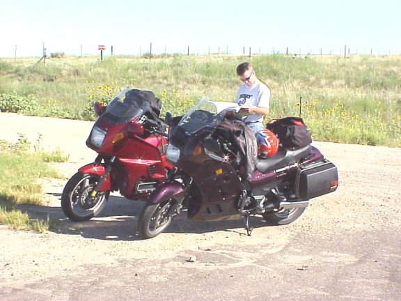
Day Three Canon City, Colorado - Lake City, Colorado - 210 miles
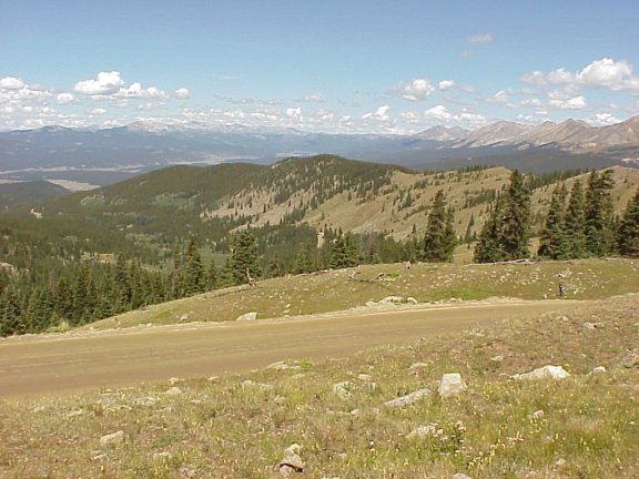
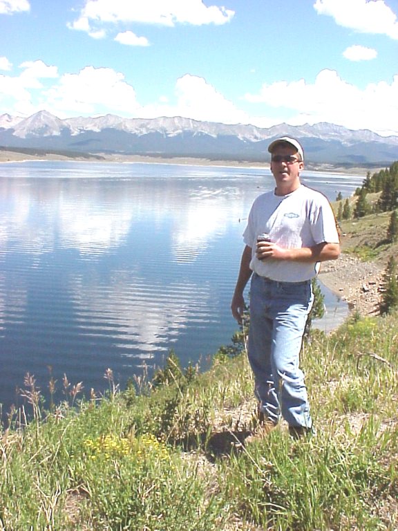
After learning at dinner the night before that the charge at Royal Gorge was $14 per person regardless of the time spent there or whether or not you rode the incline we decided our glimpse of the bridge from the ridge the night before was enough. We decided to head on toward Lake City. We rode north on C9 towards Hartsel. C9 follows the Currant Creek and the western side of Pike National Forest. The road travels through open range leaving little place to pull over and enjoy the scenery. The road was on good condition but had few twists and turns. Once in Hartsel we headed west on US24 towards Buena Vista. This road was very busy on this Sunday morning and we had to be aggressive in order to pass all of the traffic accumulating as we approached Trout Creek Pass. Once over the pass we stopped on the side of the road and observed the "Castles" rock formation off in the distance. Just before Trout Creek Pass US285 and US24 combine to climb over the pass. Once on top, the highway coming down is called the Highway of the Fourteeners. In the distance directly ahead the pointed summit of Mt. Princeton first appears, followed in succession to the right by Mts. Yale and Columbia. After 3/4 of a mile, just before the highway curves left, you then sight the sharp peak of Mt. Harvard (3rd highest peak in the Rockies), and to its right Mts. Missouri, Belford, and Oxford all higher than 14,000 feet. We dropped down the mountain and into Johnson Village virtually at the base of Mt. Princeton. Our plan was to pass through the fourteeners on Cottonwood Pass Road. During our gas stop at Johnson Village we began talking with some other bikers about Cottonwood Pass Road. I had also asked some people in the gas station about the condition of the road. We got conflicting information. The bikers told us the road was extremely difficult and in much worse shape than Phantom Canyon Road. We began to discuss some alternate routes. As car traffic began to pile up waiting to fuel up we decided to go into Buena Vista, pull out the map and discuss what we wanted to do. As we took the 3-4 mile trip into Buena Vista I began to doubt the biker's assessment of the road. When we pulled over I told Steve that guy was on a big Harley of some sort riding two up with almost zero ground clearance; of course he is not going to like anything that is less than ideal road conditions. I didn't think he took our riding style into consideration, he was only offering advice from his point of view which was vastly different than ours. Steve stated he was thinking the same thing and we decided to try the pass. We couldn't have been more pleased. The road on the way up (KMZ) was all paved and in very good condition. As we approached the top, all of the fourteeners could be seen to the north and south of us. The summit was a little crowded so we continued, looking for a less crowded spot. At the summit the paved road turned to dirt that was actually in better shape then Phantom Canyon Road. There were some big potholes but steering around them proved to be an easy task. Our spot for stopping was just below the summit and offered beautiful views (KMZ). At the base of the mountain the road turns back to asphalt and dead ends into the Taylor Park Reservoir (KMZ). There we continued on toward Cumberland Pass and the Alpine Tunnel tour. I was really looking forward to this portion of the trip. As we turned onFR765 towards Tincup we were once again on dirt, and this portion of the road seemed in less than desirable shape. Neither of us were quite ready for another 60 miles of dirt down to Gunnison even if it meant missing the Alpine Tunnel tour. We stopped at a campground and asked if the dirt continued all the way down, and were told it did. So we decided to go to Gunnison via FR742 and C135 both of which were paved. FR742 goes through Taylor Canyon which is a popular rock climbing destination. Before the intersection with C135 in the town of Almont the road parallels Taylor River offering some nice views. C135 follows the Gunnison River down into the town itself. There we headed west on US50 toward the Blue Mesa Reservoir. On the east side of the reservoir C149 intersects US50. We headed south on C149 toward Lake City. This section of road has wonderful sweeping curves as it approached Ninemile Hill and runs through the gulches Milkranch and Dutch. We stopped at The Gate state campground along the Gunnison for a rest. The afternoon rains were looming so we hightailed it to Lake City. The Quiet Moose Motel is on the north side of town (KMZ), and as soon as we got checked in the skies opened up. At night during the rain we ate at the restaurant/bar at the Quiet Moose. The food was decent and the bar had darts and a pool table; what more could you ask for?
![]()
![]()
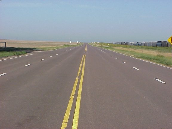
Day Four - Lake City and back - 364 miles
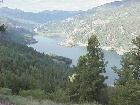
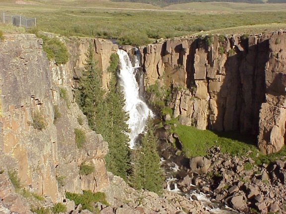
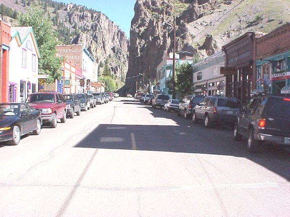
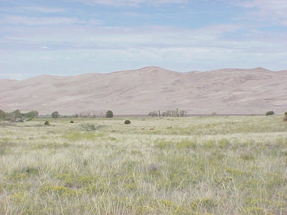
It was nice taking off in the morning not having to pack for the day since we were staying at the spot tonight. We headed south on C149. The road passes over the Slumgullion Pass where the Slumgullion Earthflow can be spotted. We also passed high above Lake San Cristobal (KMZ). The lake was smaller than I had expected. The lake was formed by the Earthflow damming up the Gunnison river thousands of years ago. We also passed the Alfred Packer site where Mr. Packer ate his comrades on a packing expedition in the 1800s. Next we traveled over Spring Creek Pass and shortly after the summit we came upon the North Clear Creek Falls (KMZ). The Falls are just off the road and close to a parking lot (our kind of sightseeing). The Falls have a spectacular 100 foot fall into a box canyon and are well worth a visit. Continuing on we were once again in wide sweeping turns and beautiful scenery. As we continued down the road we began running alongside the Rio Grande. At a scenic overlook at the crest of Stony Pass the view west looks up the glaciated valley of South Clear Creek, Hermit, and Brown Lakes glimmer on the valley floor, the 13,821 foot Rio Grande Pyramid dominates the Continental Divide and there are fourteeners in every direction. The highway turns Northeast as it follows the Rio Grande up to the old mining town of Creede (KMZ). Today we just ride through Creede only stopping for gas. As we continue south now on C149 the valley is wide and grassy but begins to narrow as we approach Wagon Wheel Gap (KMZ). We stop at a state campground (KMZ) along the Rio Grande for a rest. This area is a popular location for river rafters. The road goes through the bottom of a deep, broad canyon in the Collier State Wildlife Area before passing the entrance to the Rio Grande National Forest. Shortly after we are in the town of South Fork. We turned right and headed east on US160 towards Del Norte. We traveled through the towns of Monte Vista and Alamosa. The road was very straight and slightly congested. The San Juans were behind us and the Sangre De Cristo Mountains were in front of us. Not far past Alamosa we turned on C150 and skirted the west side of the Sangre De Cristo Mountains towards the Great Sand Dunes National Monument (KMZ). The Great Sand Dunes were about 25 miles up the road. The Dunes are quite amazing; the winds from the west carry sand and are deposited at the base of the mountains. After viewing the Dunes for a relatively short time we headed back out on C150. When we got to 6N LN. we turned right and headed due west (KMZ). This road was as straight as the eye could see and reminded me of a scene out of High Plains Drifter. We rode at speeds around 100mph with no one in sight. North on C17 and back west on C112 did little to change the scenery or our speeds. Just past Center we altered our route a little and headed north on US285. In the town of Saguache we went northwest on C114. This road was reminiscent of C9, rolling hills as we paralleled several creeks through the Gunnison National Forest. We crossed the Continental Divide again as we crossed North Pass. On the north side of the pass we traversed down into Cochetopa Canyon (KMZ) alongside the creek of the same name. C114 brought us back to US50 just east of Gunnison. There we traveled back into Lake City the same way did the day before. A repeat performance of food at the tavern, darts, and pool.
![]()
![]()
Day Five - Lake City to Ouray - 406 miles
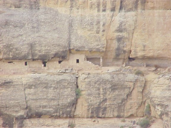
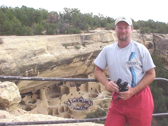
We left Lake City and headed south once again on C149, this was our second trip down this road. We rode non-stop until we reached the town of Creede. This time we stopped and walked around town for a little bit. This old mining town is quite the tourist town now. We grabbed a bite to eat and sat on a bench on main street. Traveling south on C149 took us to South Fork where we headed west this time on US160. This road follows the South Fork of the Rio Grande River through the Rio Grande Forest. As we approached Wolf Creek Pass (KMZ) we noticed some construction signs. However, we had no idea the delays we were about to encounter. Close to the summit the road was one-lane where we had to wait for an hour while cars from the other side passed and also while some blasting was completed. Coming down Wolf Creek Pass would have been nice except for the construction, the road downhill was a 16% grade, and the views were spectacular. Through Pagosa Springs we were fighting loads of traffic and continued construction. We had planned to stop at Chimney Rock but we were behind so when we saw the rock formation from the road we decided that was good enough and continued on toward Durango. We stopped in Durango to pick up a sleeping bag since we were staying in a cabin at the KOA campground that night. We decided on large blankets instead to save on space and money. As we left Durango it began to cloud up and we thought rain was in store for us. We continued west on US160 toward Mesa Verde. West of Durango the terrain becomes very arid and the scenes remind one of the desert. As we approached the entrance to the park we could see the high road of the north rim to the south carrying traffic to the ruins. Once in the park we proceeded slowly with the traffic to the southern edge of the park. There, we saw the Cliff Palace ruin (KMZ). This is probably the most famous of the ruins, and the one most photographed. I didn't realize how many different sites there were within the park. After we left Cliff Palace we stopped to view the Balcony House ruin. The view of this ruin was further away but still quite spectacular. This stop also had a nice view of the Soda Canyon. We left Balcony House and continued back the way we came in leaving the park. Once again we had to bow to time constraints. We had planned to go down to the Four Corners area but we really didn't have the time. We also thought that the scenery and roads to that area would only be fair at best. Plus we would have to turn around and backtrack which we did not want to do. So we continued west on US160 and turned north on C145 on the east side of Cortez. The road travels due north into the southern portion of the San Juan National Forest. Just south of the town of Dolores we passed the over the south end of the McPhee Reservoir. Dolores was a town founded by the Rio Grande Southern Railroad. The railroad followed the Dolores river upstream to the silver mining towns of Rico and Telluride. Now the old railroad bed is C145. Since the road follows an old RR bed it is not very steep and not terribly winding. Nevertheless the views are great as we passed south of the Taylor Mesa and started an uphill climb towards Rico. This is where Dolores creek turns into Dolores River as several creeks come together in the once bustling town. Leaving Rico we begin to climb Lizard Head Pass. Once on top we found ourselves among a group of fourteeners. The cluster, informally referred to as the Wilson Group contains several peaks over 14,000 feet, Mount Wilson, 14,245 feet El Diente Peak, 14,159 feet Wilson Peak, 14,017 feet and an unnamed summit on the spur south of Mount Wilson, known locally as South Wilson, 14,110 feet. Scarcely less imposing is Gladstone Peak, 13,913 feet. At somewhat lower elevation, about two miles east is the spectacular landmark of Lizard Head, a nearly vertical rock spire which rises 300 feet from a conical base to 13,113 feet. As we descended down the backside we passed Trout Lake on our right, and the western portal to Ophir Loop. This trail is an easy dual-sport trail through the ghost town of Ophir and links up with US550. One of the few trails we did not ride in 1999. We continued north on C145 even though that meant we would not ride through Telluride. It had begun to drizzle and we were ready to call it a day. We headed toward Placerville where we caught up with C62 north to Ridgeway. We stopped in Ridgeway to see our buddy Chuck that we met in 1999 but he was out riding somewhere on vacation. After loading with our adult beverages for the night we proceeded to Ouray and the KOA (KMZ). At the campground it seemed like old home week, we recognized most of the workers there. We ate at the Creekside Cafe (oops Kreekside Kafe, sorry) and took a turn in the hot tub. Later we spread out our new K-Mart blankets and called it a night.
![]()
![]()
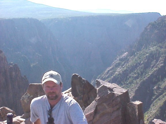
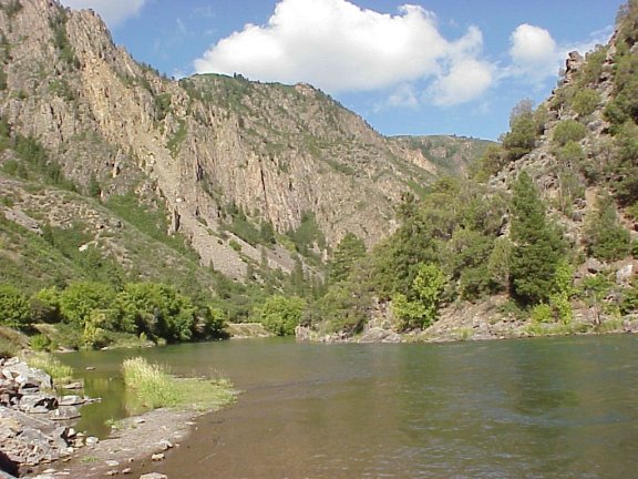
Day Five - Ouray and Back - 310 miles
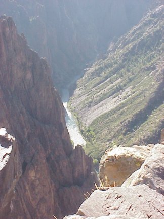
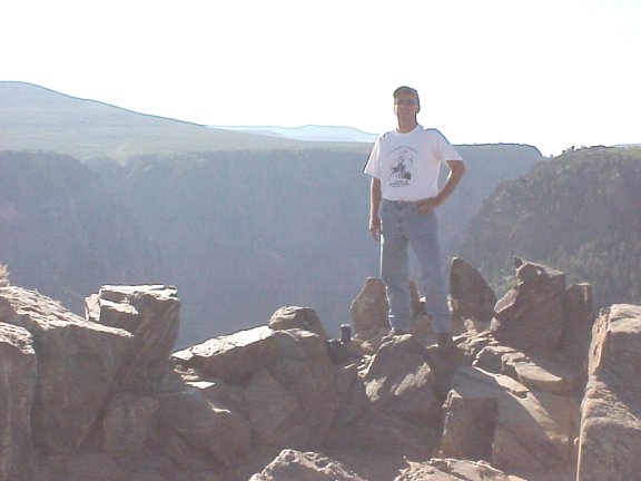
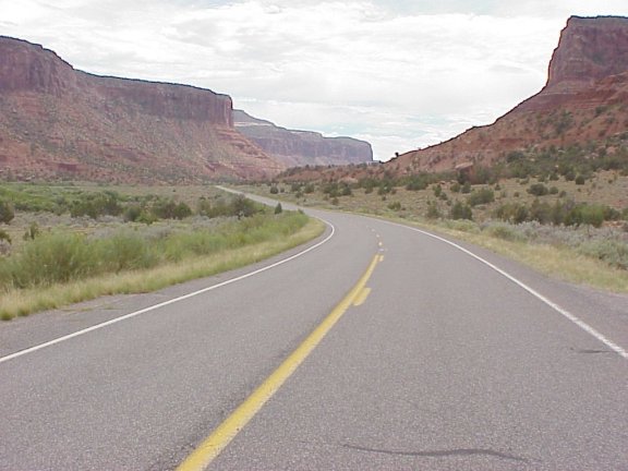
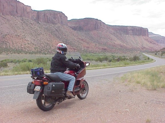
Our night's rest in the cabin wasn't terribly uncomfortable. After eating breakfast at the campground we headed out into what proved to be my favorite day. We headed north on US550 towards Montrose. We turned east on US50 for a short period before we turned north on C347 towards The Black Canyon of the Gunnisnon. The Black Canyon of the Gunnison's unique and spectacular landscape was formed slowly by the action of water and rock scouring down through hard Proterozoic crystalline rock. No other canyon in North America combines the narrow opening, sheer walls, and startling depths offered by the Black Canyon of the Gunnison. We chose the south rim drive which is 7 miles from Tomichi Point to High Point, with 10 overlooks in between. We stopped and absorbed the view (KMZ). The canyon rises 2200 feet with painted walls rising from the water. There we spotted a falcon perched on the rock's edge occasionally swooping down perhaps on some prey. Back at the east portal we traversed down to the water's edge and rode a few miles up to the dam. This view nearly rivaled the view from the top (KMZ). We were there early in the morning so we encountered few people. Back out of the park we backtracked to US550 and continued north. We had planned to tour the Grand Mesa but once again we were short on time. As we traveled north we spotted Land's End Road off to the east. This road must be awesome to ride, we couldn't believe what we were looking at. We made mental note of this road and pledged to return at a later date. Shortly after, C141 appeared on our left and we began our trek on the Unaweep/Tabegauche byway (KMZ). As we began down the road we quickly realized we were in for serious canyon carving. It starts by following the East Creek and the canyon it carved over the years. The road skirts the northern end of the Uncompahgre Plateau. The Plateau is 25 to 30 miles wide and stretches nearly 100 miles south to the San Juan Mountains. Highway 141 into Unaweep Canyon was once known as "Uranium Road" as it was the only access between the mines in the Gateway area and the processing mill in Grand junction. Quickly we were upon the Unaweep Divide which separates water from the Gunnison and Dolores Rivers. Next comes the Unaweep Seep, a unique wet meadow area which is best known as one of only a few habitats of the rare Nokomis Fritillary butterfly. I hope that wasn't a rare one I scrapped off of my fairing. We stopped at Gateway to gas up but decided to pass on the $2.00/gallon liquid, but we had some lunch instead (KMZ). Gateway is an old Indian town that was booming in the '40s during the height of the Uranium mining. As we continued south below Gateway sheer cliffs of the canyon came closer to the road. The road itself was not all that smooth in this portion of Mesa County. Once over the county line into Montrose County the road smoothed out. The curves and open sweepers were fabulous in this area, around every bend was more beautiful scenery. We passed over Roc, and Mesa Creeks where the canyon walls changed color and became more of a burnt orange color, perhaps it was the late afternoon sun. On the right side of the road we passed an old domed-shaped coke oven built in the 1880s and used during the construction of the hanging flume (KMZ). The hanging flume was a short few miles to the south. Clinging to the massive Wingate Sandstone cliffs some 100-150 feet above the Dolores River Canyon, this wooden flume was built in 1889-1890. The seven-mile flume and associated ditches delivered 80 million gallons of water per day from the San Miguel River to operate mining equipment at the Lone Tree Placer site. Even though the site was only 40 feet above the Dolores River, the technology was not yet available to pump the water directly from the river at the necessary volume and pressure to wash the gold from the gravel. We pulled off of the road to grab some pictures of the remains. We headed on towards the town of Uravan in hopes of finding some gas since we were dangerously low. Uravan, named for the uranium and vanadium processed from carnotite ore, was established in 1936 as a company town and mill site for U.S. Vanadium Corporation, a subsidiary of Union Carbon and Carbide Corporation. From the 1930s to the mid '40s the mill produced vanadium used to harden steel in war armaments. Uranium was recovered from the mill tailings during the early 1940s and was used in the first atomic bombs. Production of uranium and vanadium continued until 1984 when the mill closed. Today only the mill and some of the community buildings remain as evidence of a once thriving community. The remainder of the buildings have been removed and the area's current owner, Umetco Minerals Corporation, is undertaking environmental reclamation. Unfortunately no gas was to be found. Nothing was left to do but to hope we could make it to Naturita. We found gas before we ran out and continued down C141 until we came upon the intersection of C145. We turned on C145 and progressed towards Norwood. Driving toward Norwood, majestic mountain panoramas suddenly come into view and we knew we getting close to the San Juans. Norwood sits atop Wrights Mesa and once through the town the road falls off steeply to the banks of the San Miguel River. There we stopped for a break. As we continued we could see we heading back into some weather and stopped shortly after we got going to don our rain suits. At Placerville we turned onto C62 back across the Dallas Divide and into Ridgeway. Somehow we missed the rain. We went to our campsite cleaned up and went for dinner in Ouray. We ate at our breakfast spot of 1999's dual-sport trip. A quick trip around town to buy a t-shirt and we were back at the campground. Into the hot tub we went with our beer in hand and before we knew it, it was time for bed.
![]()
![]()
Day Six - Ouray to Hinton Oklahoma - 810 miles
We began our journey home. We left the campground and headed south on US550 - The Million Dollar Highway. I ranked this road as one of favorite rides off all time. Unfortunately the road has not been well maintained and we were left to simply enjoying the scenery rather than going all out. It is still a spectacular drive. We passed through the town of Silverton and gassed up after we toured around the town. On our way down the highway we passed the Durango-Silverton train on its way to Silverton. In Durango we stayed on US550 toward Aztec and Bloomfield NM. Once below Durango the scenery changes to that of the high desert. In Bloomfield the route changes to S44. Fifty miles before we reached I-25 we hit road construction and it was major construction. We probably lost a good hour on this road. Once on I-25 we headed south towards Albuquerque we caught I-40 east. New Mexico did not have much to offer on the roads we were on. The day was wearing on as we crossed into Oklahoma. This was a state I had not been in on my motorcycle. It was now well after dark and we felt our riding was becoming erratic, we found it difficult to maintain speed. We stopped short of Oklahoma City near the town of Hinton at mile marker 101. There was some new motel that we thought we be acceptable near the interstate but as we got closer we saw a older single story motel looking in need of some business. We rode down to the older motel and booked a room where the owner gave us a motorcyclist's rate. He happened to one himself and drank a couple of beers with us while he showed us his vintage collection of Ducatis.
![]()
Day Seven - Hinton Oklahoma to Cincinnati - 933 miles
Here we were again about to wrap another year's vacation. We headed east on I-40, at Oklahoma City we caught I-44 north to St. Louis. Once in Illinois we began to notice many state troopers so we slowed it down a bit. After we were passed by a Honda convertible we decided to slip in behind him. We let him go just so we could keep in eye on him. Around a blind curve we noticed his brakes lights on, so we immediately hit ours. Sure enough a trooper was lying in wait. He obviously was not pleased when he was stopped as we zoomed by. Many hours later we crossed into Ohio and we were home.
TOTAL MILES 4403
![]()
![]()
Email me Ken Adams

Home