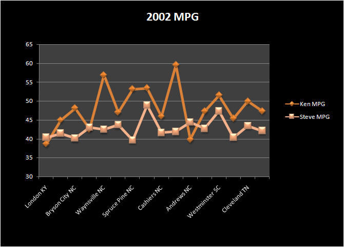
Appalachian Twist
2589 Miles
We decided to try the southeast again but this time armed with better maps, and a better idea of where to ride after much research on the internet. We employed our latest strategy of having motel reservations and staying in one location for more than just one night. Our goal for this ride was to ride as many twisty roads as possible. We knew all of the scenery would be wonderful wherever we went, we just wanted the twisty roads.
![]()
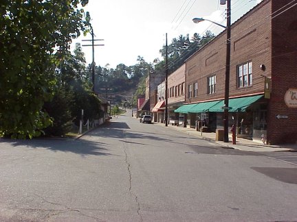
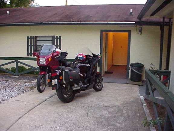
Day One (July 27, 2002) Cincinnati - Maggie Valley, NC
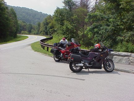
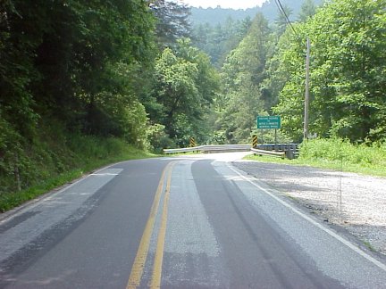
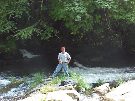
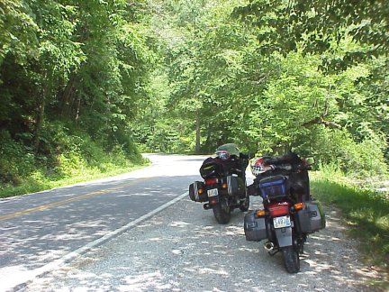
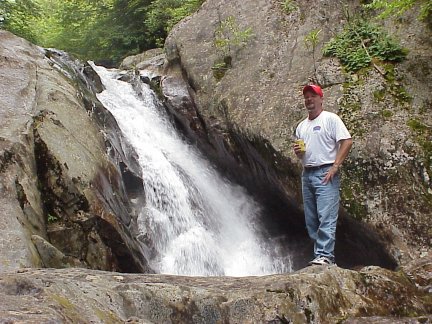
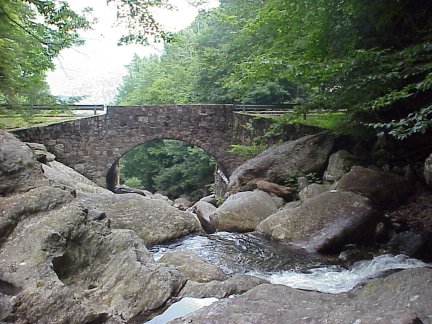
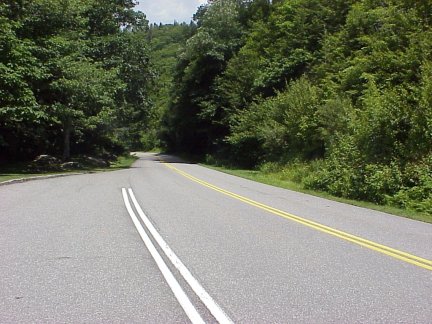
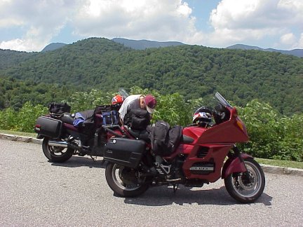
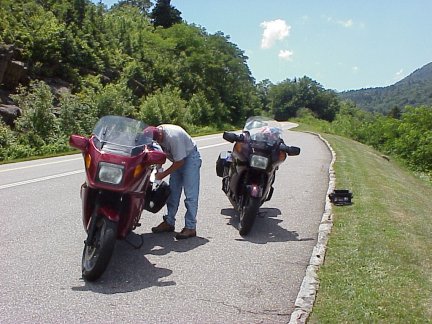
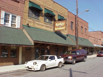
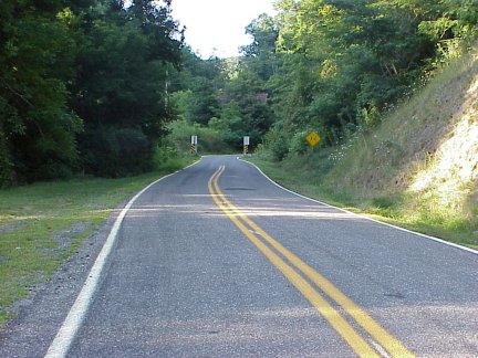
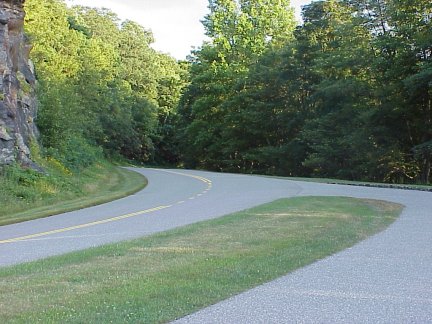
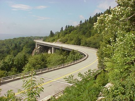
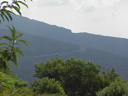
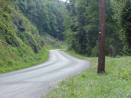
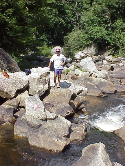
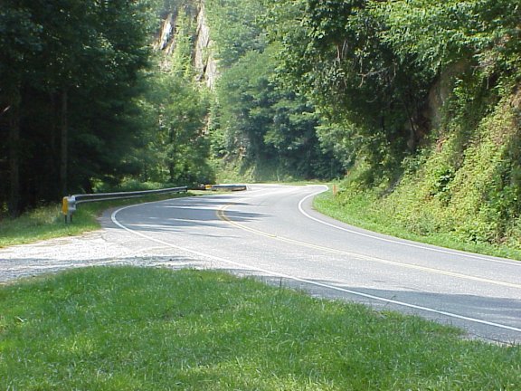
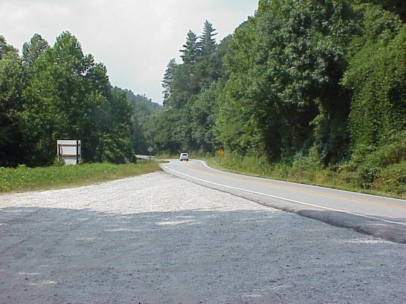
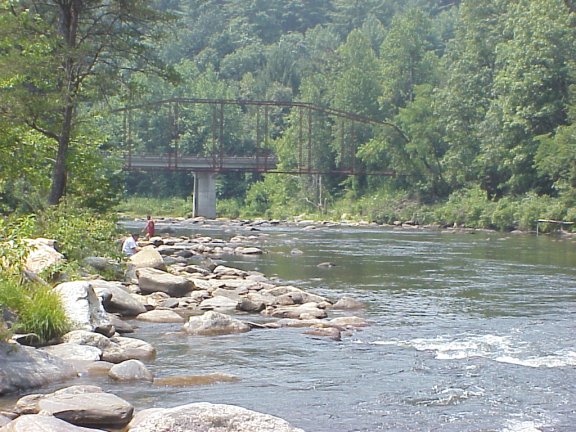
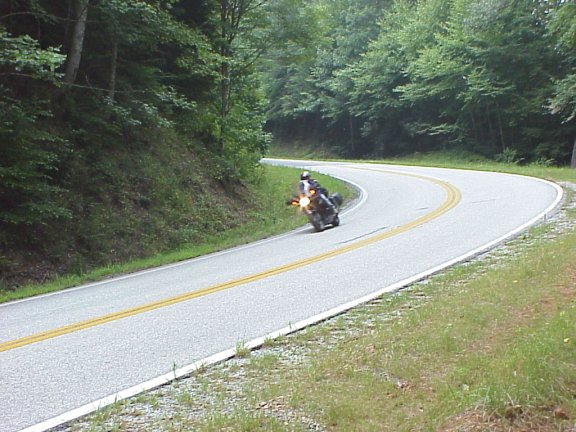
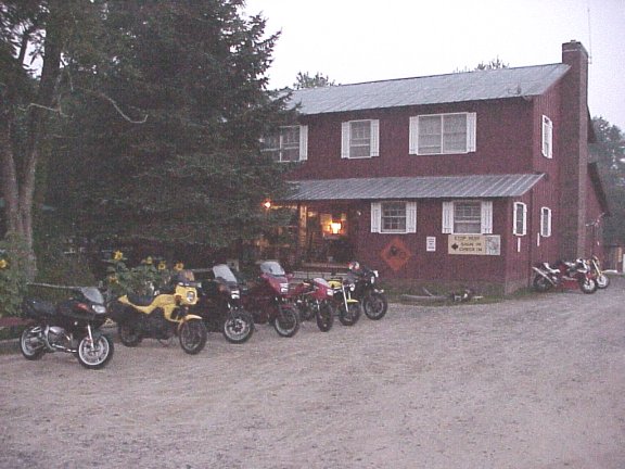
Our course for opening day had us blasting down I-75 south to the Sweetwater exit. The first destination was the Cherohala Skyway. This road was completed shortly after our 1996 visit to the area. We had heard and read that the Skyway was similar to the Blue Ridge Parkway (BRP), but was more open and more importantly less patrolled. After two quick gas stops on I-75 we stopped and ate the pinto bean special at the local Sweetwater diner (KMZ) just off of the exit. Now both the bikes and ourselves were gassed up and ready to hit the Skyway. After riding through Madisonville we hit the Skyway. After only a few miles I glanced in my mirror and noticed a pack of sport bikes had come upon us. Before I mentioned a word to Steve two of them were around us; a Triumph Trophy and some Ducati. Before I could say a word, Steve told me to hang with them if I wanted but to stop around the 25 mile mark (roughly halfway of the 52 mile long road). Off I went following the two speedsters. Within a few short miles I had caught them and rode with them for the 25 miles, which took only about 15 minutes (you do the math). After I pulled over at an overlook (KMZ) Steve was quickly behind me with the balance of the group in tow. What an exhilarating start! I found myself in an unusual situation while riding with these guys; I was following. I was able to read off of their lines and was easily able to keep up. I wonder what they thought with the seemingly less sporty and agile BMW hanging with them. The entire ride was perfect, the Skyway did not disappoint it was open with many sweeping curves. As we approached Robbinsville and the end of the Skyway the road narrows as it transgresses into the Joyce Kilmer Memorial Forest. Once in the forest we stopped at Snowbird Pass along Snowbird Lane for another break (KMZ). As we reached Robbinsville we headed south on US 129 to Topton (KMZ). There we headed north on US74/19 for a few short miles to our next destination; Wayah Road. The approach to Topton dropped us into the Nantahala Gorge. The Gorge is home to many whitewater outfitters and is a mecca for whitewater rafters. Needless to say traffic was heavy on a Saturday afternoon. Turning right onto Wayah Road we passed the entrance to one of the river outfitters, but within one mile all of the traffic was left behind. Wayah Road makes wild cutbacks across several bridges over the Nantahala River as it claws its way up the Gorge. We almost had the feeling we were riding in a cave, with the rocky faces of the gorge walls as the sides of the cave and the trees overhead appearing more like stalagmites than the hemlock and rhododendron they really are. We also noticed many people fly fishing along the river, I'm sure they thought how glad they would be to trade places with us. After climbing out of the gorge, we passed Nantahala Lake. Wayah Rd. follows its eastern shoreline, allowing great views of the large lake. We could not manage too much viewing of the lake as the road became even more twisty. After passing the lake we came upon the entrance to Wayah Bald, the 1.3 mile road to the top is gravel so we decided to take a pass (KMZ). Once beyond the entrance the road begins it descent down Wayah Mountain. We made a stop along Wayah Creek to better capture the scenery (KMZ). Hairpin turns and fun sweeping curves greeted us on the way down as we came into the town of Franklin. There we caught US441 north toward the town of Cherokee. This road is of the four lane variety and we were not quite ready for the superslab-like road so early into the trip. We referenced the DeLorme map and identified a shortcut to US19 east that would lead us into Maggie Valley. Sunset Camp Creek Rd (KMZ)., and Olivet Loop Rd (KMZ). provided just the thing. While the road wasn't terribly interesting it was better than four lane. Traveling east on US19 we came upon The Abbey Inn (KMZ) before getting down into the heart of Maggie Valley. The Abbey Inn does not exactly cater to motorcyclists but they were more than hospitable to us. We went down into town grabbed a Subway sandwich and headed for the BRP. We stopped and ate our dinner at one of the overlooks (KMZ) before we began our assault on Balsam Mountain Road (KMZ). This road can only be accessed from the BRP and dead ends at the top of Balsam Mountain where there are several trail heads (KMZ). The road was much like the rest of BRP but with tighter turns. It was starting to get dark so we decided to head back to the motel.
![]()
| Cherohala Skyway | Overlook on the Skyway | The Skyway in the Kilmer Forest |
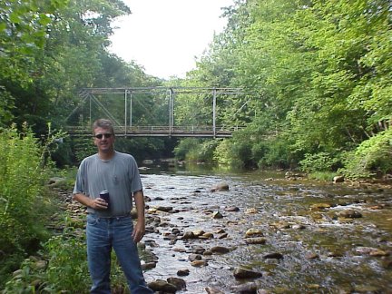
| Steve at Wayah Creek | Wayah Creek stop | Wayah Road |
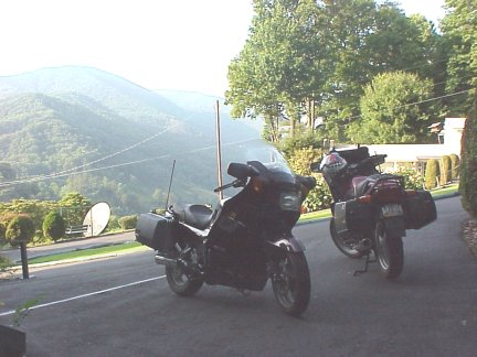
| Abbey Inn | Abbey Inn View |
![]()
Day Two Maggie Valley - Caesars Head Loop
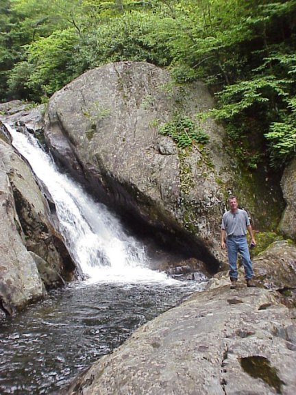
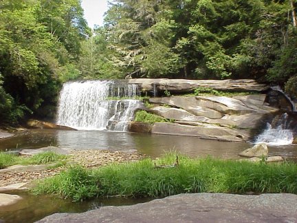
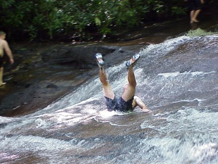
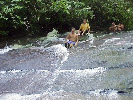
Our destination for day two was somewhat of a canned ride. I found this loop on the internet and decided it met our needs. We decided to ride counter-clockwise even though the ride was planned for a clock-wise ride. We headed east to Waynesville on US19, east on US276 where we picked up NC215 south. The road is flat in the northern parts and runs on the east shoreline of Lake Logan. Once south of the lake it follows the West Fork of the Pigeon River. We stopped for a break along the river before our ascent up to Beech Gap (KMZ) where NC215 crosses over the BRP. The road is very tight throughout its course and does not go through any towns at all. On the way up to Beech Gap the road follows the valley cut by the West Fork and there are many small but noticeable waterfalls and cascades tucked in the apexes its curves (KMZ). We stopped at one of these for a little break. Down the backside of the mountain we passed Courthouse Falls and Birdrock falls (aka French Broad Falls). We stopped at French Broad Falls for a quick look see but the falls were a part of a ministries camp, so we did not stay long. NC215 empties into the town of Rosman where we headed south on US178 towards the SC line. We stopped in Rosman to eat lunch at a local diner (KMZ). Becky the owner of Becky's wanted to join us for a ride. US178 runs near Sassafras Mountain in SC (SC's highest point). Once in SC we turned left and headed north/east on SC11. This is the Cherokee Foothills Scenic Byway and it's a poor motorcycle road. Straight as an arrow. The view of Table Rock is nice but we were led to believe this was a road to ride (probably some cager wrote this). Quickly we were back into NC turning left on US276 and headed north. US276 in SC ascends the Saluda Mountain Range and is very tight and twisty. It was once rated one of Car and Driver's top ten roads of the Southeast, and it proved correct. We rode past the entrance of Caesars Head State Park (KMZ) before getting back into NC. We rode through the town of Cedar Mountain where we pulled off for a rest on East Fork Road. Next we went through Brevard, converged with US64 for a short time before US276 broke off again and entered the Pisgah National Forest. US276 is a great road as it enters the park, but on a Sunday afternoon it was far too crowded. The south end of US276 in the park is also home to Looking Glass Falls and Sliding Rock. Both of these are popular attractions on hot summer weekends. We stopped at the Sliding Rock (KMZ) but there was line to slide down the rock so we decided to try a less popular area. Further north we found an area where we could slide down a rock but I'm sure it wasn't as thrilling as the real Sliding Rock. After spending an hour or so sliding down the rock we went back south to see if Looking Glass Falls (KMZ) was worth a visit. We happened upon a good parking space so we decided to stop. The area was crowded but the stop was worthwhile. We went swimming in the frigid water and swam underneath the Falls. We went back north on US276 and the traffic was much less dense and after we passed a few slow moving cars we were free and and clear all the way back to Bethel. US276 is quite twisty and in great condition as it runs along the Pisgah Ridge. The road follows the Pisgah creek until the intersection with the BRP where it follows the East Fork of the Pigeon River on the way back down the mountain into Bethel and Waynesville. That night we went to a couple of the local eateries, had some bar food and a few brews before we headed back to the motel for the night. Our excitement for the night was a mouse we discovered in our room at about 5:30. After unsuccessfully chasing the mouse for about an hour we decided to give up, get up and ride.
![]()
![]()
Day Three - Little Switzerland Tour
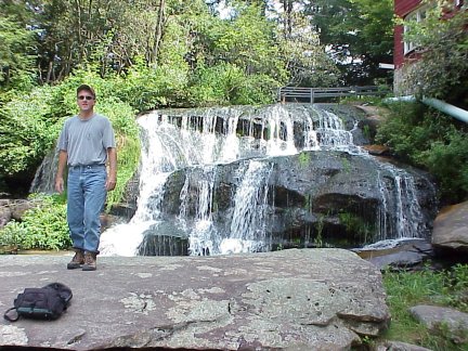
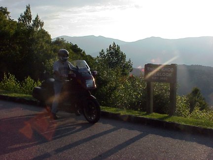
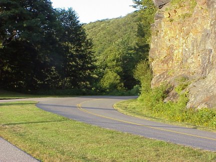
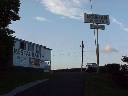
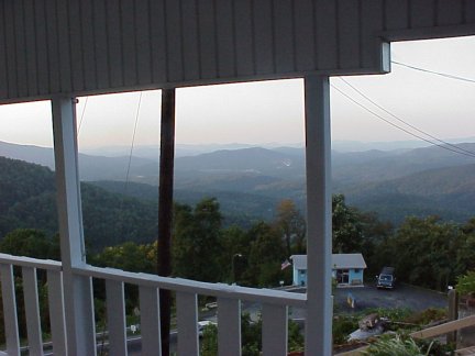
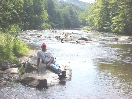
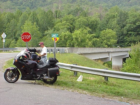
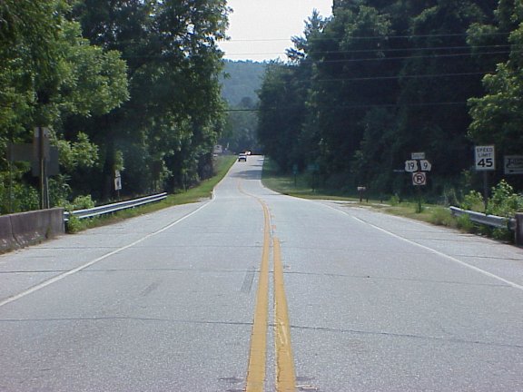
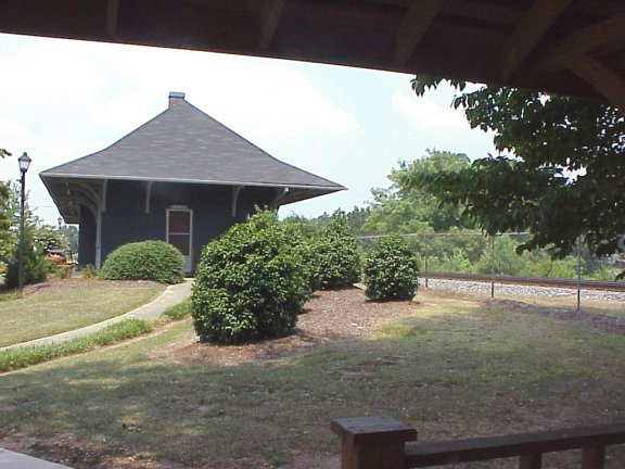
Finally, Monday morning came and we were hoping the traffic situation would be minimized. We started with an excellent breakfast in Maggie Valley at Joey's Pancake House (KMZ). We headed west on US19 and caught the BRP once again for an extended run. I cannot begin to tell how much I enjoy the Parkway. Every turn is sweeping not one decreasing radius turn in the 469 mile length of the Parkway. Mile after mile of gorgeous scenery with the best road conditions you could imagine. Our first stop was the Wolf Mountain overlook (KMZ) at milepost 424.8. We stopped next at Walnut Grove overlook at milepost 396.4 (KMZ). I could have run the Parkway all day but we exited just south of the French Broad River at NC 191 and headed south. NC191 South to Hendersonville proved to be pretty unremarkable and I thought afterwards we should have just stayed on the BRP, exited on I-26 and blasted down to Hendersonville. Once in Hendersonville we took US176 south. The road south of Hendersonville is rather flat but the twisties pick up as we approach Saluda. Saluda is home to the Norfolk Southern Railroad and the steepest grade of railroad in the U.S. In the early 1800s the ability to transport passengers and goods over the Blue Ridge Mountains to Asheville and west into Tennessee was essential when this 3-mile grade up Saluda Mountain opened on July 4, 1878 cresting in the center of Saluda, where it runs parallel to the main street of the town. It was the beginning of a new era for the Saluda area, bringing prosperity and a new way of life to the settlers. US176 roughly follows the railroad so it was a rather quick descent into the town Tryon. The road follows the Pacolet River and is in decent condition but I thought as I rode it would be better going up the hill than down. We stopped along the road for a break (KMZ). In Tryon we caught NC108 north toward Lake Lure. At Mill Spring we took NC9 north (KMZ) into Lake Lure, there we stopped to investigate taking a dip in the lake but we decided to continue. Shortly after we passed Chimney Rock. We could see the rock so we felt no need to fight the crowds in climbing to the top. Just beyond the rock we stopped along the French Broad River for a respite. We headed north on NC9 which shares itself with US64 and US 74A. I made a mistake (even after looking at the map twice) and turned on US64 west when we wanted to continue on US74A (KMZ). We missed two good opportunities the first was the route I had intended, up US74A. The second was north on NC9. We ended up back in Hendersonville rather than near Asheville, what a blunder! US64 was nice in this area so it was not a total loss. We blasted up I-26 to put us back on the BRP. Exit #6 off of the Interstate, west on NC146, north on NC191 put us exactly where we exited the Parkway earlier in the day. Back on the Parkway at MP 393.6 we headed north. We stopped at MP 375.3 Bull Gap overlook. Next was our stop at Toe River Gap MP 354.8 (KMZ). This stop had a nice view of Mt. Mitchell, the highest point in NC and east of the Mississippi. We were nearing our final destination for the night, the Mountain View Motel (KMZ) in Little Switzerland. At our stop at Bull Gap Steve called ahead to make sure they knew we were still coming and to verify our special room accommodations. Steve had reserved the best room in the motel. They regretted to tell us they had double booked the room and that they would have another room for us free of charge. Obviously that was ok with us. We got to the motel fairly early in the evening so we rested up for a short time and went into Spruce Pine to eat. We found a local eatery called Cedar Crest (KMZ) in the downtown area. It was overpriced with poor service to go along with the poor food. We don't complain about food much but this was really bad. Afterwards we headed for our nightly ride. We rode west on US19 to Double Island Road (KMZ) located just west of Micaville. The road's entrance is south of US19 but doubles back underneath US19 and continues north. I found this road on the internet and we were plenty excited about the ride. The road was plenty scenic but it was rather tight and traveled through a lot of residential areas. The road climbed up Chestnut Mountain and down to the banks of the North Toe River. We looped around on the road marked as Wheeler on the DeLorme map but it was named something different (which now escapes me). Back the way we came put us down back on US19. We continued south beyond US19 and went south on NC80. NC 80 is seriously twisty, a fact belied by its important-looking number and innocuous designation on maps. It looks like a straight-ahead, more direct route up the mountains than nearby U.S. 221. This road has got to claim its share of unsuspecting white-knuckled tourists: "Honey, why don't we take this route 80 here. I think it goes straight to the Parkway". It is almost a little too tight but with the lack of traffic on Monday night it was a pleasure. NC80 dumped us back on the BRP at MP 344.1. We headed back north and stopped at MP 338.8 Three Knob Overlook (KMZ). We had stopped at this overlook in 1996 so being the nostalgic types we stopped there again. Back to MP 330.9 to our exit for the motel. We hung out in the parking lot of the motel that night and talked with some other bikers for awhile.
![]()
![]()
Day Four - Grandfather Mountain Tour
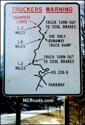
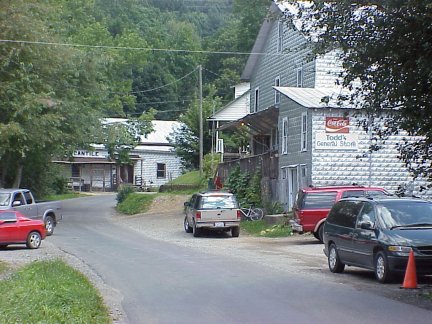
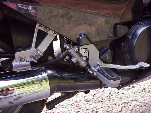
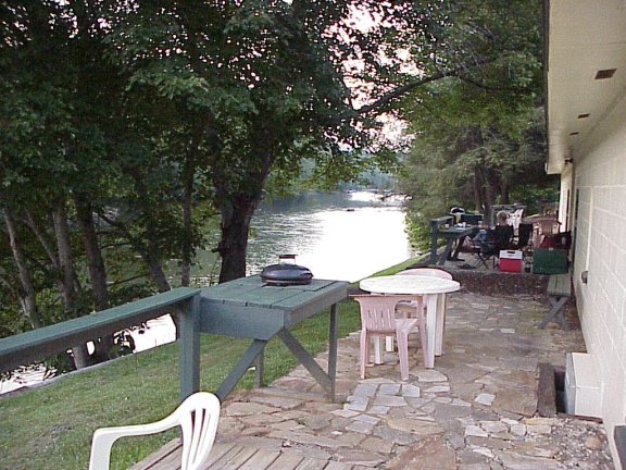
We started the day by taking the US226A tour (KMZ). We headed west on US226A from our motel which quickly turns south and follows Three Mile Creek down the valley between Locust Knob and Chestnut Ridge of the Woods Mountain. US226A is extremely tight down the mountain and was difficult to pass slower moving traffic. At the bottom of the hill in Turkey Cove we hit US226 and headed back up north toward our motel. This road is less twisty and with the uphill run we screamed back up the mountain. It was a nice approximately 35 mile side trip. Back on the Parkway we were headed north and exited at MP 316.3 to view the Linville Falls (KMZ). We walked roughly 1 mile back towards the falls but as the trail was climbing with no end in sight we decided we needed to gat back to riding. We next stopped at MP 304.4 on the Linn Cove Viaduct. Another spot we have stopped at before but one with great scenic vistas. Back up on the Parkway we headed north and viewed the great scenery while intermittently turning up the volume. At our designated exit point at MP280 (access to US 221) the Parkway was closed for repairs. We turned right on US 221 headed North/East to Brownwood Road (KMZ). We turned left on Brownwood which brought us through pastoral farms and woods to the town of Brownwood where we turned left and headed north towards Todd on Railroad Grade Road (KMZ). This road follows the route of an old railroad that once ran there along the banks of the New River. The 8 mile ride is gorgeous but extremely flat and the road is exceptionally narrow. This is a very popular place for bicycle riding so blasting down this road is not wise. We stopped along the river just short of downtown Todd (KMZ) to soak in the views. Todd was once a thriving logging town in the early 20th century and the Todd General Store dates back to 1914. Once through town we caught NC 194 west toward Boone. NC 194 is a scenic byway the spans the High Country. Around the town of Todd and points west the countryside is dotted with Christmas tree farms, old barns, and rolling pastures. As we arrived in Boone we were in familiar territory with Mountain City TN only a short 30 miles across Stone Mountain. In Boone we decided to stop for a bite to eat. The street was under repair and we did not have a good spot to park the bikes but we decided to try this particular sushi place on the main drag. As I was putting my bike up on the center stand a heard an awful crash. Steve's bike had fallen over. The damage was minimal but the right foot peg casting was badly damaged. We tried to fix something up using his rear peg but we were unable. He had to ride the balance of day with his right foot on the rear peg. I was not worried about the lack of comfort, only the safety factor. Needless to say he took it easy the rest of the day. NC 194 runs with US321 & US 421 until the town of Vilas where NC 194 turns left and proceeds up a steep hairpin turn towards Vale Crucis, the Valley of the Cross. The road here runs through the Watuga River valley is flat out beautiful. Levi Silliman Ives named this area in 1842 because of the convergence of two streams that form the shape of a cross. Valle Crucis is home to the Mast General Store. The store opened in 1883 and is on the National Register of Historic Places. In Valle Crucis we went straight on Broadstone Road rather than taking a right to continue on NC 194. Broadstone Rd. is a nice winding narrow road through pastoral lands and small farms. This road dumps out onto NC 105 where we headed south for a short time until we got to Shull's Mill. There we took a back road called Old Turnpike Road on the DeLorme map but was marked as Shull's Mill Road (KMZ). Shull's Mill Road was originally the Yonahlossee Turnpike, built in the late 1800's to connect the resort communities of Linville and Blowing Rock. At the beginning of Shull's Mill Road, you'll see the Shull's Mill Country Store and across the road, the Shull's Mill Baptist Church. Both were built around 1850, when Shull's Mill was a robust settlement. In the roughly four miles before the road goes under the BRP some of the best views of Grandfather Mountain can be had. Midway along the road, you'll see Camp Yonahlossee, a nearly 80-year-old summer camp for children. The road was a toll stop between Lincolnton and Abingdon, Virginia, meaning travelers had to pay to get between the mountains. A sawmill was erected at the site, as well as a train depot, and during 1915, a thousand people lived in the area due to the logging industry. The area was devastated in the famous 1940 flood, and lost its place as one of the larger communities in the High Country. Now Hound Ears Club covers the slopes, with some of the most expensive houses in the western part of the state. We turned right and headed south on US 221. This is one of my favorite roads. Before the Lincove Viaduct (KMZ) was completed in 1987 this was a part of the BRP. Just below the Lincove Viaduct we stopped at some waterfalls we spotted from along the road. Continuing south on US 221 we were winding up Grandfather Mountain, we rode past the entrance to the park but had no intention of stopping. Back down the other side we pulled into the town of Linville. There US 221 runs with NC 181 before it turns northwest to catch NC 194 running due south. At the town of Three Mile we ran due west over to US 19E for a bit of back tracking through the towns of Spruce Pine and Burnsville. We got off of the large four lane road at Mars Hill. As we exited and rode through Mars Hill a thought of Hank Williams for a brief moment as this was were he lost his life in an automobile accident. NC 213 runs along side Bailey Ridge and Sevenmile Ridge in the Walnut Mountains. It is fairly flat and every bit a secondary road. NC 213 hooks up with US 70 (KMZ) and US 25 outside of Marshall. The road is a little more fun in this area as we passed by streams including Big Laurel River and the Little and Big Hurricance Creeks along with Laurel Creek. A brief run through Tennessee and we dropped down to the French Broad River and into the town of Hot Springs (KMZ). The Hot Springs was first discovered in 1792 and the 200 room Hotel was built in 1886. Buncombe Turnpike was built at this time connecting Tennessee to Charleston. We stopped at the Springs at looked around for awhile but there wasn't much to see. We continued south on NC 209. This was truly a great find, a fantastic motorcycle road. The road starts at an elevation of about 1400 feet in Hot Springs and twists through the small towns of Trust and Luck. Don't blink or you'll miss these towns. Just south of these towns at the Haywood and Madison county line the elevation climbs to 4000 feet at Hebo Mountain. Back down the mountain we rode into Lake Junaluska at an elevation of 2600 feet. There we caught back up with US 19 and rode through Maggie Valley again toward our destination of Bryson City where we were staying for the night. We had planned to US 19 into Bryson City but as we came upon the BRP I could not help but to suggest one more stint on the Parkway. We rode the Parkway to its end stopping twice along the way to soak up as much scenery as possible before we bade farewell to the Parkway until next time. At US 441 we headed south into Cherokee and its throngs of tourists on the backside of the Great Smokey Mountain National Park. We went to Bryson City located our motel and unpacked. It looked like rain so we headed down the street to a local Mexican restaurant to eat dinner. We went inside with a group of riders from Maryland. As soon as we got in the door the skies opened up for a brief downpour. The food was ok and the company was much better as we discussed roads traveled around the area and across the country. After dinner we went back to motel, sat on the deck and did what we do best. We were staying at Riverbend Lodging Motel on the Tuckasegee River.
![]()
| The type of sign I love to see | The Lincove Viaduct | A view of the BRP from the Lincove Viaduct |
| Our stop along the New River on Railroad Grade Rd. | Downtown Todd NC | A view of Railroad Grade Road |
![]()
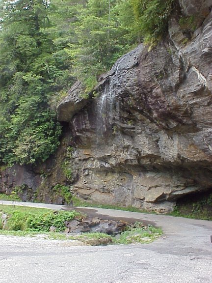
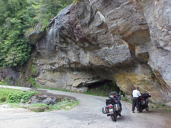
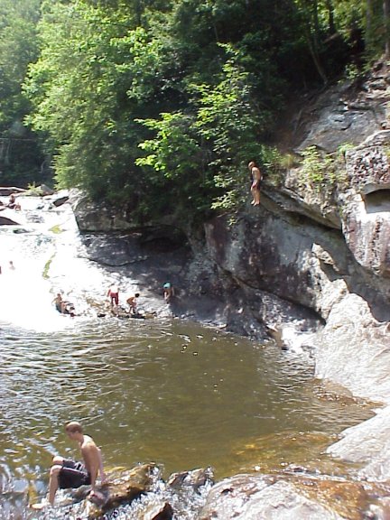
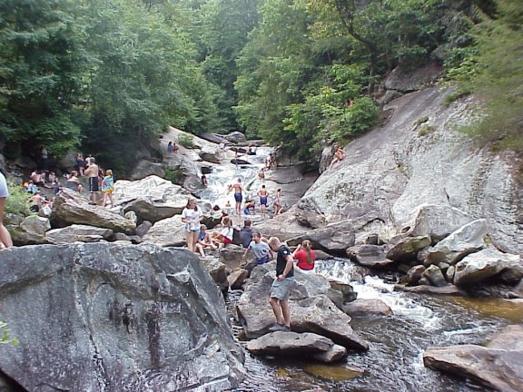
Day Five - Waterfalls Galore
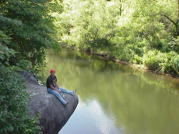
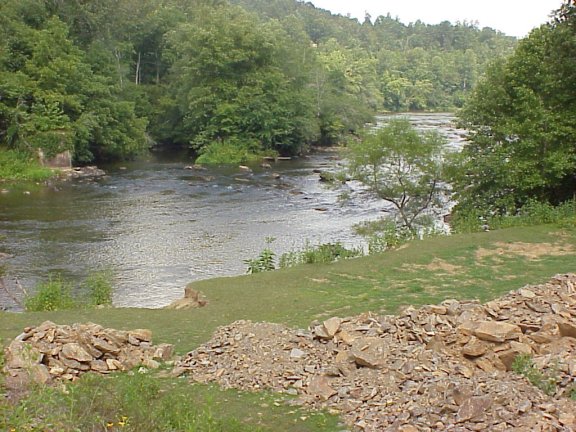
We started the day by stopping at the local hardware store to get some nuts and bolts to fix Steve's peg. This was easily accomplished and we were on our way. We traveled US 74 east to the town of Sylva where we picked up NC 107 south. NC 107 was a nice road and follows the Tuckasegee River (KMZ) once past the campus of Western Carolina University. The road elevation is about 2600 feet in this area and we dropped down into the town of Tuckasegee. There we decided to alter the trip and head down NC 281. This road was good but could have been better had the road surface been better. The road became very twisty as it wound down to Wolf Creek Reservoir. Just south of Wolf Creek Reservoir is the Tanasee Creek Reservoir where we stopped and debated whether we wanted to continue on the gravel road (KMZ). How could a state highway turn to gravel? We decided to proceed on the gravel. After about 5 miles we came upon Fisher Road (KMZ). It was paved and the map showed it going back to NC 281 further south around the north of Lake Toxaway. We proceeded on Fisher Road and it indeed took us to NC 281 all the while on pavement. We decided not to stop at Toxaway Falls and continued west on US 64 toward Cashiers. In Cashiers we spotted a Subway and decided it was time for lunch. We went south on NC 107 and planned a stop at Silver Run Falls for lunch. We first passed the small turnoff for the falls along the east side of the road. After turning around several times we determined the small pull-off must be the spot (KMZ). We hiked the short distance to the falls and sat and ate lunch. After the few people who had gathered left we jumped in for a quick swim. The water was cold but it felt good. We dried off and continued south on NC 107. We had mapped our trip routing us west on Bull Pen Rd which turned into Horse Cove Rd. When we came upon Bull Pen Rd. it was marked dead end and it was gravel. We didn't bite on this one we passed it up and continued down into SC and hooked up with NC 28 for a run back north into NC. This ultimately turned out to be a great detour. NC 28 into Highlands NC was a wonderful road. We turned right onto SC 28 and headed into the Sumter National Forest. This road follows the Chattooga River once in the forest. Also there is the Russell Farmstead. The Russell Farmstead was built after the Civil War, serving as a farm for the Russells and as a stopover for the travelers between Walhalla, SC and Highlands, NC. A train used to take vacationers escaping from the coastal heat as far as Walhalla where they would have to ride horseback for two days to get to Highlands, NC. Mr. Russell built his B&B at the halfway point right where people would need it. The B&B could accommodate as many as 80 people per night. The main house burned down in the late 80's but there are still some neat old buildings. Just past the Farmstead we crossed the Chattooga River and into Georgia. This part of GA 28 knifes through just eight miles of the very northeast corner of GA. There is little traffic on this road; most has been diverted to the less scenic but more efficient US 441. The best part of the ride is in NC. The traffic engineers must of had a rare case case of cooperative spirit because they kept this road going through three states. As NC 28 climbs toward Highlands we passed the Satula Falls overlook on the left but we did not stop. The ride from the falls into Highlands is very scenic, as the mountains on which the town was built are craggy and steep. On our approach up the mountain we encountered a little rain so we stopped to don our rainsuits (KMZ). We didn't have too much time to view the sights as the road is very twisty and requires a good deal of attention. Highlands is 4118 ft above sea level and I imagine it matches the prices of the local motels and eateries. We turned right and headed west on US 64/NC 28. The rain stopped by the time we reached Highlands but we rode the 2 miles to Bridal Veil Falls (KMZ) before removing them. We stopped to view the falls on the side of the road. The old road still remains and goes underneath the falls. Further down the road is Dry Falls but this is more crowded and we decided not to stop. Another six miles down the road we entered the Cullasaja Gorge area. The Cullasaja Falls is also in the area. The road follows the Cullasaja River which means "great twisties" and is a good motorcycle road. Along the river in the gorge area we spotted a swimming hole (KMZ) where we stopped for a swim. The swimming area featured some cliffs to jump from and a rock slide. After our swim we proceeded into Franklin where we said good bye to US 64 and stayed on NC 28. Now we were following the Little Tennessee River. The road here is flat and fairly open but still had some nice curves. We stopped at the Carnes Road bridge for a break (KMZ). Before we knew it we were back in Bryson City. For dinner we stopped at a nice southern barbeque restaurant. After we ate we decided to do some exploring around the city. I had read about the Road To Nowhere (KMZ) and we quickly found this and rode to its end. In the midst of World War II, while many Swain and Graham County NC men were fighting for their country, the US Government and the Tennessee Valley Authority decided to build a hydroelectric power dam which would flood 11,000 acres of North Carolina land. The TVA bought or took 67,800 acres of land from Graham and Swain Counties leaving 1,300 families homeless, some of which were widows with children, some who were elderly and many of which had never lived anywhere else. These people received no relocation assistance from the TVA or the government and the ones who refused to sell, had their land condemned and taken.
![]()
![]()
Day Five - The Tail of the Dragon
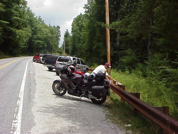
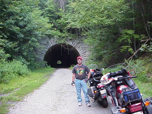
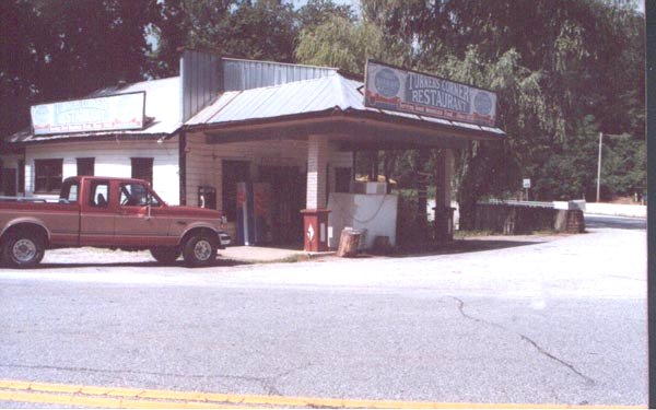
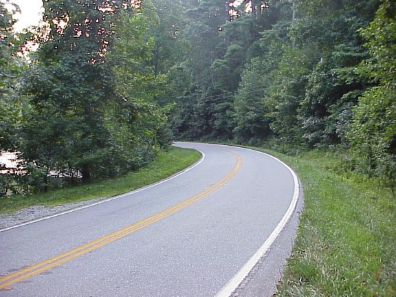
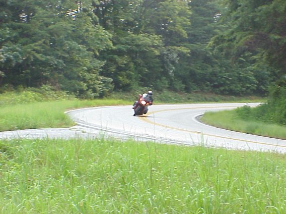
Our day today was to be highlighted by our trip to Deal's Gap (KMZ) to ride the Dragon. The whole area is one good road after another. Imagine our disappointment after turning off of US 74 to head west on NC 28 when we discovered that some traffic engineer got the bright idea that making this once great motorcycle a four lane divided highway. A better route would have been to stay on US 74 to US 129 north to Robbinsville then turn on Kilmer Road and run the south side of Santeelah Lake. This would have put us back on NC 28 at Stecoah Gap, maybe 5 miles west of the town of Stecoah where NC 28 returns to normalcy and two lanes. We caught glimpses of Lake Fontana through the tress on our right as we soaked up the miles on this tight and twisty road. We turned right at the entrance to the dam (KMZ) and proceeded towards the west end of the lake where the dam is located. We crossed over the dam and up the other side to a scenic overlook that provided a great view of the dam. Riding back across as we looked right we could see the Little Tennessee River lapping at the dam below. Back out on to NC 28 we continued west, rode through Fontana Village and continued while running along the Little Tennessee River. Before we knew it we were at the Crossroads of Time in downtown Deal's Gap; population 6. The Crossroads of Time complex has gas, food, and motel with an accompanying campground. One of these times we'll have to stay there. We stopped briefly for a quick check of our nerves and proceeded to take on the most twisty 11 miles in the nation. The road looked as if had been recently paved and our early morning start meant traffic was almost non-existent. We both took out hard but we had decided we would stop near the Calderwood Reservoir to turn around (KMZ). This area provided good views of the reservoir and dam and is about 14 miles from the beginning. We met there turned around and did it again. Everyone seems to have a direction preference and since we know had ridden both ways I found the east to west direction to my liking. I prefer right handers and I think there are more of them riding west. Back at Crossroads of time we stopped to pick up an obligatory t-shirt. We rode south on US 129, crossed the Tennessee River just west of the Cheoah Reservoir and rode along the Cheoah River. This part of US 129 is exceptionally twisty all the way to Santeelah Lake where the road opens up and the severe twisties are minimized. While this part of the road isn't as tight it is still pleasurable to ride. We stopped before we reached Topton at a roadside picnic to eat our sandwich we picked up in Robbinsville. We continued south on US 129 as it ran with US 74 and US 19 into the town of Andrews. We were determined to get off of the four lane divided highway so we turned south on NC 141, This was probably a mistake given the road was straight and not very scenic (KMZ). We turned left and on US 64 and headed towards Chatuge Lake. As soon as we turned on US 64 I noticed the sign for Old US 64 (KMZ). We turned around after deciding to explore this road. It was well worth it. It wasn't in the same league as some of the other roads we had been traveling on but it was definitely worth the trip. We turned on Hall Road (Brown Rd. on the DeLorme map) for a quick stop along Crawford Creek (KMZ). It was difficult getting down to the creek but it was worth it on such a hot day. Back on Old US 64 we turned right on Young Harris Rd as a shortcut over to NC 63. We turned right and headed south on NC 63. This road took us over the state line into Georgia. We were running down the west of Chatuge Lake. We turned left on US 76/GA 17 headed toward the the town Hiawassee. We had also been in this area in 1996 and noticed a big difference, the place had grown and the road had become a four lane highway. We passed GA 288 which would have taken us around Hiawassee but we didn't bite when we should have. Once through Hiawassee we turned right on GA 17 and headed south toward Helen GA. The road twists along the Hiawassee River then follows the Chattahoochee River into Helen. We cruised through Helen to see its sights turned around and went back to the north of town where we turned left and headed west on ALT 75 (KMZ). This road dead ends into US 129 where we headed north. We stopped along US 19/129 along Dick's Creek (KMZ) just before it dumps into the Chestatee River. Turner's Corner Cafe sits at the intersection where US 129 separates from US 19 (KMZ). This cafe (formerly restaurant) was a place we had stopped before. They used to have the state's biggest bear, killed by a truck, stuffed and on display in the restaurant. The new owners fixed the place up considerably but the former owners took the bear. We went in and asked about the fare but decided to wait until the next day to dine there. South on US 19 we began a steep climb up Cedar mountain. The road here is very twisty and very wide with passing lanes. At Rockpile Gap (KMZ) we turned right on GA 60. GA 60 is one of my favorite roads, it is extremely twisty, well marked curve signs and banked turns. I can just fly on this road. There is also some great scenery at the Chestatee Overlook and Woody Gap but we were too in tune with the road. Occasionally we would slow a little to capture some scenery but it didn't last long. Soon we were in Suches where we were staying for the night. We had dedicded to stay at TWO (KMZ). TWO stands for Two Wheels Only. It is a resort that was opened by Frank Cheek in the 70's but is now owned by his daughter Britt and her husband G.T. They have level camping spots, cabins, and even mobile homes to stay in but we decided in one of the upstairs bedrooms. There are three bedrooms upstairs that share a bathroom and kitchen along with all the motorcycle magazines you could dream of. Downstairs is a common dining room with a pool table and other amenities. There is even a pool for those hot summer days. However, the best part is the nice deck where after a day of riding you can sit with other motorcycling enthusiasts and talk motorcycles all night long while drinking your favorite beverage. While we took advantage of the pool the best part was relaxing the deck after riding all day. After taking a dip in the pool we decided there was still time left to get in another ride. We headed north on GA 60. Above Suches the scenery changes as we rode along the Toccoa River and Skeenah Creek. The road here is in a valley but the road does remain twisty. We went into Blue Ridge GA got a bit to eat and turned around to ride it again. This time we stopped along the river to soak up the scenery. Pretty soon we were back at TWO for the night.
![]()
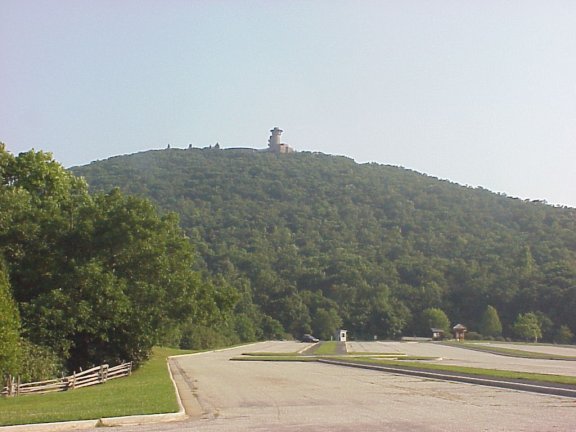
![]()
Day Six - Wolf's Den
We rose early to get served the first breakfast of the day but after waiting for 15 minutes we decided to head out on our trip for the day, we could wait no longer. After gassing up at the gas station across the street from TWO we headed east on Wolf Pen Gap Road. The scenery on Wolf Pen Gap Rd. is amazing. With several farms, a creek, and Lake Winfield Scott, the views alone are reason enough to this ride, but the road is the real treat. We twisted through several hairpin turns, switch backs, sweeping turns and twisties as we climbed through Wolf Pen Gap at an elevation of 3300 feet. Further east the road "Ts"at US 19 where it is necessary to turn left (north) for a few short miles before turning right back onto the Gap Road also known as GA 180. After about 10 more miles of great road we took the GA 180 spur road up to Brasstown Bald (KMZ). This three mile trek up the mountain is nice and is a well maintained road. On top of Brasstown Bald the views from the parking area are good. Probably not as good as the view from the top, but even this being our second visit we did not bother hiking up to the observation tower. Both times we have been here it has been early in the morning and virtually no one in sight. Back down the mountain we continued east on GA 180. The road comes to an end at GA 17 where we turned right and headed back toward Helen. The Chattahooche River was on our right as tight hairpin curves eventually give way to sweeping curves. The Chattahooche River provides much of the power and drinking water for Atlanta, which is amazing to me since it does seem to have much volume. Along the way we climbed Unicoi Gap at 3000 feet where there is a nice park and the Appalachian Trail crosses the road (KMZ). Just north of Helen we turned left on GA 356. This road took us to Unicoi State Park. The park is home to Anna Ruby Falls, but far too touristy for us. We continued on the road until its end at GA 197 where we turned left and headed north toward Lake Burton. The first few miles are quiet farm country with gentle sweeping curves. The asphalt was new and smooth. As we approached the south end of the lake I saw Burton Dam Road (KMZ) and we decided to turn and do some exploring. We found the dam and stopped for a break. The road back to the dam was dotted with summer homes where people from Atlanta vacation (I guess). We wound our way around the lake to Tiger GA where we headed north on US 23 for a short time before turning south on US 76. Although the map makes this road look small it was heavily traveled. As we approached the SC state line we crossed the Chattoga River just above the Tallulah Gorge. We stopped at a little state park and walked down to the river. It was quite nice and we thought this would be a good place to take a break but we were not quite ready for one, so we went on into Westminster. Bu the time we reached Westminster it was lunch time so we stopped to fill up on gas and got a sandwich and ate at the old train depot in the center of town (KMZ). It had gotten hot by lunch time and we decided to find some back roads and head back to the river spot. Once back at the river we took a plunge in the river (KMZ) and spent about an hour or two just lounging around. After our cool dip in the waters of the Chattoga we tried to find our way down into the gorge and head back into GA. We could not find a way to accomplish this. We even committed the sin of asking directions but to no avail. We eventually worked our way to the Cherokee Foothills Byway south of US 123. Once again we confirmed what a disappointment this road was. We jumped on I-85 west for a few miles and worked our way back to Helen. We turned left once again on GA Alt 75 but this time turned right on GA 348 known as the Richard B. Russell Highway. This road is a flat out race track. We were not alone on this road, there were numerous sport bikes zooming around all over the place. We stopped at the half way point (KMZ) for a break and saw no less than 10 packs of bikes going by. We continued back the way we came and back to TWO for the night. Once there we still had plenty of daylight so we headed back down GA 60 and ate at Turner's Corner Cafe. Coming back night was beginning to fall on us so we had to take it a little easy not wanting to meet any furry animals up close.
![]()
| Brasstown Bald 1 | Brasstown Bald 2 | Brasstown Bald 3 |
| Lake Burton Dam | Chattoga River | Westminster SC |
| Richard B. Russell Highway | Ken on Highway | Steve on Highway |
| TWO |
![]()
Day Seven - Ocoee River Run
The worst part of any trip was upon us that last morning of getting up for the ride home. The nicest thing about the Southeast for us is we are always only a day's ride home. We left early Saturday morning and we were home by 4:00. But wait there was still some more good riding ahead of us. We had contemplated riding through the Chattohoochee Forest in the Northwest corner of the state and hitting Alabama while we were at it, but we decided to head toward home in a more direct route. It was not all bad by any means. First we got to run GA 60 one last time up to Morganton and McCaysville. Once through McCaysville we crossed over to Copperhill we passed the large pile of sludge which is really slag, a byproduct of the cooper mining once done in the area. The mines have been abandon for some time and now the produce sulfuric acid. Needless to say the smell was less than impressive, fortunately our full face helmets provided some protection. Shortly North of Copperhill we turned left on US 64 and ran along side the Ocoee River. In 1996, the Summer Olympics in Atlanta brought the world to this quiet section of eastern Tennessee. The Ocoee River played host to whitewater portion of the Olympics. The Ocoee Whitewater Center is still a hub of activity for these enthusiasts. The river gradually becomes the Lake Ocoee as the road progresses through sweeping turns and tight twisties. On the west end of the lake we passed the Ocoee Dam and before we knew it we were in Cleveland and on I-75. After a couple of quick gas stops we pulled into home.
![]()
![]()
Email me Ken Adams

Home