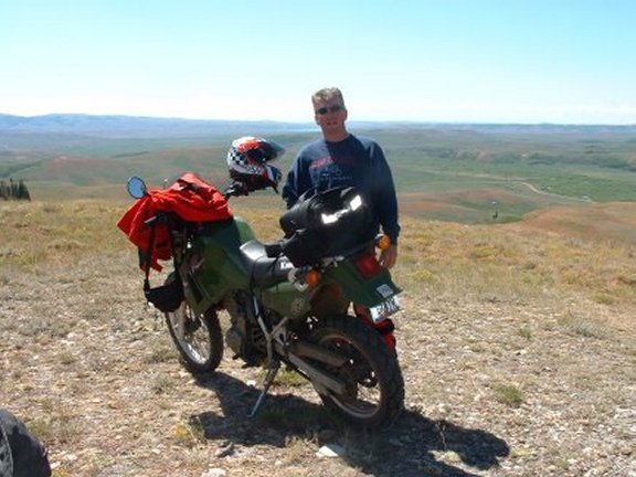
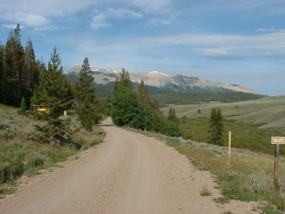
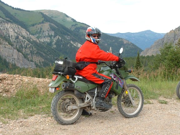
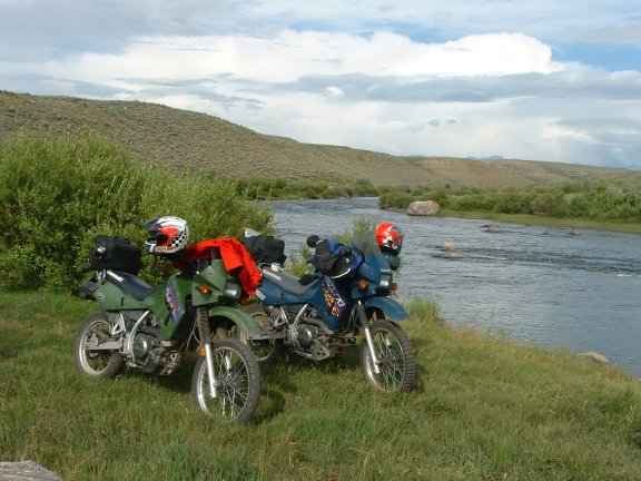
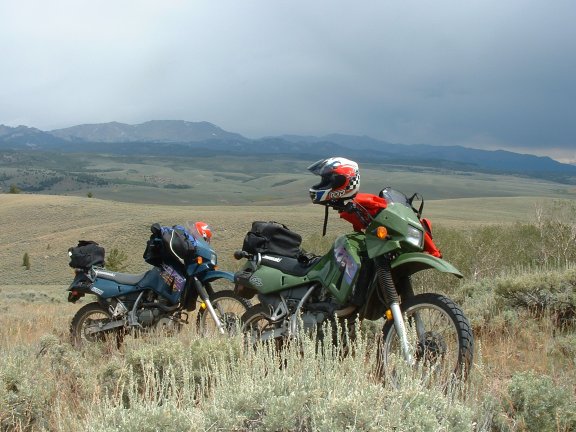
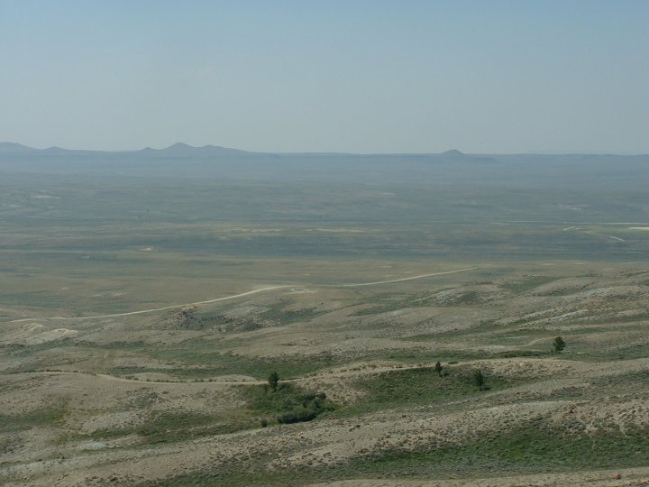
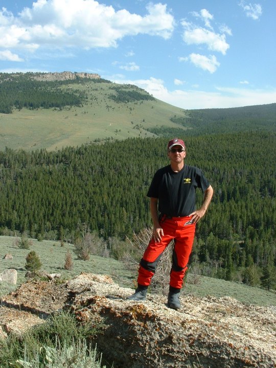
Roaming Wyoming - Dirt
Throughout
our ride last year as we traveled the roads of Wyoming we caught ourselves
wondering where the myriad of dirt paths led. We even rode a few of them on our street bikes, but it
wasn’t very pleasurable. So we
decided to do something similar to our 1999 dual-sport trip to Colorado.
We knew there would be a lot more street involved in this trip in
comparison to 1999. Based on this
knowledge we both purchased Kawasaki KLR 650s for the trip.
We had done a little research last year while in Wyoming when our
idea was first hatched. We had
gotten some dirt road maps at the local Lander motorcycle dealership.
Armed with these maps, and the even more important DeLorme map we began to
plan our trip. We would base
ourselves in Pinedale, but as we laid out our plan we realized we would
need to spend a couple of nights further south. We chose Rock Springs which is less accommodating than Pinedale, but it was strategically placed for
us.
![]()
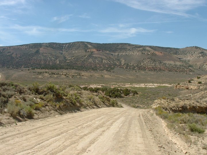
Day One -
Cincinnati to Cozad NE
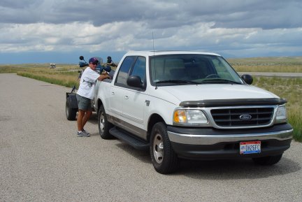
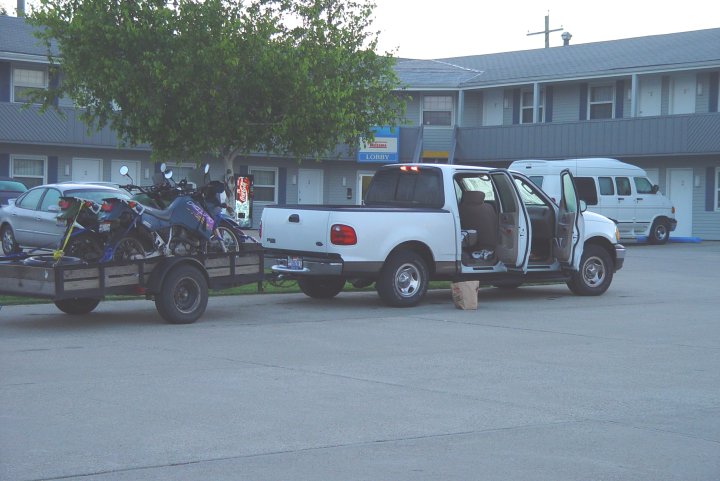
We
pulled our bikes out on a borrowed trailer.
We left around 7:30 a.m. and arrived at the Circle “S” Motel
(KMZ) in Cozad
around 9:00 p.m. local time.
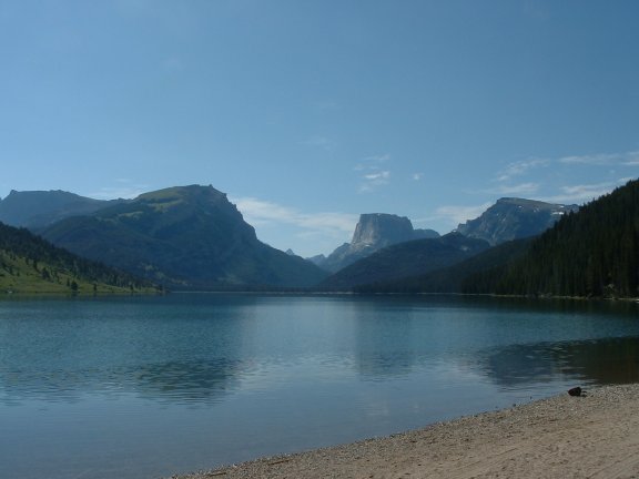
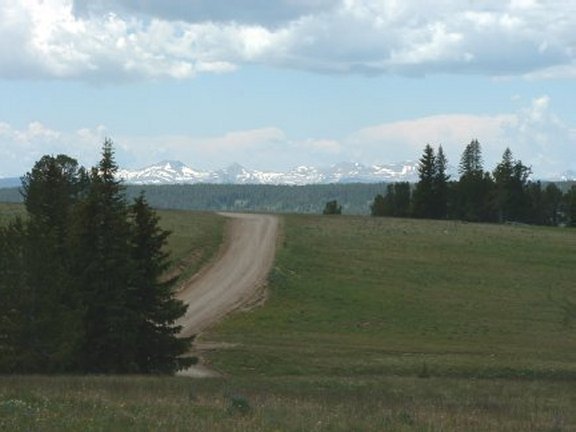
Day Two
– Cozad NE to Pinedale WY
After
breakfast at the downtown diner we were off.
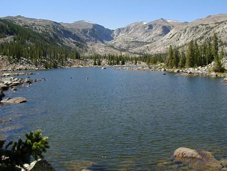
We arrived in Pinedale (map)
as scheduled, in time to get some riding in. We had
it planned to head east around some of the surrounding lakes. There are three fairly large lakes around Pinedale;
Willow,
Fremont,
and Boulder
(map).
We started by heading up
Skyline
Drive toward Fremont Lake, but turned back after looking skyward and seeing
rain. We then headed south toward
Boulder
to avoid the rain, and ran towards Boulder Lake. Before we reached the lake we noticed some trails and decided
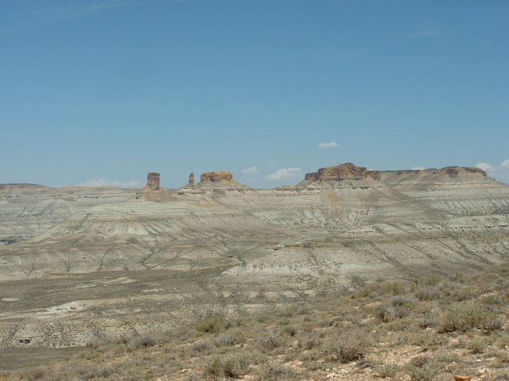
to do some exploring. We stopped by
some rock formations to get our bearings. It
was terribly windy, and downright cold. The
temperature with the wind couldn’t have been much more than 45º.
By the time we got back down to the dirt trail it began to rain.
By the time we hit pavement we were drenched and had been pelted by hail.
Not a great start. We beat it back to the motel where the rain had already
stopped. A quick change of clothes
and we were back riding up Skyline Drive toward Fremont Lake.
We spotted a truck with an empty trailer near a trailhead and decided we
would follow. The trail meanders
around the small mountains in the area but didn’t seem to be going anywhere
special. We turned around and
headed back along the lake. We
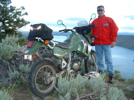
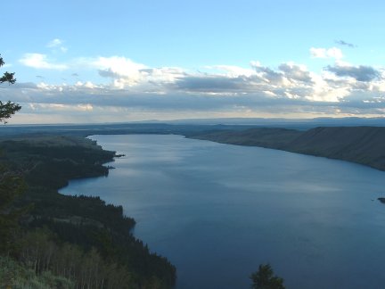
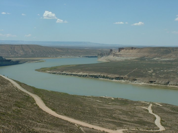
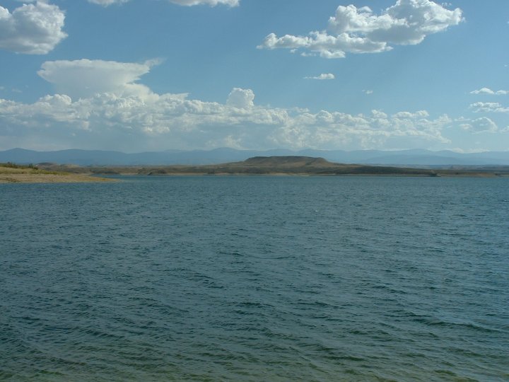
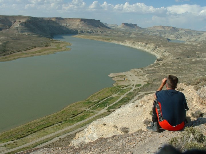
noticed a trail up a hill , took it and were rewarded by a perfect view of the
lake
(KMZ). After viewing for a while we
headed back to the motel and readied ourselves for the next day.
We were staying at the Half
Moon Motel in downtown Pinedale
(KMZ); an old CCC
camp barracks. It
is about one block off of the main street.
We were placed on the backside of the motel, probably to keep the
bikers away from the rest of the guests. It
worked out ok for us though, as we had a nice place to park the truck and our
bikes.
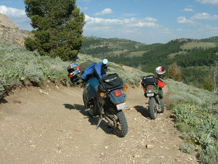
![]()
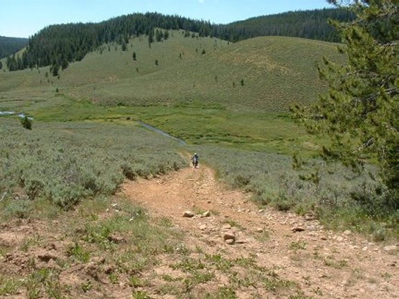
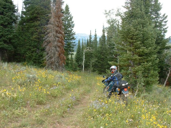
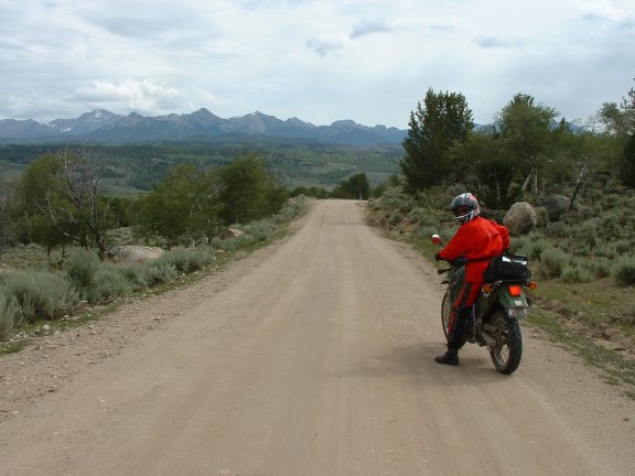
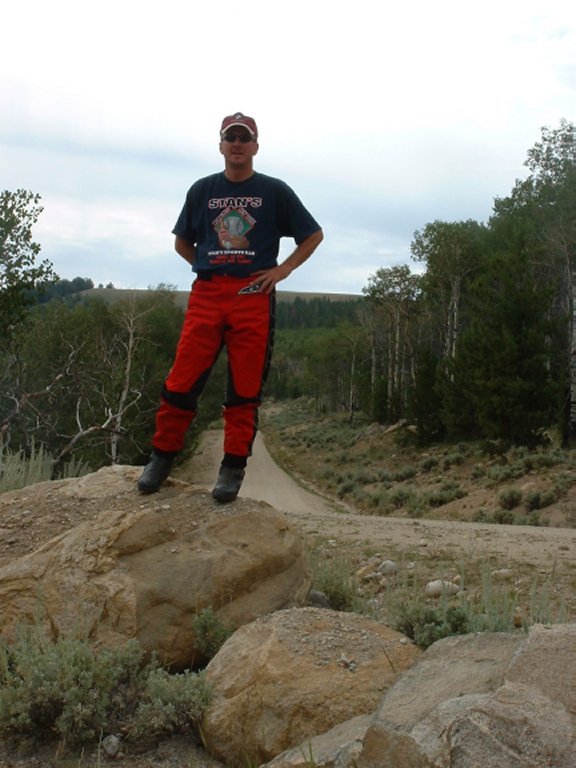
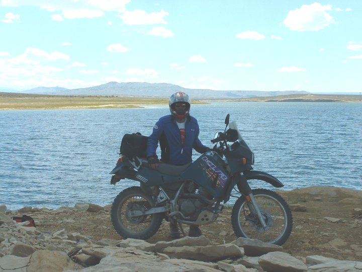
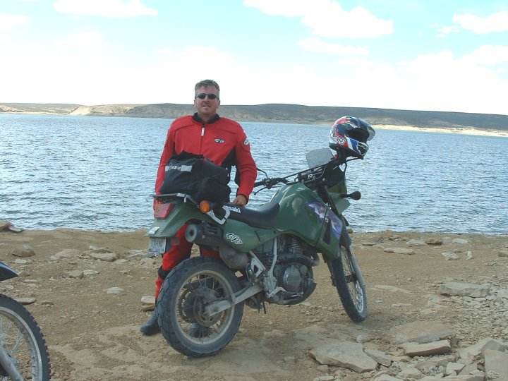
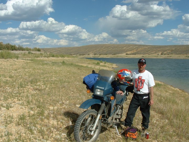
| A view along the road of things to come | Steve on the Boulder Lake trail | |
| Another view of the Boulder Lake trail | Ken on the Fremont Lake trail | |
| Fremont Lake |
![]()
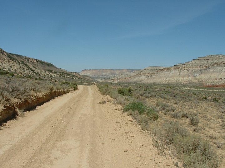
Day Three
– Commisary Ridge
We
started by going to the Wrangler Café
(KMZ)
for breakfast.
We chose this spot because it looked like the spot where the locals went.
We jumped on the bikes and rode 106 miles down US189 to
Kemmerer.
We passed through Daniel
on the way there and stopped for gas in La Barge. Once in Kemmerer the trip really begins. We
were already chilled by the roughly 90 minute trip at speeds of 70mph and a temperature
of about 40º. In
Kemmerer we picked up W233 to the west and north.
This is also called the Hams Fork River
Rd.
The paved road climbs a bit and at mile #4 we crossed the river.
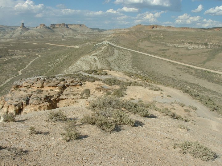
We traveled through a small valley between the Hams Fork Plateau on the
west and Commissary Ridge on the east. There
was an abundance of fishing spots along the river on the west side of the road, and plenty
of people fishing. We passed by
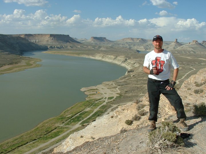
Viva Naughton Reservoir
(KMZ), found a trail off of the pavement and rode to an
overlook high above the reservoir for a brief stop.
After 20 miles the pavement finally ended but not before we crossed over
Beaver Creek and Teddy Bear corner. We
had heard about the corner but didn’t know the genesis behind it.
As we were traveling through the valley we noticed some nice trails along
the ridge to our east. We climbed
up a steep ridge and found some trails with great views
(KMZ) of the reservoir to the
south and one of the road with the river along side.
Back down on the road we crossed Pole Creek and the valley began to
narrow
(KMZ). Just beyond the creek
crossing we could see where the West Fork of the Hams River met the main stream.
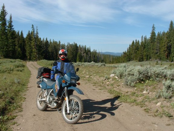
Shortly after the dirt road began we entered the Bridger-Teton National
Forest. Here the road changed
fairly dramatically from packed gravel to very loose gravel with more dirt mixed
in. After riding on this surface I
began to wonder if they did this to keep the speeds down for people like us.
If that was the intent
it worked. We were not
creeping, but we went from cruising at 50mph to about 30mph.
The sparse frontier-look quickly converted to lodgepole pine and aspen
trees. We passed by the old Elk
Creek Ranger Station and the Hams Fork campground.
We came upon a fork in the road where one fork led to a 4WD road that
goes to Green Knoll and Big Park. The
other fork to the west follows basin creek and leads to the entrance of Nugent
Park. We took the latter.
After a few short miles we
took a trail down to basin creek for a stop.
The trail dead-ended at the creek. After
our stop we tuned around and headed back towards W232 and
Cokeville. We came upon W232 where the pavement ends.
South to Cokeville on pavement or north on dirt.
We headed north. We were out
of the National Forest and once again the roads were better packed allowing us
to increase speed. Muddy Ridge was
to our west and the Tunp Range
on our right.
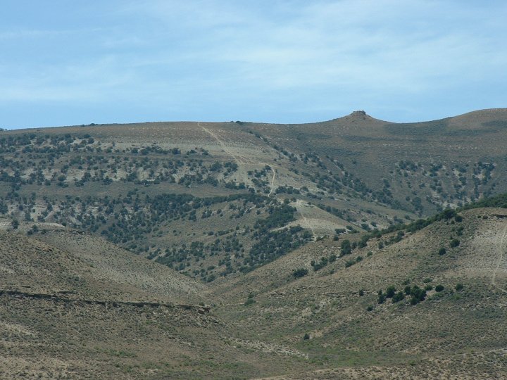
We spotted more trails along Tunp Range and rode up for a glimpse and some pictures.
We could see Mount Wagner to the north.
After about six miles back on the road we entered back into the National
Forest, and the road began climbing through a small canyon.
We came upon a decision point as we rode along La Barge Creek. Our original route had us going back to La Barge and
Big
Piney but I read where the lower portion of
Greys River Road was worth the trip
and I had not planned for us to be on that portion.
So we decided to head north on
Greys River Rd and see if the literature
was correct. It was.
A lot of trails merged in this small area.
Mount Thompson was in view to the south, Commissary Ridge and Indian
Springs were off the to the east. One
road led back to Smiths Fork Road, and another back to Kemmerer along
Fontenelle
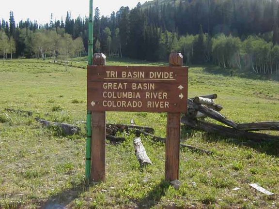
Creek. We continued north on Grey River Rd. We climbed a small saddle on the Tri-Basin Divide.
Water here either travels to the Columbia River, the Colorado River, or
the Great Basin. The road dropped
down past spruce and fir trees as we began following the Greys River.
Wyoming Peak was to the north,
Wyoming Range to the east, and the
Salt
River Range to the west. The
road then passed just below Mount Coffin and three miles later we passed Spring
Creek Road. We stopped along the
Tri-Basin divide for some pictures
(KMZ). We
crossed over Swift Creek and past the Cazier Guard Station.
We turned east on Deadline Rd looking for a trail along the ridge, but it
appeared to be only a hiking trail. Back out on Greys River Rd we came upon
Sheep’s Creek Rd that goes over
McDougal
Pass, eventually turning into
McDougal Pass Rd. We climbed up the
pass through Sheep Creek Canyon. This
area is just plain beautiful as we passed over the Wyoming Range.
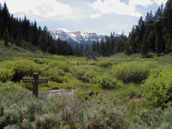
We passed over Hardin Creek, and soon were following Cottonwood Creek.
We were quickly back into the open range.
We followed Cottonwood-Merna Rd, and made a turn to the north before
finding ourselves back at Daniel Junction and the feeder road back to Pinedale.
We had stopped on a bluff overlooking the open range for a rest and
picture session. Back in Pinedale,
we washed up and headed back to the Wrangler for dinner
(KMZ).
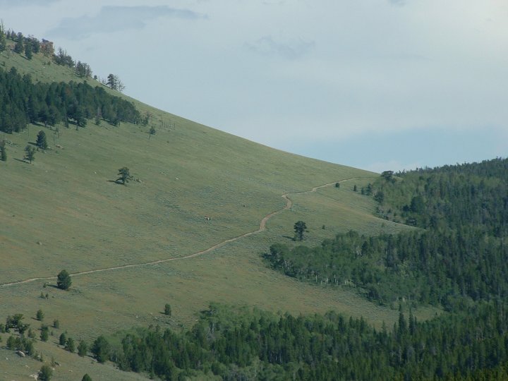
![]()
![]()
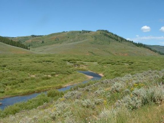
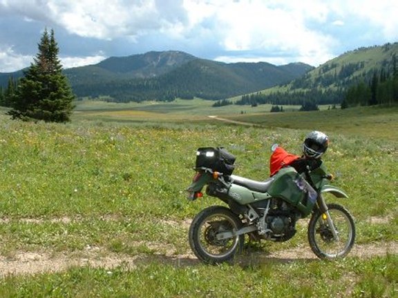
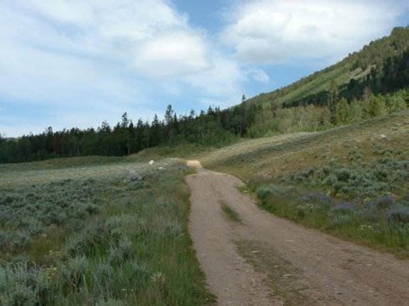
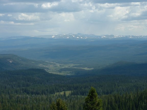
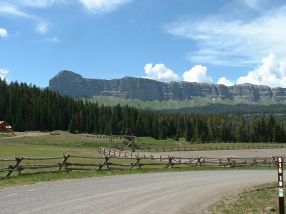
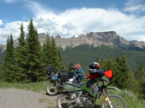
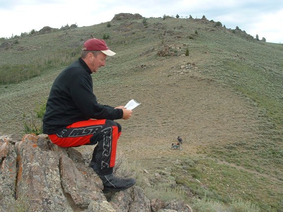
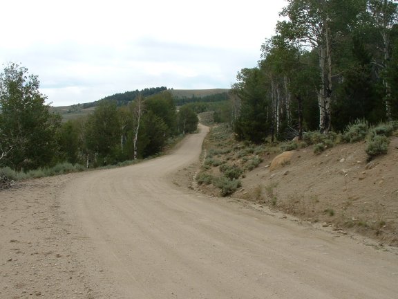
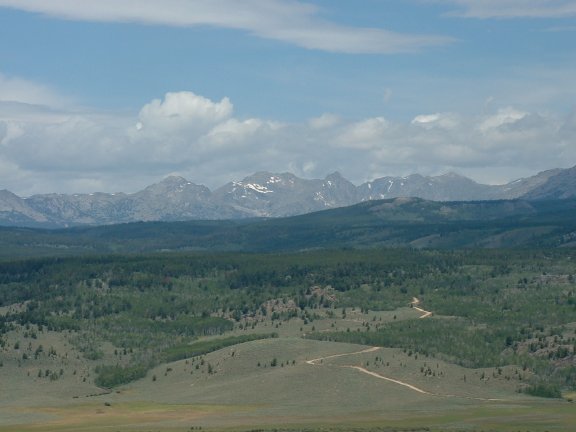
Day Four – Union Pass
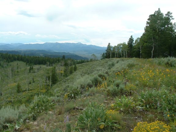
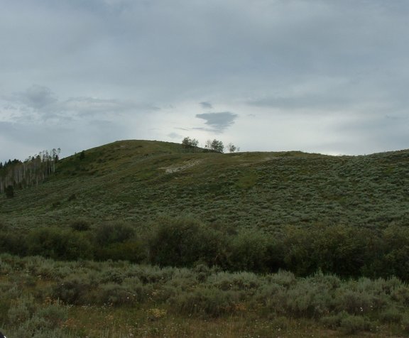
The night before as we were walking around Steve noticed some other bikes in our Motel parking lot that looked very familiar to him. After some consideration he realized that these bikes belonged to some guys he had met trail riding in Indiana near home. It wasn't that difficult to realize who belonged to the bikes, one was a BMW Dakar and the other a Suzuki V-Strom, both with full knobbies (not many V-Stroms with full knobbies). It was Ray and Paul who were taking a three week ride down the Continental Divide Road. He placed a note on their bikes and stopped by their room as we were all leaving. They joined us for breakfast, and we traded stories about our trip thus far. They asked us to ride with them for awhile but we explained Union Pass was waiting for us. We parted company, bundled up, and headed up W352 towards Cora. We could see the Wyoming Range to the west, The Gros Ventre Mountains to the north, and the Wind River Range to the east. Cora is only 4 miles above US191 and after another 10 miles we turned east on Moose Gypsum Rd (KMZ) toward Big Bend Lookout and Little Sheep Mountain. This road was more trail than than the other more gravel types roads we had been on. The road was deeply rutted and a little difficult to navigate. The scenery was worth the trip. We stopped along the trail for some pictures (KMZ). The road brought us down onto the Green River Lakes Rd that winds along the Green River and dead-ends into the campground at Green River Lakes (KMZ). Along the road towards the lake Square Top Mountain comes into view. We stopped at the lake to look around. The lake looked crystal clear but was smaller than what we had imagined. We turned around and headed back the way we came traveling west along the Green River. We turned north onto Union Pass Rd. and across the river. Now the river was on our right, we crossed over Tosi Creek and Klondike Hill came into view to the North. The road here was a washboard where my little windshield shook loose from my fairing. With it removed we continued northward toward Triangle Peak and began climbing up Bacon Ridge above Tepee Creek to a junction at Kinky Creek Rd. We considered taking this road but it looked like rain to the west so we decided to stay on course and on Union Pass Rd. After about four miles we passed by Mosquito Lake (KMZ) which happens to aptly named. The Wind River Mountain Range was now in good view as were at the top of a plateau. We stayed to the east and crossed Raspberry Creek, then Strawberry Creek and finally South Fish Creek. The terrain changed from open range at the top to white pine as we continued. We continued down the backside of the pass toward US26/US287. Once on the road we stopped for Gas at DuNoir but the place was closed on Sunday. We decided to do the Brooks Lake loop (KMZ) and take a chance on running out of gas. The loop around Brooks Lake is only ten miles. Our plan was to ride that and find a back way to Kinky Creek Rd and go back the same way after that. The road around the lake was nice and well maintained to the lake. Once there we found a 4WD road that completed the loop. We were back on US287. We continued west looking for the road but quickly realized we needed to head back east and look for FR357. We found this road but it was closed off. Now we were in a dilemma we had to go back exactly the way we came so we stopped one last time to contemplate the gas situation. DuBois was about 15 miles further east with a certain thunderstorm waiting for us. We did some quick calculations and decided we could make it on the gas we had. So we went back the exact same way we had come. The nice thing about traveling the same routes out here was it looked entirely different going the other way. We got back before sundown.
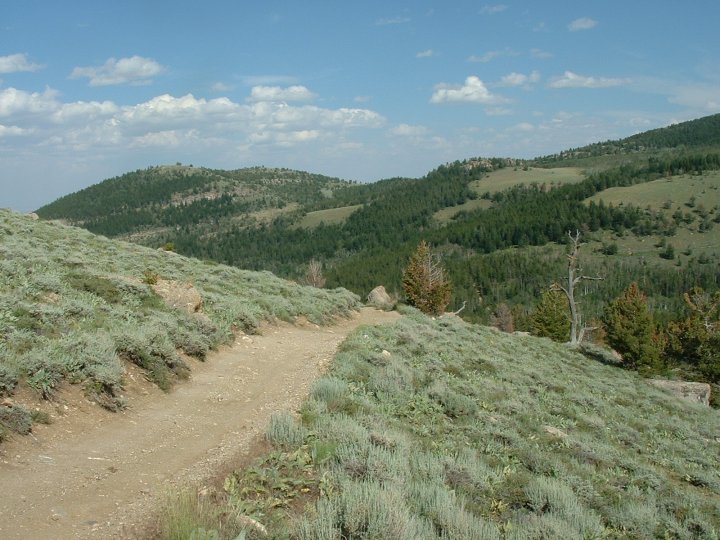
![]()
![]()
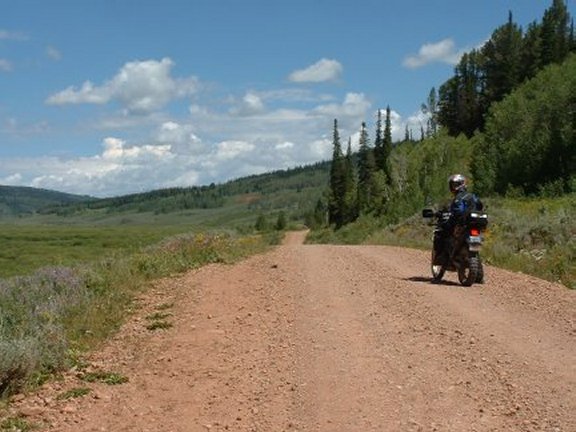
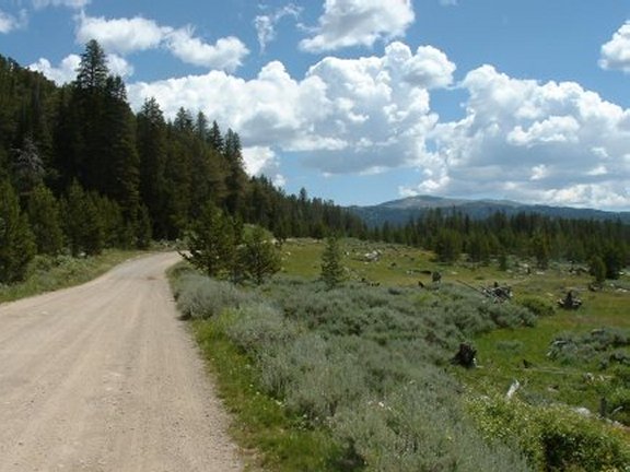
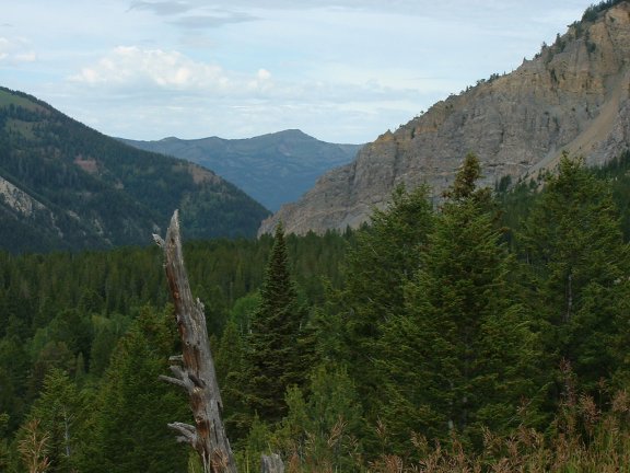
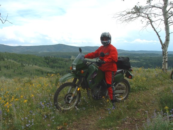
Day Five – Greys River
After getting a feel of the land we decided to alter our plan for Monday's ride. We had two days left before we headed south to Rock Springs so we thought we should go back up to the northern section of Greys River Road. We decided the best route to where we wanted to go was back over McDougal Pass. Traversing the pass in a different direction was amenable to us. We headed west over Cottonwood-Ryegrass Rd (CR Rd) towards McDougal Pass. CR Road's packed dirt enabled us to move along at a pretty good clip. We were riding abreast a group (herd?) of pronghorn deer that were trying to cross the road in front of us. I let a couple of the faster ones get ahead of us and they managed to cross. We were moving in excess of 50mph. As we approached the pass it did not disappoint in terms of scenery. The different direction made it seem like a different route. We spotted a trail off to the south and followed it for a couple of miles and stopped for a break. Once over the pass we were back on Greys River Rd (KMZ). The road north of Sheep Creek Rd (KMZ) was very different than to the south. The road was in good condition made of tightly packed gravel. A street bike could navigate this portion with ease. Now Grey River was on our left and we stopped along the river for a rest. We could see Virginia Peak to the southwest and Sherman Peak to the west. We crossed the river and entered McCain Meadows. The road turns almost due west as we passed between Bradley Mountain on the north and the Salt River Range on the south. Soon we were in the town of Alpine and US26. We rode through the Grand Canyon of the Snake River on US26/US89. We could see many whitewater river rafters in the canyon below (KMZ). The road here had recently be redone, but was heavily traveled. The road crosses the river and was now on our left. We stopped along the Snake River for a breather. A few miles further up the road we came to Wilson/Fall Creek Road and headed north. The road follows along the creek to the north, between Munger Mountain on the east and Snake River Range on the west. After a couple of miles, the road leaves the creek and climbs up to a small park. This area is developed. Back down towards the river we found pavement again and it looked like we were getting into more development. We spotted a trail off the left that seemed to be horse trail (KMZ). We wound back the trail until we came upon a ranch. We turned around but stopped to view the Tetons off in the distance. Back on the road we were quickly in Wilson on W22. We headed east on W22 bringing us just south of Jackson where we headed south on US189 toward Hoback Junction. Just past Bondurant we began looking for a trail we noticed on the map. Just past Robinson Butte we saw a trail running off into Raspberry Ridge (KMZ). We took the trail and were pleasantly surprised by the views. We hung around on these trails before continuing south on US189. As we came upon the Warren Bridge we found another trail running along the Green River. We rode this for a time before dropping down along side the river for a stop. Back out on US189 we took Pape Road for a little diversion past Old Fort Bonneville, into Daniel Junction then back to Pinedale.
![]()
![]()
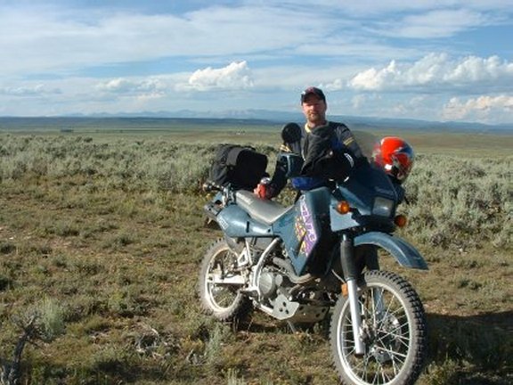
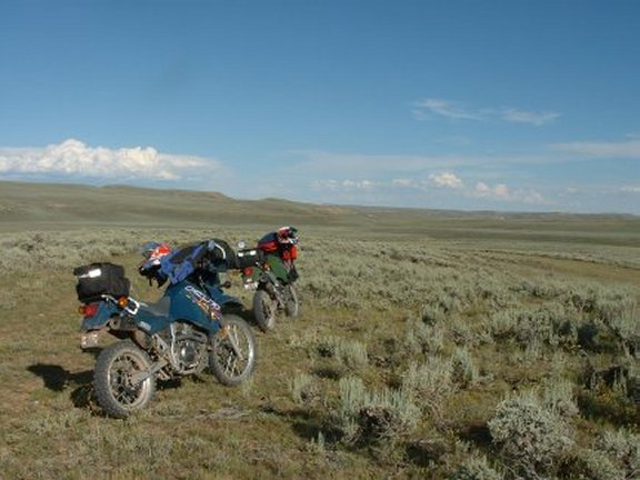
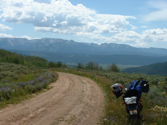
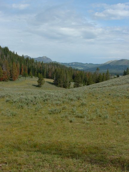
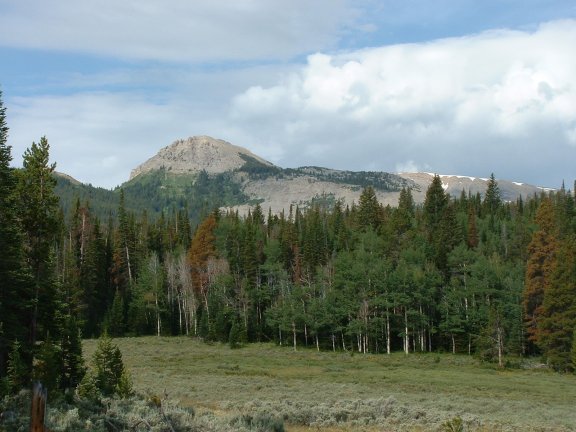
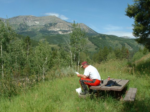
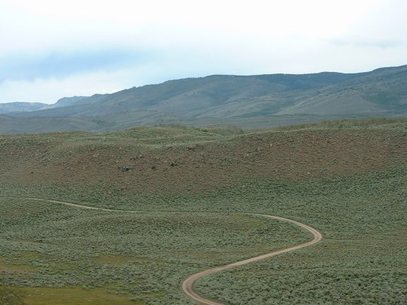
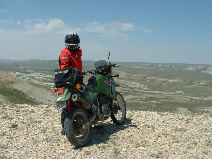
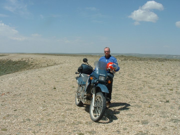
Day Six – Big Sandy
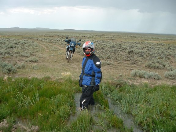
Our last day to ride in the area before packing up and moving south. We decided to just head toward the Big Sandy area and look for some good roads. We headed south on US191 and turned left on W353 at Boulder. This road is a part of the Continental Divide Trail. Just before the turn onto W353 we noticed an Osprey nest on a pole just south of the city. The power pole near the highway has supported an osprey nest for many years. Ospreys normally build their nests (eyries) on top of large columns of rock or in trees with broken tops. Utah Power and Light Company built this nest site by adding an extension and platform to an existing pole. This provides the birds a safer place to nest and prevents powerline damage due to falling nesting material. After traveling about five miles the pavement ended and turned to gravel. After another couple of miles we found our first road we wanted to explore. It was unmarked, but it followed the Silver Creek into the Silver Creek Canyon. The dirt road narrowed and we were surrounded by the canyon walls. We noticed some much smaller trails heading off toward the canyon walls. We took one of the trails and it took us to nice view of the valley below. There, we could see Big Sandy Road off in the distance. We continued further on the dirt road but we came to a dead end after about eight miles. We turned around and headed back to Big Sandy Road and continued east. We stopped along the road before reaching Buckskin Crossing (KMZ). This part of the Big Sandy River has been known as the Buckskin Crossing since the 1860s. Legend is that a trapper and hunter named Buckskin Joe lived here with his wife and daughter. The daughter died here. A marker is near his cabin site. This crossing was used by the fur companies and trappers, Captain Bonneville, Captain Wm. D. Stewart, and later by John C. Fremont. Captain Stewart’s artist—the noted Alfred Jacob Miller—made the first painting of this area in 1837. This ford of the Lander Cutoff of the Oregon Trail, campsite and burial ground was heavily used by the emigrants, their hundreds of wagons and thousands of mules, cattle and horses. This was the mail route from the east to the west side of the Wind River Mountains in the early 1900s. Big Sandy Creek was named by William Ashley on his trapping expedition in 1825. Of the thousands of people who passed this way only the wagon tracks and graves remain. After the crossing we continued on toward the Big Sandy Recreation area. This area is very popular with the hiking crowd. The trail ends at the trailhead into the Bridger-Teton national Forest also known as the Cirque of the Towers. We didn't have any certain direction, we were simply trying to avoid the rain. Upon reaching the trailhead the rain began (KMZ). We stopped under a stand of trees in a somewhat futile attempt to stay dry. After the rainfall lightened we continued back the way we had come. After a few miles we got a respite from the rain. We saw a trail leading up some of the bluffs and we decided to explore. These bluffs were at the base of Little Prospect Mountain, and we could see the trail leading to the Recreation area where we had just been (KMZ). Back on the road we turned on the Emigrant Trail (Lander Cutoff). We passed through the crossroads of Leckie, but I don't recall anything being there. We crossed over the Little Sandy Creek and found our way back onto Big Sandy Road, now with the split name including Elkhorn Road. We were getting back into rain so we decided to continue south toward Farson. Off in the distance we saw a butte with a trail leading to it, so we decided to explore. We couldn't quite find our way to the butte, and decided to cut our losses and head back the way we came. There was a rather small creek we had gone around, but when we doubled back we discovered a need to cross it. It didn't seem that difficult a crossing (famous last words) as I approached the creek. It couldn't have been more than two feet wide and it was grass covered. So, I gunned it just about flipped over the handlebars as my bike sunk several feet down. I jumped of my steed and it easily remained upright. My boot sank down in the muck, and I summoned Steve for assistance. We both struggled and finally freed her. We continued on to Farson in driving range and stopped at the city shelter for some reprieve. After the rain slowed we continued back up US191 to Pinedale for some needed new clothes and warmth.
![]()
![]()
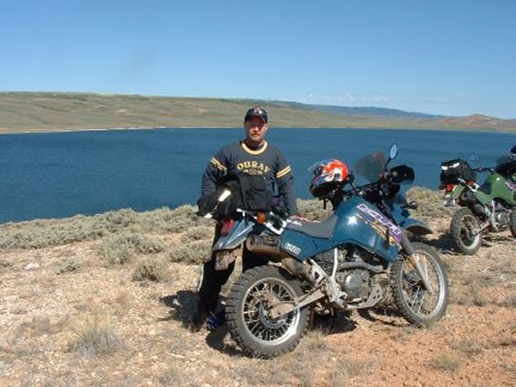
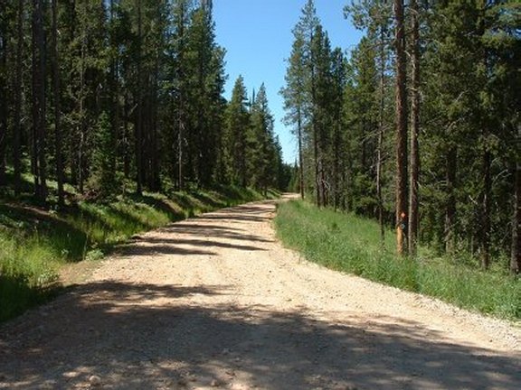
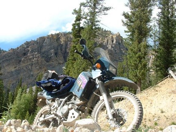
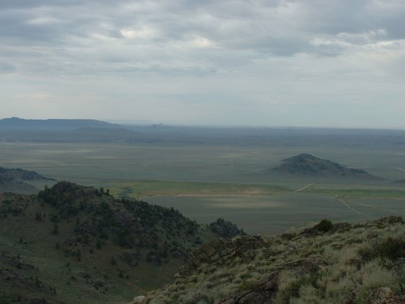
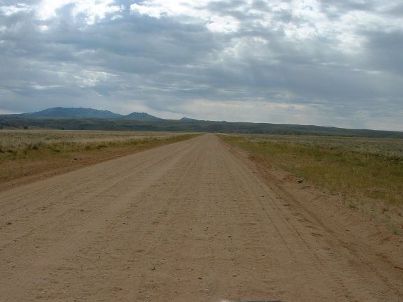
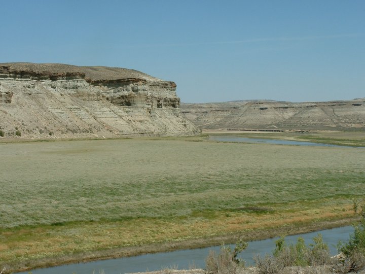
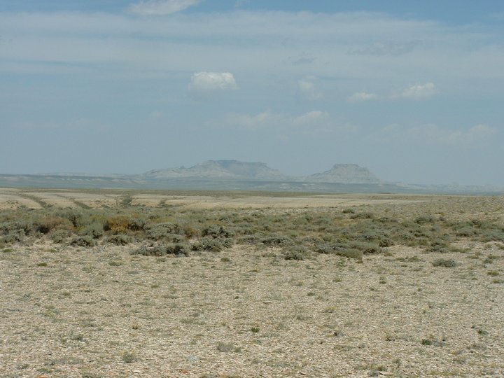
Day Seven – Flaming Gorge
The night before we had packed everything up so we could head out first thing in the morning. We were heading south to Rock Springs where we would based for two days while riding in the area. We left early and arrived in Rock Springs around 9:00 a.m. ready to ride. We dumped our stuff in our KOA cabin (KMZ) and set out for the Flaming Gorge. We were to ride down the east side of the reservoir and catch as many good looking roads as possible. In 2003 we rode our street bikes down the west side of the reservoir. The ride really begins south of I-80 on US191. Traveling south on US191 we turned right on Little Firehole Rd meandering through the arid landscape trying to stay on course. This was more difficult than we had anticipated since the roads were not marked all that well. We made a wrong turn and found ourselves at a dead-end at the Green River far above the reservoir. We backtracked a little while but soon found another road that looked promising and took it. We had laid out a route but we quickly realized there was far too many good roads, and soon we applied the strategy of just going where the trails looked good. We finally found ourselves back on Little Firehole Rd and took it to the Flaming Gorge campground. There we found some trails high above overlooking the campground and reservoir. We stopped for some pictures. We continued on and found the old Cherokee Trail. In 1873, "The United States Geological and Geographical Survey of the Territories" made a survey of the area south of the Union Pacific Railroad. The Survey ran from Rock Springs and Green River, Wyoming, south to the White River in Utah and Colorado. The survey clearly shows a road running from Green River to Brown's Park. The trail was simply called "the Wagon Road from Green River City to Browns Park." Following what would become the principal route south to Brown's Park and later Vernal, the road traveled east along Bitter Creek then turned and followed Little Bitter Creek south to the top of Miller Mountain. The trail then descended Miller Mountain to Sage Creek near Maxon Ranch where it crossed this stream and traveled up the flanks of Little Mountain. The trail moved over the eastern flank of the mountain and descended into the Red Creek Badlands. Following Red Creek through Richards Gap the trail followed the creek through Red Creek Canyon and into Brown's Park. More than likely here in the Red Creek area the trail joined the Bryan to Brown's Park Road. The 1873 map does not indicate that the Green River trail ever went any farther south than Brown's Park. We only traveled a small portion of the trail but it offered great scenery as we thought what it might have been like to have to walk this route. The trail ended at the reservoir, probably where it used to cross the Green River before the days of the reservoir. We stopped at the reservoir and took a quick dip in the frigid waters. Afterward we continued in pursuit of the next challenge. We found a trail and explored back deep in a canyon and came upon a trail we couldn't master. There just was not enough room to navigate and gain speed to climb the hill. We turned around with our tail between our legs and found another great spot high above the reservoir to stop. We headed back to our campsite and decided to ride some of the trails we had spotted around the area. As we began riding these local trails I tried going up hill Steve had just climbed. I didn't make it but managed to turn my bike around. The hill was rather steep and while my bike was on its side before I rode it back down I had unknowingly partially cracked my gear shifter. Everything seemed ok at the time but I would soon find out I had a big problem. We set up camp, did some swimming in the campground pool, and called it a night. There wasn't much to do at the campground after dark.
![]()
![]()
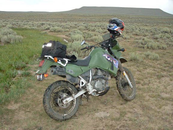
Day Eight – Oregon Trail
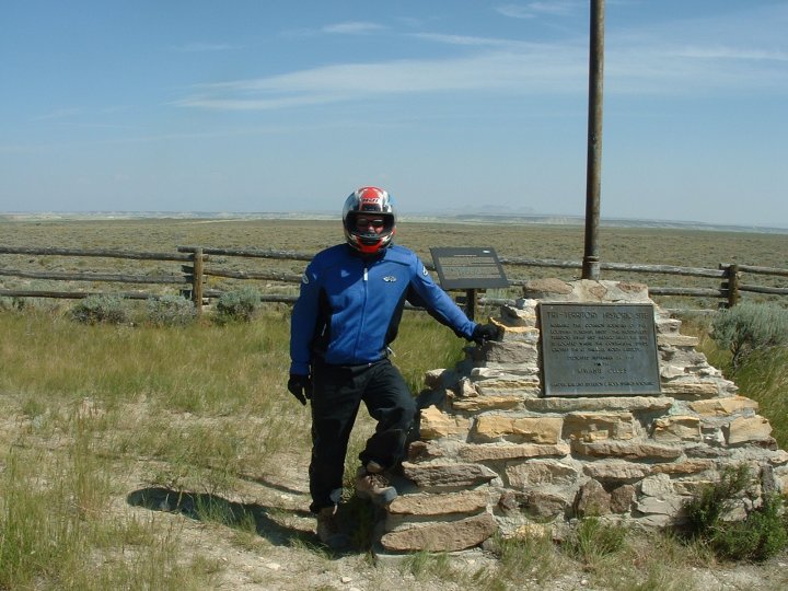
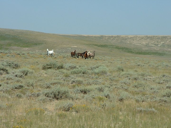
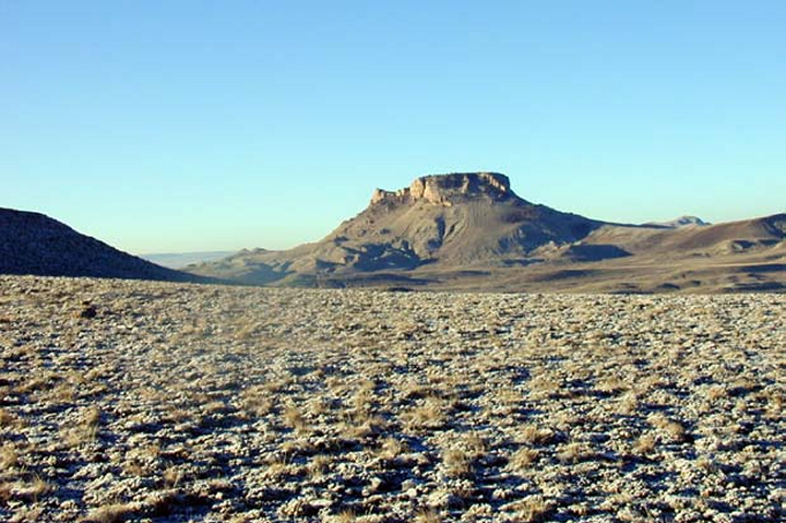
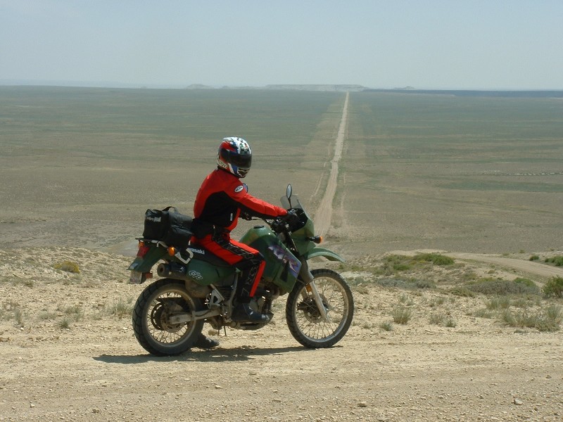
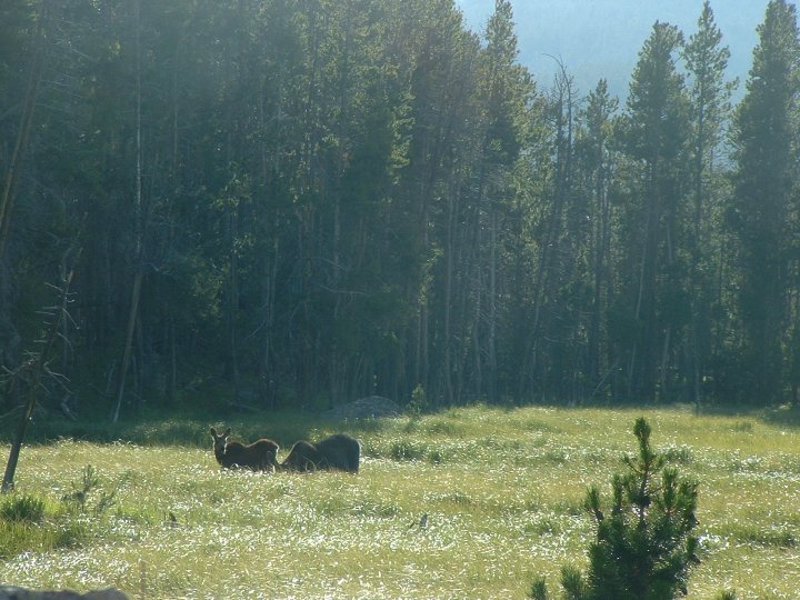
Despite the trouble I was about to face we headed out for what turned out to be my favorite of the trip. We thought the weather was going to be warm again but as we headed out east on I-80 the temperature was below what we had anticipated. Once we exited the interstate the sun began to warm things up and we were no longer traveling at speeds of 80 mph. We exited at Thayer Junction (122) and took the service road running parallel to the interstate. We headed north on Nine Mile Rd past the Jim Bridger power station. The area was full of large trucks, rail lines, and was not terribly scenic. Once past the power plant the scenery started to improve. We could see large buttes off in the distance (KMZ). Soon we were in the Great Basin area and we found Freighter Road which we took us into the Jack Morrow Hills. We quickly found a trail raising into the bluffs high above the road (KMZ). Once on top we had a clear view of the entire valley, and was it ever immense. We could see many roads/trails off in the distance. We got our bearings and continued north. We came upon the Tri-Territory Monument (KMZ) where we spotted some wild horses. We stopped and read the plaque at the monument and discussed our next move. We took off in a direction we thought was towards the Oregon Buttes but it dead-ended at an oil well. We backtracked and finally found our way. It was about this time I realized I had a problem with my shifter, it was getting more difficult to change gears as the crack size increased. As we rode down a bluff we came upon the straight and long section across the basin (KMZ). We hadn't seen a soul since we had gotten past the power plant. As we were traveling on the basin road we came upon a huge mud puddle in the road where we had had to go off road to traverse it. We had just passed a family out the trails riding dirt bikes. A Father, Mother and their two boys. Once around the mud puddle my shifter finally broke, I was in first gear. As we stopped to assess the damage the other bikers came back to try and help, but there wasn't anything they could do. Fortunately Steve had the same type of bike, so I replaced my broken shifter with his, got my bike in third gear, and then replaced it back on his bike. I continued on the trail not being able to shift out of third gear. We finally reached W28 after traversing the Oregon Buttes. There we stopped at a rest stop (KMZ) and repeated the procedure this time shifting into 4th gear. We knew there was a Kawasaki shop in Lander about 40 miles away. So I managed to get the bike started in 4th and wound her out the 40 miles to Lander. Fortunately we hit all of the lights in town and made it to the Kawasaki shop no worse for wear. After a quick purchase we were on or way again. Apparently the broken shifter was somewhat of a common occurrence on the KLR. We decided to loop around to W28 by way of Louis Lake (KMZ). We had made this trek before but were on street bikes. This time it was much more fun. We wanted to ride up to Shoshone Lake on a trail we had spotted the year before. As we rode past the Sinks Canyon lodge we decided not to stop since we had already seen that. We continued to look for our trail but we could not find the entrance. Once on top of the mountain in Sinks Canyon we could see our mistake. We debated turning around but we decided to continue on. We got off road in the Canyon and found some great trails to ride. These were true dirt paths and it taxed our skills. We continued on around and passed Frey Lake and Louis Lake. We spotted some moose off in the distance and stopped for some pictures. Back on W28 we headed back toward Rock Springs. As we approached US191 we could see a major storm in the distance. It looked at one moment that it would blow to the south and miss us, and the next moment like we would get drenched. In the end we only got a little rain, missing the bulk of it. We continued down US191, through Eden, and were quickly losing light. We got back to the campground and readied as best we could for our exit the next day. We set Adair IA as our destination for the night. We had stayed there on two other previous trips. There really isn't anything special, but we like tradition. At the motel we got our corn hole set out and played a few matched. This typical mid-western game drew a few onlookers as Steve gave me a lesson in the game. As we were playing, a pick-up truck pulled up trailering some bikes, and come to find out it was Paul Taylor; the winner of the 2003 Iron Butt Rally. We drank a few beers with him and listened to his stories about the event, and dreamed of doing it in 2005. I doubt if we will, but we will be trying to acquire a couple of the patches by riding 2000 miles in 48 hours.
![]()
![]()
Email me Ken Adams

HOME