The Rock
Newfoundland & Nova Scotia
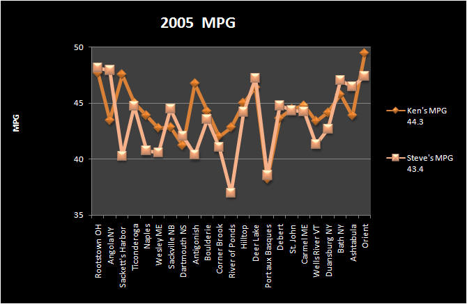
5013 Miles
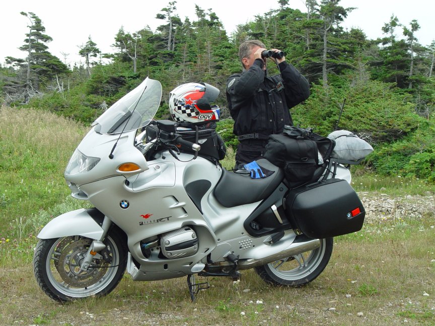
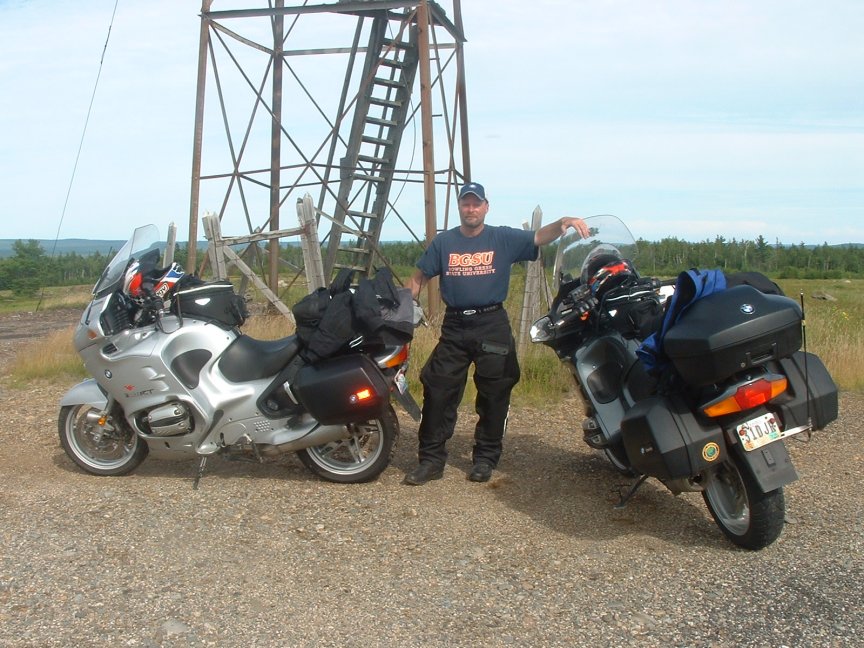
It had been four years since we had taken a long street ride. We had gone to the southeast in 2002, trailered to Wyoming in 2003, and taken dual-sport bikes back out to Wyoming in 2004. We dusted off an old plan to ride to the land of the Vikings affectionately known as "The Rock". We had both purchased BMW R1150RTs earlier in the year so we were looking forward to see how the new bikes would function. We had planned to take two ferry trips to get to our destination in Newfoundland. After researching and discovering the cost of the Bar Harbor to Yarmouth NS leg we decided to take the land route. It was an easy decision since we wanted to put as many miles on the clock as possible.
![]()
Day One - Cincinnati to Henderson Harbor NY (686 miles)
We started out on Thursday and planned to ride hard enough to allow some time riding along Lake Ontario. We rode up I-71, east on I-76 and I-80 over to OH11 which is the just like an interstate. Up to I-90 and we were quickly through PA and into NY. We made good enough time that we were able to jump off I-90 at NY414 and into the town of Clyde. We didn't know it at the time but Clyde sits on the old Erie Canal, and we stopped at a spot on the canal where we watched several runabout boats slip in, and we saw an old modified canal boat cruise on past. We continued up NY414 and headed east on NY104. We were close to the lake but didn't really catch a glimpse until we got through Oswego and turned north towards Henderson on NY3. The road between Pulaski and Henderson was a little inland allowing for only quick glimpses of the lake but it was nice riding. We pulled into the Aspinwall Motel right around dusk. The owners were out and about to greet us, and could not have been more hospitable. We unloaded and headed into Henderson Harbor where there were some nice, quaint little motels and cottages. We stopped to grab a bite to eat and headed back to the motel.
![]()
![]()
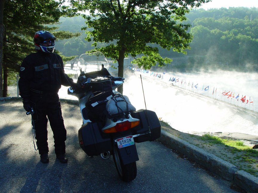
Day Two – Henderson Harbor NY to Portland ME (469 miles)
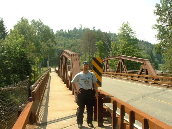
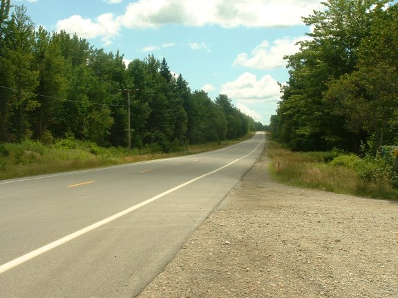
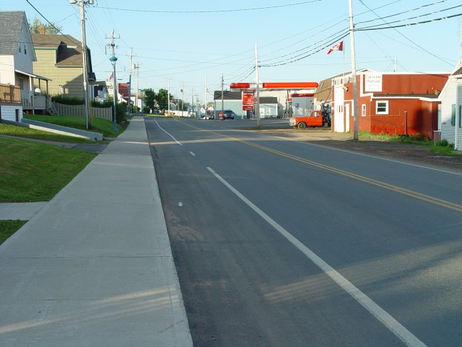
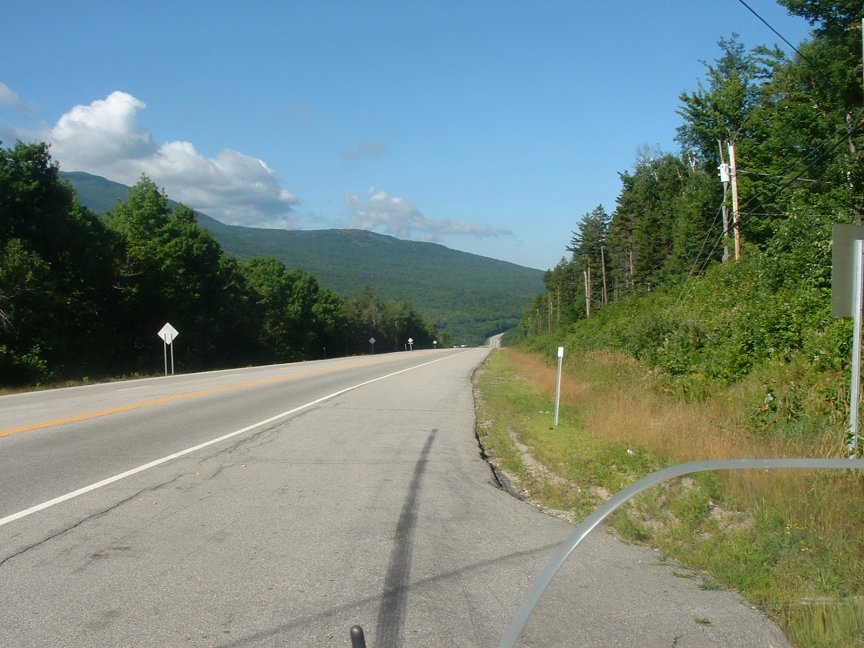
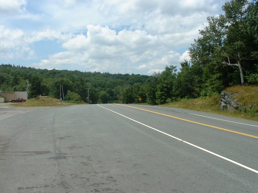
We stayed on NY3 and motored to Sackets Harbor where we filled up on gas and took a couple of pictures of Henderson Bay. Route 3 east of Watertown is a nice road that gradually climbs up into the Adirondack Mountains and runs along several rivers and through many small towns typically located on lakes. We stopped in Star Lake to take a picture along the Oswegatchie River. Continuing on, we quickly came upon a nice stop just east of Cranberry Lake on the south branch of the Grasse River. As we continued east the mountains were becoming bigger, we were now looking at mountains in the 3,000 foot range, and the ski areas were becoming more prevalent. We came into the town of Tupper Lake which is in the heart of the 1,000 lakes country and the lake itself is the source of ten rivers. The area here is heavily forested, everywhere you look there is nothing but fir trees. Soon we were in Saranac Lake (KMZ), where we stopped to take a couple of pictures of the beautiful downtown without ever getting off of the bikes. We changed roads in Saranac Lake to NY73 and headed south towards Lake Placid. It wasn't long until we ran into the biking & hiking crowd. Lake Placid draws these types of people who vacation here, I guess thinking they may have a spot on the next Olympic team. It was Friday morning and already the place was jam-packed. We stopped to take a picture of the ski jumps (KMZ), that can be seen along NY73 where it, Riverside Dr, and the West Branch of the Ausable River all converge. Shortly after our stop we blew through Keene and down to NY9 where we planned to take the bridge over to VT. We were going down NY9 at a nice clip when we decided we had gone too far. We pulled the map out and realized we had gone too far south and were now due west of the Ticonderoga Ferry. We needed gas so we headed towards the Ferry on NY74. This road provided a nice view of Lake Champlain as we headed east and down towards the historic town. After filling up we decided not chance the Ferry either being on the far side or not having room. So, we decided to blast the 10 miles north to the bridge to cross (KMZ). Near the crossing is Crown Point State Historic Site where the Champlain Memorial Lighthouse sits. This also put us in position to head east on VT17 rather than VT73 which we had previously traveled on. Immediately after crossing the bridge we ran into a brutal rainstorm. It stayed with us until we got through Bristol VT, where we made a stop along the New Haven River (KMZ). We had just entered the Green Mountain National Forest and the scenery, as well as the road, was perfect. We hit rain again as we headed north on VT100 and on to I-89 for a short haul to US302. We have traveled this stretch of road many times and it never disappoints except, maybe when it's raining. We crossed the Connecticut River in Woodsville where we had made a stop back in 1994. Just beyond this point we turned onto NH112, better known as the Kancamagus Highway. Just past Stillwater the rain stopped so we stopped for a brief time along the Wild Ammonoosuc River (KMZ). Back on the bikes we were back into the rain, although the heavy stuff had stopped. The road was still wet making the ride less than perfect, but this highway is always entertaining. We were losing daylight and we still had our sights set on a lobster dinner in Naples ME. I think we knew about this time that we were not going to make Bar Harbor that night. We were simply not making good time with the rain. So we stopped for our lobster dinner which we had to eat in parking lot since the place was standing room only and a two-hour wait (KMZ). We continued on US302 and set our sights on Portland to stay for the night. We went through town and found the Falmouth Motel (KMZ) a few yards south of where we stayed in 1994.
![]()
![]()
Day Three
– Portland ME to Peggy's Cove NS (591 miles)
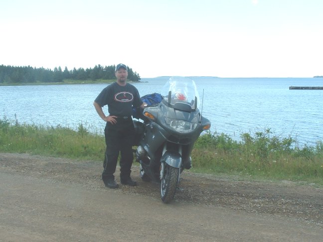
Saturday morning, and we knew it was going to be crowded going up the coast so we set out early and headed up US1. We decided to wait for breakfast and catch something along the road. US1 parallels I-295 and runs through the little towns of Yarmouth and Freeport before breaking away and heading almost due east to Brunswick. In Brunswick the road runs along the Androscoggin River and then over the New Meadows River. Next we ran into Bath (KMZ) where the high bridge over the Kennebec River offers fine scenery of the surrounding area. Continuing on US1 as we approached Wiscasset where we found a nice spot for breakfast; Karen's Kitchen (KMZ). It might have been our best breakfast of the trip, we continued on through Wiscasset and over the Sheepscot River where I realized we had stopped to take a picture in 1994. In the 1994 trip report I now know I had mislabeled the caption, oh well no one will notice. Another few miles and another previous spot revealed itself, this time Sherman Lake; I believe we stopped there on the return side of the 2001 trip. As the day was getting longer the traffic was picking up. We slid through Rockland (another previous stop (1994)) before noon but it was slow going. The weather was beautiful but the slow going made it a bit too hot. We crawled along the coast and then through Rockport before reaching the beautiful town of Camden. As we went through Camden I thought my wife like to shop here but there really wasn't much for us. On the north side of town (KMZ) we hit the Camden Hills State Park (yes we also stopped here in 2001), but this time we stopped at the gate to speak with the attendant and she informed us of the wonderful view that could be had by going back out across US1 and up Mt. Battie Auto Road. The view from up here was indeed spectacular. We took many pictures of Camden Harbor and Penobscot Bay. Additionally we could see Cadillac Mountain at Acadia National Park and Mt. Megunticook, the highest of the Camden Hills and the highest peak on the mainland. After the visual feast we set back out onto US1 where the continued congestion only led us to devise a breakout option. We decided to head north on ME46 just past Belfast (KMZ). This was a very small tightly confined road that made passing difficult but we managed, and hit ME9 east and began to make good time. ME9 is a nice open road that is fairly straight but one that offered good scenery and has great passing capability. We rode hard and realized we would soon be in need of some gas. We decided to go through Beddington, where we thought we spotted a gas station, thinking we would find something soon. As we got close to Wesley we became fairly concerned. We passed a little stand where Steve thought he saw a pump but we rode past and decided after cresting the next hill to turn around and investigate. We were pleasantly surprised to find out they indeed had gas, so we filled up. After gassing up we stopped again at the crest of the hill to take in the full view. Arriving in the border town of Calais (KMZ) the heat had increased and the long line of vehicles waiting to cross over into Canada didn't improve our comfort. After about an hour we were through, and blasted up Canada 1 toward Saint John. We stopped near Anagance NB for a quick stop before filling up on gas at Sackville. Once back on the road we stopped at the Nova Scotia welcome center (KMZ). The terrain had gone from lush green forested areas with rolling hills to flat mostly treeless terrain. We had already ridden about 450 miles at this point and we had lost an hour in the time zone change so we were running short on time quickly. We had wanted to see the Tidal Bore on the Bay of Fundy but we simply were out of time. We blasted toward Halifax and made our way to the motel well after sun-down. When we arrived at the Clifty Cove Motel (KMZ) we quickly realized what we had missed by arriving after sundown. It was a great place with a fantastic view, Adirondack style chairs setup to to soak up the view and a full compliment of riders from all over the place. We walked around and met some people before calling it a night.
![]()
![]()
Day
Four
– Peggy's Cove NS to Chéticamp NS (350 miles)
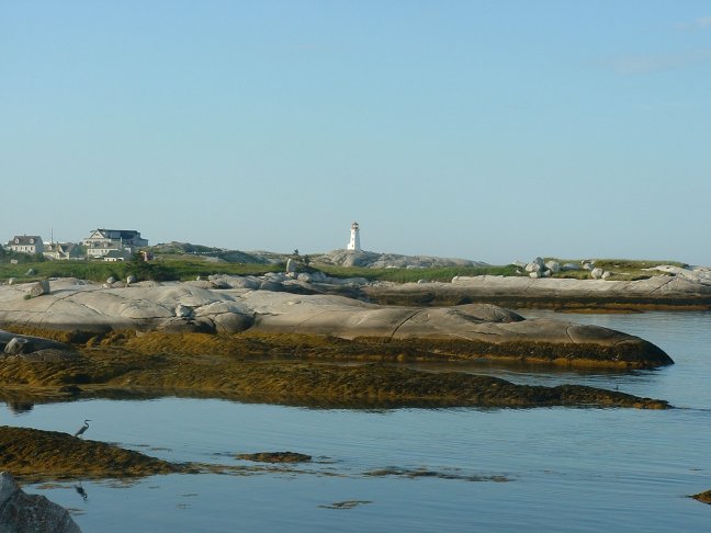
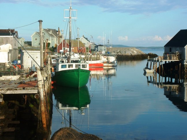
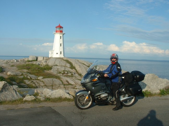
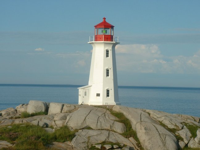
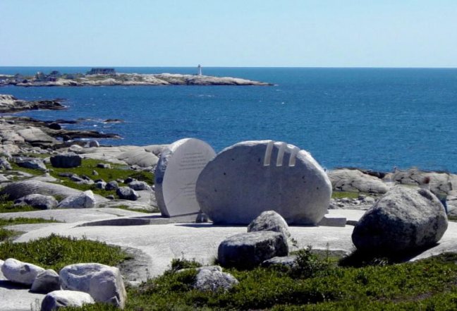
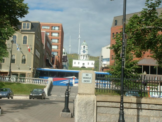
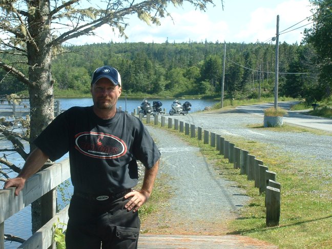
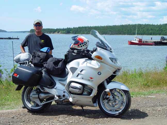
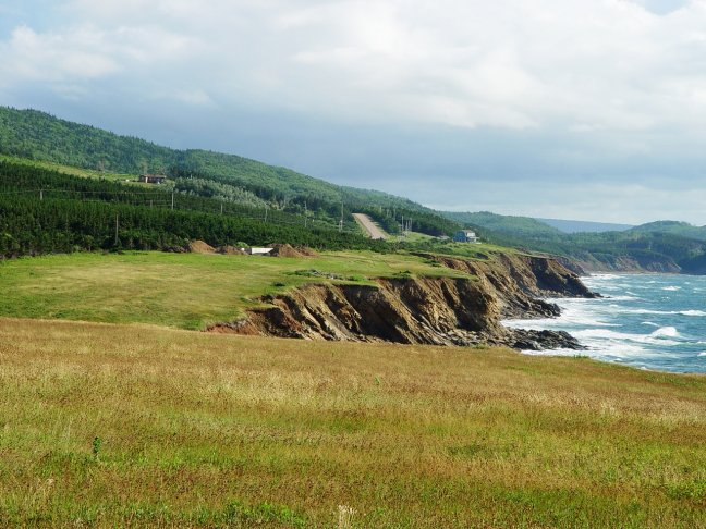
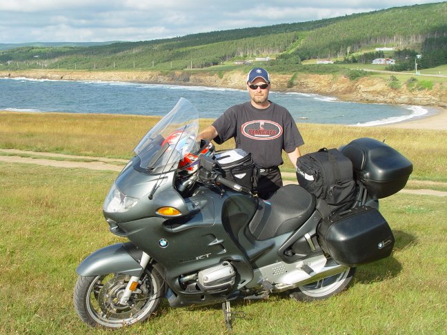
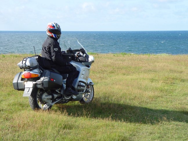
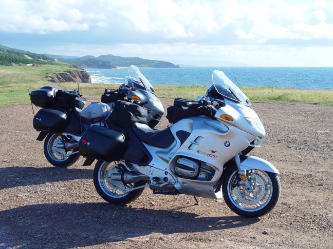
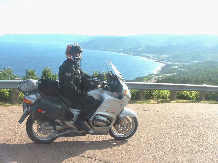
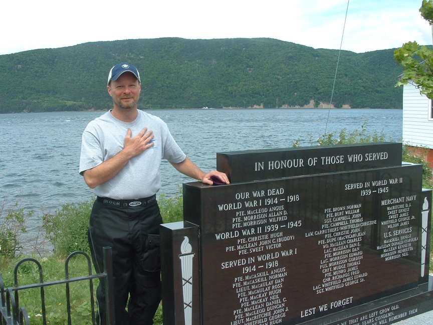
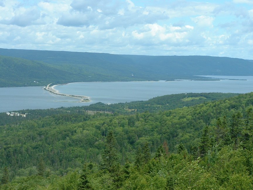
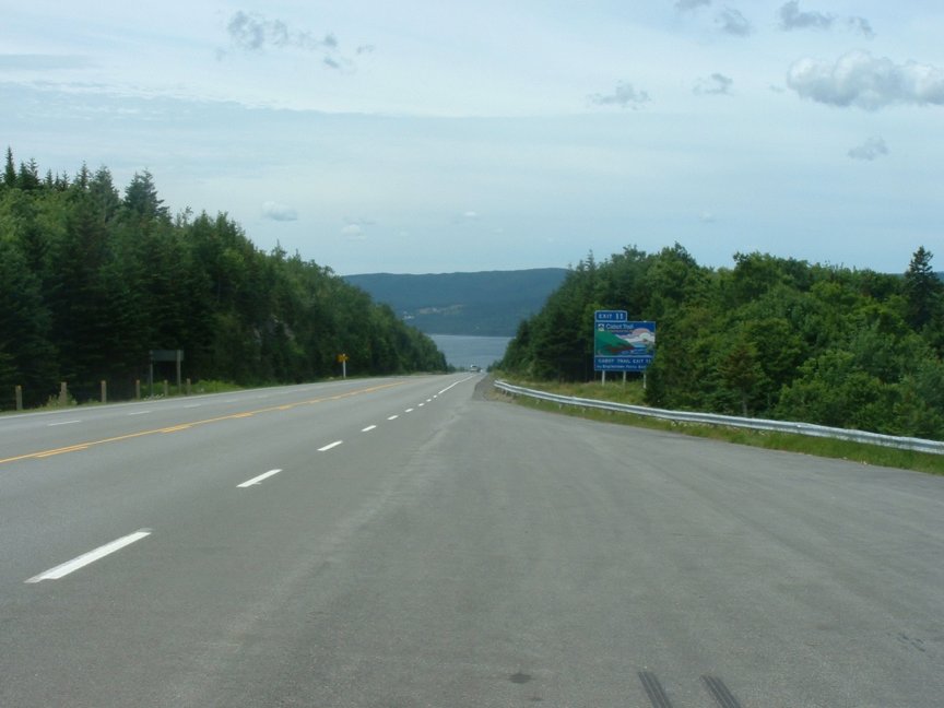
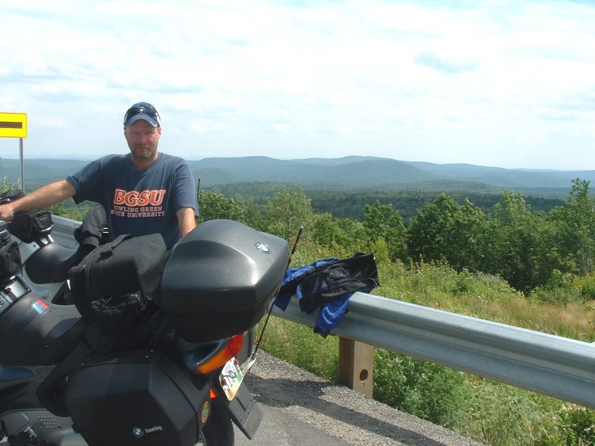
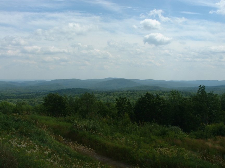
We started out by touring Peggy's Cove since we didn't have the opportunity. According to legend, Peggys' Cove was named after the only survivor of a schooner that ran aground and sank in 1800; a woman named Margret. Local folk called her "Peggy" and her home came to be known as Peggy's Cove. The original lighthouse there was built in 1868. The lighthouse is probably one of the most photographed spots in Canada, but early on Sunday morning we just about had the place to ourselves. Also in the area is the monument to the 229 who perished on Swiss Air flight 111. After taking our photographs we ran up north to downtown Halifax where we grabbed a bite of breakfast. Halifax was founded by British General Edward Cornwallis in 1749. The British created Halifax to act as a naval and army base to protect them from the French who had established the town of Louisbourg on the northern island of Nova Scotia. Halifax acted as a British naval base until 1906 when the Canadian government took it over. After breakfast we briefly toured the citadel (KMZ) that sits atop a hill in the middle of the city. The present Citadel, completed in 1856, is the fourth in a series of forts since 1749 to occupy the hill overlooking the harbor. It is an excellent example of a 19th-century bastion fortification complete with defensive ditch, ramparts, musketry gallery, powder magazine and signal masts. Although never attacked, the fort was garrisoned by the British Army until 1906 and by Canadian Forces during the First and Second World Wars. We got on Canada 7 after filling up in Dartmouth and headed up the eastern coast. We stopped near Jeddore at Oyster Ponds Park (KMZ). After running off about 100 miles we stopped at Ecum Secum if for no other reason than the name. We continued up the coast catching glimpses of the ocean before we headed inland toward the town of Antigonish. The town is home to Saint Francis Xavier University founded in 1853. We gassed up and grabbed some lunch as we waited out some rain. Back on our bikes we were quickly on Cape Breton Island, one of the highlights of our trip. We purchased a good map and headed up the Cabot Trail (history). The weather remained cool and we kept all of our riding gear on, but the rain had gone away. It was sunny and probably in the high 60ºs. We crossed over the Canso Causeway and were officially on the Cape. We hit the Cabot Trail as we headed up the western coast on C19. The scenery was beginning to get more interesting as we caught glimpses of St. Georges Bay and rode through the many small towns dotting the roadway. At Port Hood we stopped briefly and contemplated going north on a small road to view the lighthouse on Port Hood Island but we were having too a good a time riding. Once through Port Hood the road jets inland around Mabou Harbor. In the early part of this century there were few harbors that could provide refuge for larger vessels in this region of the Gulf of St. Lawrence. Shipping was the indispensable key to development of the coal mines, gypsum mines, lumbering, farming, and mercantile businesses, and it provided employment for a large number of people. Mabou had special potential because it was ideally situated at the mouth of the Mabou River. Mabou Harbor is a passage 800 feet long and 175 feet wide, flowing into the Gulf of St. Lawrence in a westerly direction. The north side of the passage consists of a high clay bank extending for a considerable distance beyond the Harbor. The south side consists of the end of a beach or spit which projects across from that side. Once in the town of Mabou we took a small road due west to see the lighthouse. The present lighthouse, with a height of 47' has been in continuous operation since July 15, 1884 and remains a necessary and functional part of Mabou Harbor. The present lighthouse was the "back tower" which was constructed as a wooden building, square in plan, painted white, with sloping sides surmounted with a square wooden lantern. It is the surviving twin of a second and shorter lighthouse (33') that stood at the entrance of the Harbor and was known as the "front tower." Both buildings were erected by E.C. Embree for $2,450. The front tower which was built on a pier was removed in 1893 "to a place of safety" because of the dilapidated condition of the pier. It was later replaced by a buoy beacon. At this time no photographs of this former lighthouse have been found, nor is its history well documented. Additionally the current one was undergoing some renovation so we didn't stay long. We continued back north up C19 and stopped in Inverness at a travel information house. There we made reservations at a motel in Chéticamp. At Dunvegan we took the less traveled C219 road hugging the coast. This paid off well as we came upon Whale Cove where we got off the road onto a high cliff overlooking the Gulf of St. Lawrence. This was a beautiful place that had fantastic views, and we took many pictures. We continued over Margaree Harbor and were in Chéticamp before we knew it. Chéticamp is an Acadian fishing village and tourist center located beneath the Cape Breton Highlands on the gulf of St. Lawrence. We found good accommodations there at Laurie's Motor Inn. We had dinner there and enjoyed some adult beverages at the Acadian pub where some locals put on a Celtic dance routine.
![]()
![]()
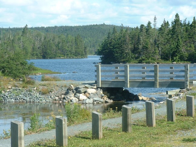
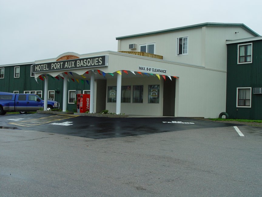
Day Five – Chéticamp NS to Port Aux Basques NF (168 miles)
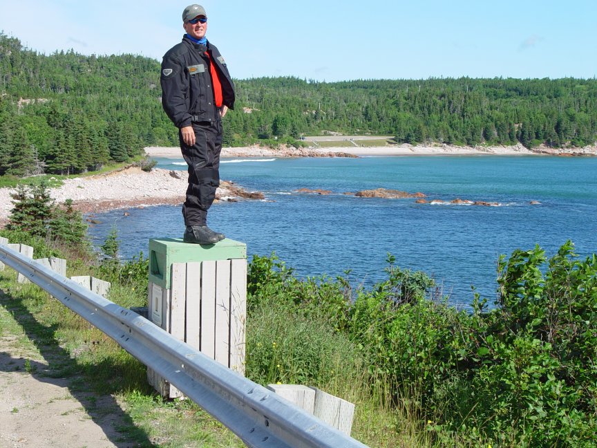
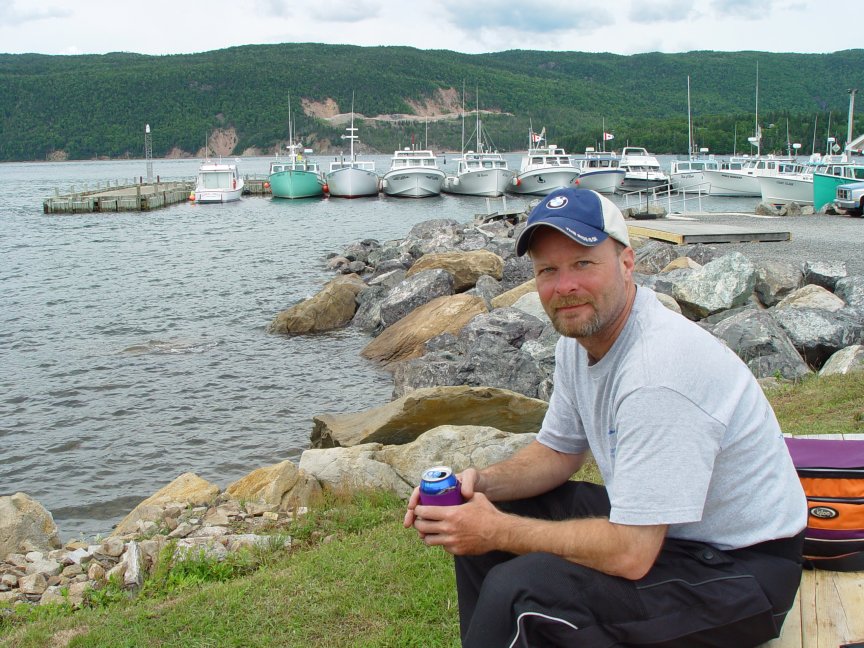
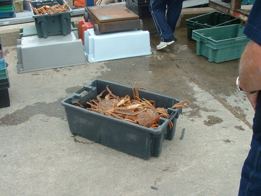
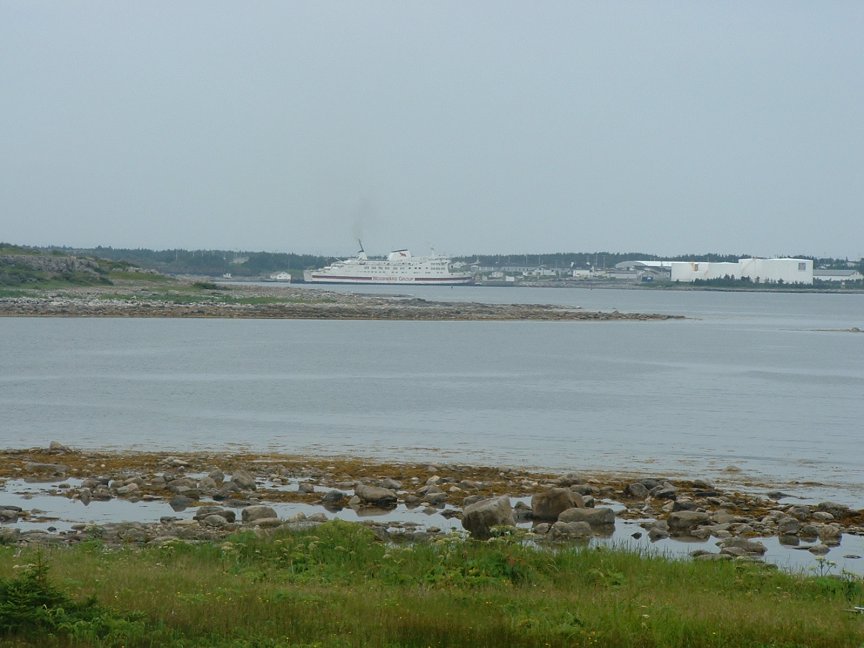
We left the motel under clear and sunny skies but was it ever cold. It was no warmer than 45º when we hit the Highlands on the Cabot Trail just a few short miles north of Chéticamp. It was Monday and there wasn't too much traffic as we pulled out and rolled the throttle on. We were about to embark on one of the best rides on the continent. Cape Breton Highlands National Park is known for its spectacular highlands and ocean scenery. The Cape Breton Highlands are the most striking feature of northern Cape Breton. Steep cliffs and deep river canyons carve into a forested plateau bordering the Atlantic Ocean. One third of the Cabot trail runs through the national park along the coasts and over the highlands. Established in 1936 it is a must ride for every motorcycle enthusiast. We didn't make it very far before we had to pull over to take some pictures and soak up the scenery. In 37 short miles we reached Pleasant Bay founded in 1828 and home today of 350 people, mostly fishermen. There are also a number of charters based here for the whale watching industry. Another 29 short miles and we were in Cape North and officially on the other side of the cape. We spotted the Atlantic Ocean and rode on its shores for a little while before coming into South Harbour. We stopped there for a couple of pictures before continuing on. The east side of the cape wasn't as scenic as the west side but still kept our heads on a swivel so as not to miss anything. We went thought the towns of Neils Harbour, Ingonish, and Little River. Before we knew it we were just south of Indian Brook where we had decided to take C312 through Englishtown down to C12. Just before Englishtown we had to take a ferry across St Anns Bay. I guess we maybe should have gone the long way around and visited the town of St. Anns dating back to 1629 when it was founded as a French Settlement. So with history on our minds we decided to stop at the Englishtown War Memorial to pay tribute to some of the local boys who gave their lives in the service of their country during WWI and WWII. By now we realized we had not gotten gas in 240 miles. We continued toward our destination in Sydney hoping we would find some gas soon. Fortunately we found some in Boularderie on C14 after 255 miles, that last five of which we very concerning. We stopped to view Big Bras d'Or, which is a channel of water leading from Big Bras d'Or Lake out into the ocean. We were ahead of schedule and had some time to kill before our 4:00 departure time on the ferry to Newfoundland. We took a side road that led us down to a wharf on the channel where a load of crabs were being brought in. We watched the unloading and relaxed for a little while before heading into Sydney. We quickly found the ferry entrance (KMZ) and decided to make a run to the local store to stock up on some drinks and snacks for our 4 hour ferry ride. We got in line and learned that all motorcycles get a free ride to the front of the line. We thought what treatment, and how this is the only way to cross. The whistle sounded and we were off, up the ramp and onto (or into) the ship. Tie down straps were supplied and all of the bikers worked quickly to secure their bikes and run upstairs to get the prime seating spots. We had tried to get a sleeper or dormitory room but they had all been reserved. Instead we located and secured a very wide booth that would allow us to lie down. We thought we might take a snooze but all of the people around us were very nice and we had a great conversation the whole time. Occasionally we would walk up on deck to stretch our legs and soak up the fresh salt air. Before we knew it we were across. Back on our bikes we searched for our motel where we had reservations. It was late but we found the motel with ease and called it a night.
![]()
![]()
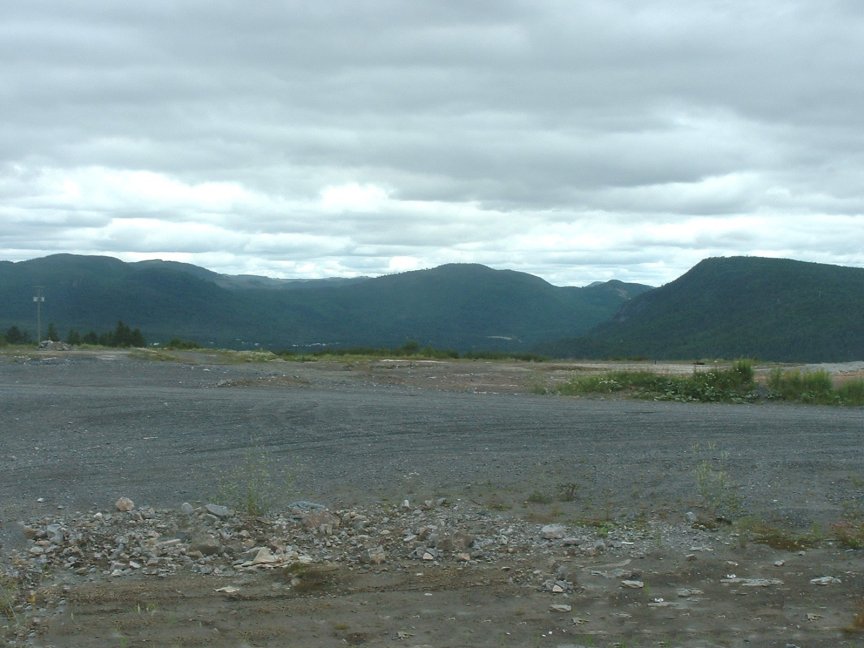
Day Six – Port Aux Basques NF to St. Anthony NF (457 miles)
After a good night's sleep we were ready to go and hit the Viking Trail. The morning started in a cold, intermittent mist with brief bouts of light rain; not the way to start the day. We suited up and rode as fast as we could in the poor weather trying to get ahead of the rain. We stopped at Corner Brook to fill up and continued north on the Trans-Canada Highway. It's the world's longest national highway. At 4,860 miles, it stretches from Victoria, BC, to St. John's, NF, and through every province in between. Constructed over some of the world's most treacherous terrain, it took 20 years and $1 billion to complete. Just north of Deer Lake we turned northwest and got on the Viking Trail. The road hugged the western shore of Newfoundland and we quickly found ourselves in thick forested terrain on the east and a view of the Gulf of St. Lawrence on the west. The rain had cleared, and it was bright and sunny. The temperature was still far below normal (I think) but it was comfortable for riding; probably in the high 60ºs. After passing through the town of Rocky Harbour we began the ascent up to Gros Morne National Park. The rocks of Gros Morne and the adjacent parts of western Newfoundland are world-renowned. This park is ground zero for the geological studies, and is known as the "Galapagos of Geology". The park is a rare example of the process of continental drift, where deep ocean crust and the rocks of the earth's mantle lie exposed. More recent glacial action has resulted in some spectacular scenery, with coastal lowland, alpine plateau, fjords, glacial valleys, sheer cliffs, waterfalls and many pristine lakes. We stopped along the road to view the nearby fjord and continued on. Further up the coast we came upon Arches Provincial Park, a site that features a natural rock archway created by tidal action. We didn't do much more than take a few pictures before heading on. The road was now right on the water as we traveled mile after mile with the Gulf on our left and a jagged rock terrain on our right. We were still technically in Gros Morne Park when we stopped near the Western Brook Pond in the park. We did not have much chance to go view the fjord but the surrounding scenery was great. We spotted a little path going down to the Gulf so we stopped and headed over the rather steep cliff down to the water's edge. Back on our bikes we stopped on the Castor River to stretch our legs. The river had a strange orange cast that probably had some ecological significance but we did not contemplate it too long. The mosquitoes here were out in force so we headed on. We stopped at River of Ponds to gas up and continued on. Our final stop before our destination was just a wide spot in the road just north of Hilltop. We cruised into St. Anthony just before eight o'clock. We ate at the motel restaurant and decided to ride up to Fisherman's Point just at dusk which was probably close to ten o'clock. It's wonderful riding in the northern portions as it stays light so long. We wondered around the park and headed back to the motel in full darkness.
![]()
![]()
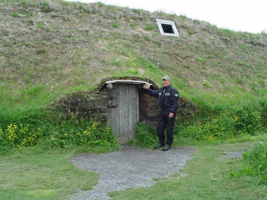
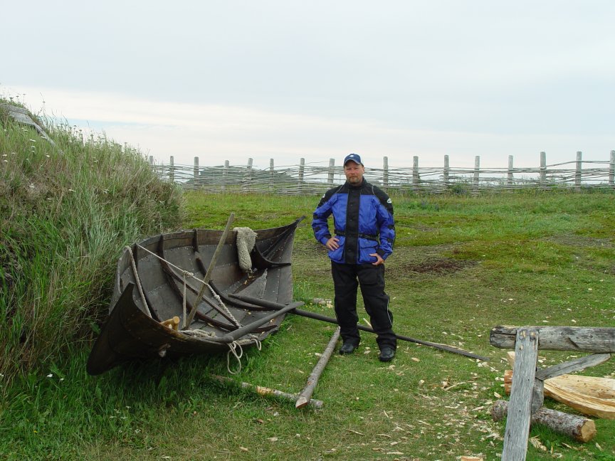
Day Seven – St. Anthony NF to Port Aux Basques NF(482 miles)
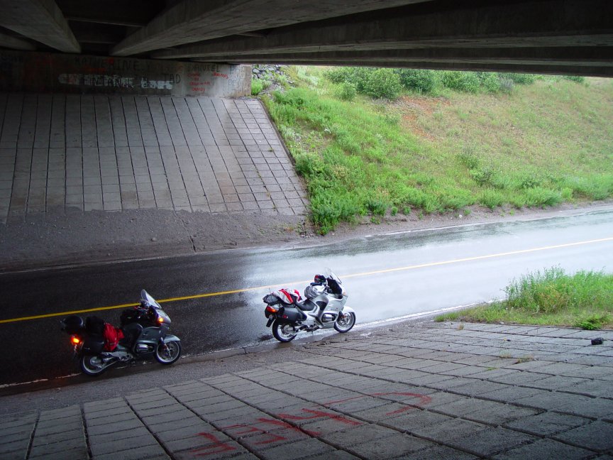
After a restful night at The Haven Inn we grabbed some breakfast in the motel restaurant and headed up to L'Anse-aux-Meadows. The park has the first historic traces of a European presence in the Americas, the ruins of a Norse settlement from the 11th century, with wooden and earth houses similar to those found in Norway. According to the Sagas, in 985-986 Bjarni Herjolfsson was blown off course from his trip to Greenland and spotted Newfoundland. In 995-996, Lief Eriksson went looking for this land and described Vinland. Thorfinn Karlsefin and Thovald Eriksson led an expedition to find Vinland and established a village for 3 years in what is now L'Anse Aux Meadows. While there the first child born to Europeans on the North American continent was born: Snorri Thorbrandsson. A Norwegian team in 1960, led by Helge and Anne Stine Ingstad discovered the site while searching for Vinland, the first Viking settlement in North America. Helge met a local fisherman, George Decker, who showed him what locals thought was an aboriginal camp. Excavation of the site later discovered the Viking settlement. During the 1920s, Newfoundland author W.A.Munn in his book "the Wineland Voyages" first suggested the L'Anse aux Meadows area might be the site of the Norse Saga's Vinland. We arrived there early in the morning before the park was open, so we decided to give ourselves a self-guided tour. We walked down into the village and had the place to ourselves. We wondered around awhile and decided to head on. We headed south back down the coast the way we had come the previous day. We stopped at St. Barbe near the Port-au-Choix historic site to catch a glimpse of the ferry to Labrador. We were a little low on gas so we stopped at Hilltop to fuel up. We met some locals there and struck up a conversation. The owner of the gas station was a former fisherman who had traded in his nets. I think he missed his former occupation but he said there wasn't much money in it anymore. It was exceptionally hard to understand him with his thick "Newfie" accent. I probably understood only about half of what he said, and he probably only understood half of what I said. He remarked at how slow we talked. Bike on the bikes the skies were growing dark and we were soon in a steady, cold rain that lasted all the way to Port Aux Basques. All the great scenery we had seen on the way up was now shrouded in clouds and rain and the ride was fairly miserable. We stopped near St. Stephens under a bridge for a reprieve. By the time we got to the PAB ferry it had stopped. We wiated in line for the ferry with a significant number of other bikers who marveled at the distance we had traveled. Most were from Nova Scotia and Prince Edward Island. We conducted the same routine but with a little more certainty as we were grizzled veterans. Steve went upstairs to stake out a booth where we could sleep and by the time he came back down my bike was secure and I held down our spot. We drank a few beers before falling off to sleep. It was not a particularly restful sleep in the booth but it beat alternative. We sailed around midnight and reached Nova Scotia around 4:00 or 5:00 A.M.
![]()
![]()
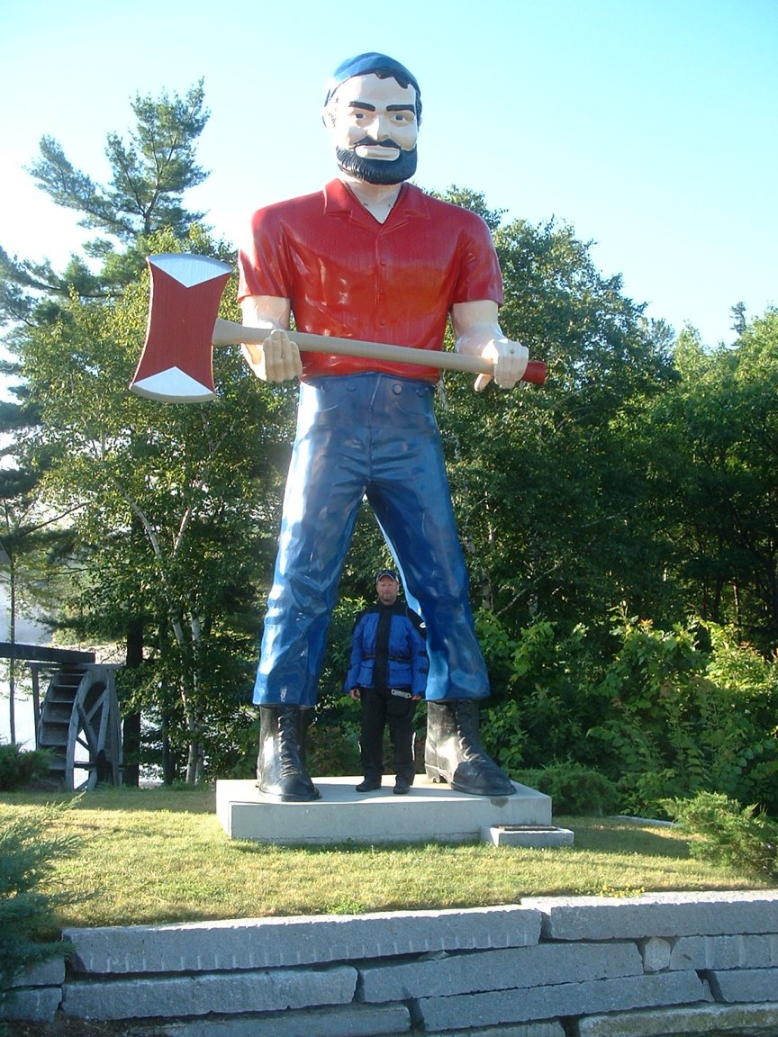
Day Eight – Sydney NS to Farmington ME (661 miles)
We rode about five hours on the ferry and slept maybe about half that time, but we rode off of the ferry before dawn and began our trek home. We did not have a specific destination we just planned to ride as long as we could. It was raining when we left and there was about 10 bikes ahead of us and a couple of trucks as we traveled south on the 105. We managed to pass the entire group after a few miles which was no easy feat. It was dark and raining but once ahead of the pack we were determined to keep going even though we had hoped to stop for some coffee and breakfast. The ride was pretty miserable; we rode 212 miles in the rain before we stopped at Debert for gas and lunch. Back on our bikes we rode another 160 miles to Saint John NB before gassing up again. The rain had stopped and the day was turning out pretty nice. While gassing up we decided to stop at Pleasant Bay and soak up some sun before crossing over the border. We found a nice little park along the Bay of Fundy. We crossed the border; this time only taking us about 15 minutes. We got back on ME9 and buzzed south where we had planned a stop near Wesley. We had spotted a fire tower on our way north a few days earlier that looked like it would have a nice view. We stopped and took some pictures before continuing on. In Bangor we decided to take U.S.2 rather than interstate. We stopped at Carmel to eat some dinner and gas up. We decided to ride for another hour or so to find a nice motel (KMZ). We found a nice in Farmington and spent the night. U.S. 2 had proven to be a nice road with a fair amount twists and turns and rolling hills.
![]()
| Pleasant Bay | Steve near Wesley | Near Wesley [1] | Near Wesley [2] |
| Near Wesley [3] | ME9 | Dinner in Carmel | Motel |
![]()
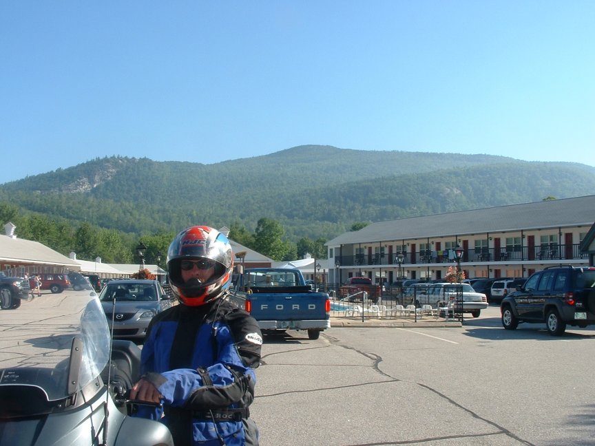
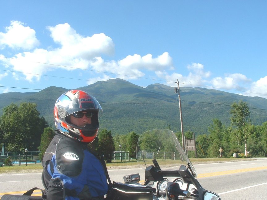
Day Nine – Farmington ME to Bath NY (598 miles)
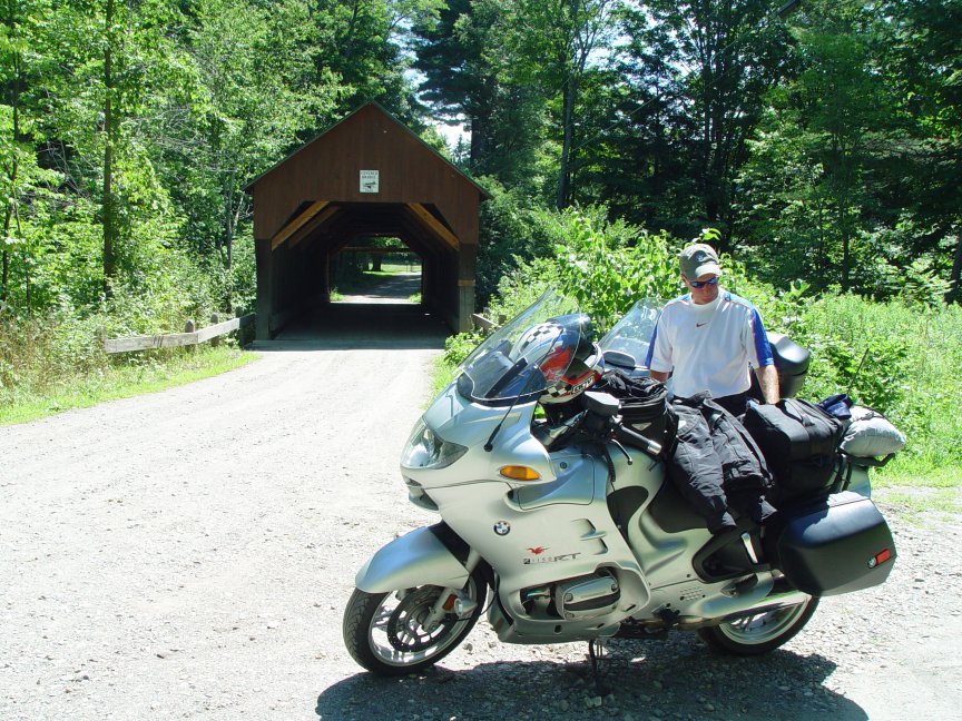
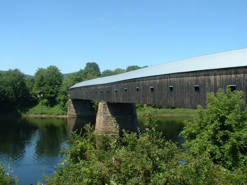
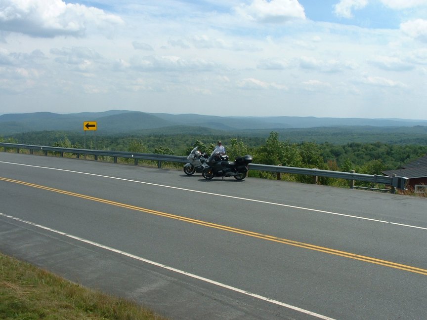
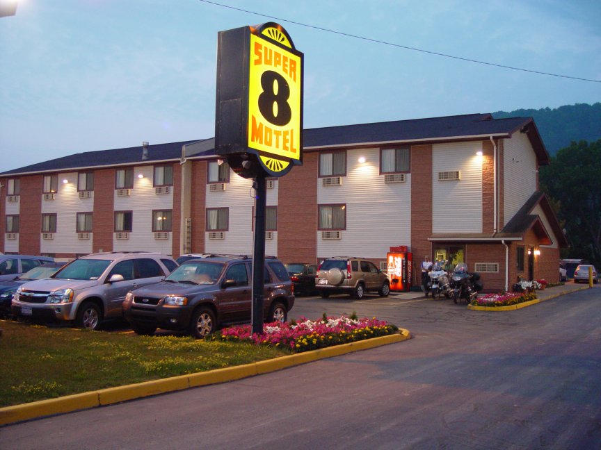
Friday started with sunny skies and the promise of good weather. We knew we had the ability this day to go at a leisurely pace and we would wind up somewhere in Western NY, and able to ride home on Saturday by noon. So we started by heading west on US2; a road we had traveled many times in the past. We thought about having breakfast in Mexico or Rumford but we didn't see anything that tickled our fancy. We decided to stop and view the falls in Rumford (KMZ). The 175 mile Androscoggin River, known in the early records as the "Great River", flows about 11 miles from west to east through the town. At the end of the run is the "Great Falls", the highest falls east of Niagara Falls in New York. First known as Pennacook Falls, then Rumford Falls. At the falls is the home of the former Oxford Paper Company, at one time the largest paper company, under one roof, in the world, now the MeadWestvaco Paper Company. We continued on and stopped in Gorham NH for breakfast (KMZ). We were now in the heart of the White Mountains and truly enjoying the ride. The weather was perfect as we continued on US2 toward St. Johnsbury VT. Once there, we decided to head south on I-91 and look for a good place to jump off to ride along side the Connecticut River. We first jumped off at Wells River VT, crossed the river and rode south on NH10. As it winds its way from its headwaters near the Canadian border, the Connecticut River in the town of Haverhill makes two dramatic oxbows. The broad sweep of this fertile river bottom land was the focal point in 1761 for the first settlers who labored to carve the beginning of a settlement in this northern most out-post of colonial New Hampshire. Haverhill NH is a beautiful little town along the banks of the Connecticut River that's history dates back to 1704. We traveled down the road with abundant corn fields all around. At Orford NH we crossed back over the river and rode south on I-91 for a few miles before exiting again at Lebanon. Now we were headed south on NH12A toward the town of Cornish. We spotted the Blow-Me-Down Covered Bridge and decided to stop to Augment our covered bridge tour we continue in our area of the world. The bridge spans a deep gorge on the Blow-Me-Down Brook (KMZ). The bridge was built by James Tasker in 1877 for a cost of $529 and restored in 1980. Soon after we stumbled on the Cornish-Windsor Covered Bridge (KMZ). We had hit the mother lode and didn't really even know it was coming. This is the longest wooden covered bridge in the United States and the longest two-span covered bridge in the world. Satisfied with ourselves with continued down 12A for a time before jumping back on to the interstate. We exited at Brattleboro VT and headed west on VT9. This is a great road that cuts across through the Green Mountain National Forest. There is pull off at the highest point where we stopped for pictures (KMZ). This area is near Mt. Snow and Molly Starks State Park. We next passed through Bennington VT as we neared the NY border. We hit traffic as we crossed the state line and headed into Troy. Once through Troy we decided to hit the interstate hard and see how far we could get. We gassed up in Duanesburg NY and continued west on I-88. We targeted Olean where had stayed before but by the time we reached Bath we figured we'd better stop and find a place as darkness was upon us. The only place in town was the Super Eight (KMZ). We were pleasantly surprised by the clean room and hospitality. This certainly was not our normal style.
![]()
![]()
Day Ten – Bath NY to Cincinnati (557 miles)
Bath to Cincinnati; all interstate. What else do I need to say? We were home before 2:00. We never seem to have any pictures of the last day.
Email me Ken Adams
HOME
![Kancamagus Highway [1]](fri1-nh112[1].jpg)
![Kancamagus Highway [2]](fri1-nh112[2].jpg)
![Kancamagus Highway [3]](fri1-nh112[3].jpg)
![Steve at Whale's Cove [2]](http://kenadams.org/mc2005/sun-stevewhalescove2.jpg)
![Ken at Whale's Cove [2]](http://kenadams.org/mc2005/sun-kenwhalescove2.jpg)
![Cabot Trail [1]](http://kenadams.org/mc2005/moncabot1.jpg)
![Cabot Trail [2]](http://kenadams.org/mc2005/moncabot2.jpg)
![Cabot Trail [3]](http://kenadams.org/mc2005/moncabot3.jpg)
![South Harbor [1]](http://kenadams.org/mc2005/monsouthharbor1.jpg)
![South Harbor [2]](http://kenadams.org/mc2005/monsouthharbor2.jpg)
![South Harbor [3]](http://kenadams.org/mc2005/monsouthharbor3.jpg)
![Big Bras d'Or [1]](http://kenadams.org/mc2005/monbigbras1.jpg)
![Big Bras d'Or [2]](http://kenadams.org/mc2005/monbigbras2.jpg)
![Ferry [1]](http://kenadams.org/mc2005/monferry1.jpg)
![Ferry [2]](http://kenadams.org/mc2005/monferry2.jpg)
![Ferry [3]](http://kenadams.org/mc2005/monferry3.jpg)
![L'Anse-aux-Meadows [1]](http://kenadams.org/mc2005/wedmeadows[1].jpg)
![L'Anse-aux-Meadows [2]](http://kenadams.org/mc2005/wedmeadows[2].jpg)
![L'Anse-aux-Meadows [3]](http://kenadams.org/mc2005/wedmeadows[3].jpg)
![L'Anse-aux-Meadows [4]](http://kenadams.org/mc2005/wedmeadows[4].jpg)
![L'Anse-aux-Meadows [5]](http://kenadams.org/mc2005/wedmeadows[5a].jpg)
![L'Anse-aux-Meadows [6]](http://kenadams.org/mc2005/wedmeadows[6].jpg)
![PAB Ferry [1]](http://kenadams.org/mc2005/wedferry[1].jpg)
![PAB Ferry [2]](http://kenadams.org/mc2005/wedferry[2].jpg)
![PAB Ferry [3]](http://kenadams.org/mc2005/wedferry[3].jpg)
![Near Wesley [1]](http://kenadams.org/mc2005/thurs2wesley1.jpg)
![Near Wesley [2]](http://kenadams.org/mc2005/thurs2wesley2.jpg)
![Near Wesley [3]](http://kenadams.org/mc2005/thurs2wesley3.jpg)
![Rumford Falls [1]](http://kenadams.org/mc2005/fri2falls1.jpg)
![Rumford Falls [2]](http://kenadams.org/mc2005/fri2falls2.jpg)
![NH Covered Bridge [1]](http://kenadams.org/mc2005/fri2bridge1.jpg)
![NH Covered Bridge [2]](http://kenadams.org/mc2005/fri2bridge2.jpg)